Milford Haven to Neyland – 10th June 2023
On trail STEPS 16,600 Estimated distance, 7.5 miles
So here we are the 2023 section of Alison Way’s adventures on the Wales coast path. Picking up in Pembrokeshire where I left off in 2022, with a new set of waterproofs, new superfeet insoles in my walking boots and 4 new pairs of bridgedale socks (3 blue and 1 grey!). I have a comfortable base in a holiday let about mid-way along the trail I want to do on this holiday.
Looking for an easy starter to day 1 – decided to park the car in Neyland and get the bus to Milford Haven and walk back, a walk which is dominated by skirting around the enormous Milford Haven oil refinery. I found a free car park and a suitable bus stop, and waited. I established a touching point (a rock by the bus stop). The bus was about 10 minutes late, and dropped me in a parallel road to where I joined the trail by the town war memorial (establishing a touching point there to pick up on another day). Unfortunately I had believed my phone app and that we might have showers. It began to rain hard so I donned my new kagoul (blue and white polka dots!!) but my waterproof trousers were still in the car.


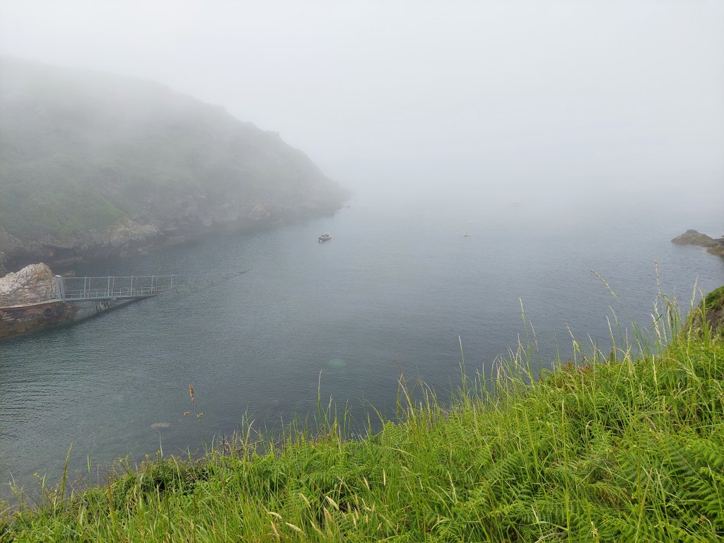
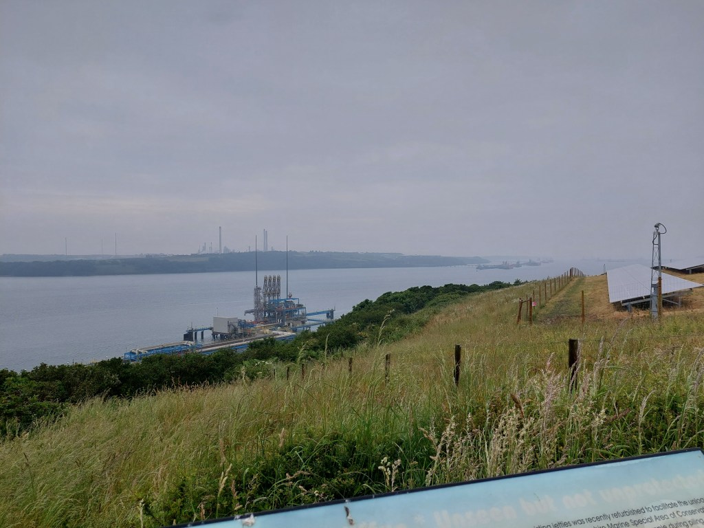
The initial trail took me through parts of Milford Haven, finding a much needed toilet by the water gardens, and then down to the black bridge, crossing castle pill. By this stage the unforecasted rain was hard and persistent!. I worked my way up to regain height through a housing estate, with discouraging signs suggesting it was a private road (though occasional coast path acorn stickers were reassuring). A rather dangerous section on the side of B4325 followed for about ¼ of a mile. Before heading down a farm track to Venn Farm. The track skirted the farm, and then across a couple of fields to nearer to the oil refinery. A track through some scrub and woodland eventually reached the coast line, and huge fences were surrounding the numerous solar panels in the fields around the oil refinery.
I met a couple just before the turn of the path along the coast. The coast path turned out to be fence on one side, hedge and overgrowth on the other with very occasional views of Milford Haven. The path was pretty overgrown too making it slow and wet going! There was impressive displays of wildflowers through the fence. I was in need of lunch and a break but being fussy about having a view I went about a mile and a half before somewhere suitable emerged.


In this section I encountered 3 foot bridges, over pipes and roads. These were made of wire sheets, and extremely transparent. The first 2 were flat and once I had realised not looking down was a good idea, not too bad. I have never been very keen on walking on things were you can see the world beneath you (on piers etc…). The last foot bridge was sloping down at about 30 degrees from horizontal. I gingerly crossed (as it was slippery due to the rain) and held on to aspects of the wire fence, which unhelpfully prevented access to the handrail! I really didn’t enjoy the last one (but needs must) and I went into ‘intrepid’ mode. At the other end of the bridge, I found some steps with sufficient view to warrant a lunch stop and had some much needed sustenance and I had calmed down significantly by the end of the break. It was still raining – but more a steady drizzle. I had a chat with a passing walker during lunch, and advised her not to look down on the footbridge ahead!

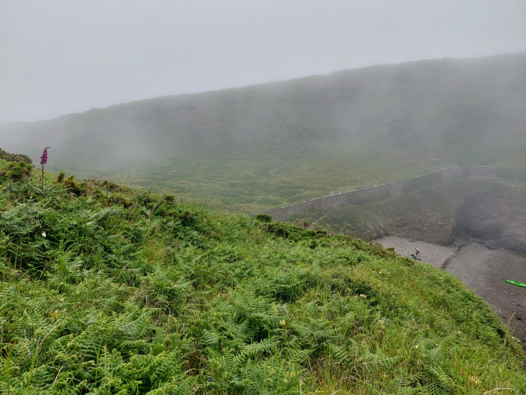
Thankfully there were no more footbridges, there was another section down to sea level, and back up again, and then quite a nice wooded section, with a wide path and not so overgrown as it had been around the refinery. Eventually the track reached a road into Hazelbeach and the path continued on a road by the shore back to the car. I enjoyed a rest on a wet British legion bench by the toilets in Hazelbeach and the rain had just about stopped.

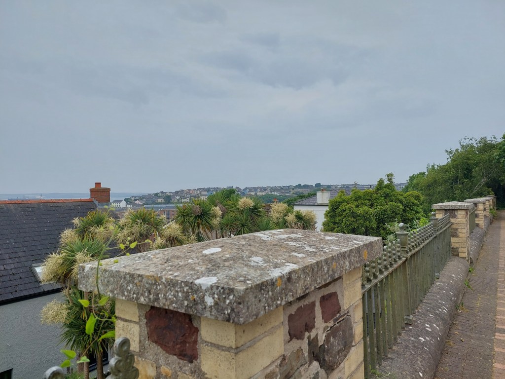
I enjoyed the section on the road, admiring the views across Milford Haven and the different gardens and houses. It is clearly a very good year for flowers and ornamental cats and a delightful pig! I eventually made my way back to the car. I was a bit stiff as this had turned out to be a longer walk than I had anticipated! I also messed up using the phone step counter so the distance is a bit hazy but it was all pretty much on the trail!


St Martin’s Haven – Marloes Penisula 11th June 2023
Steps – 16,708 On trail 12,256 off trail 4452
Distance 7.68 miles on trail 5.62 miles off trail 2.06
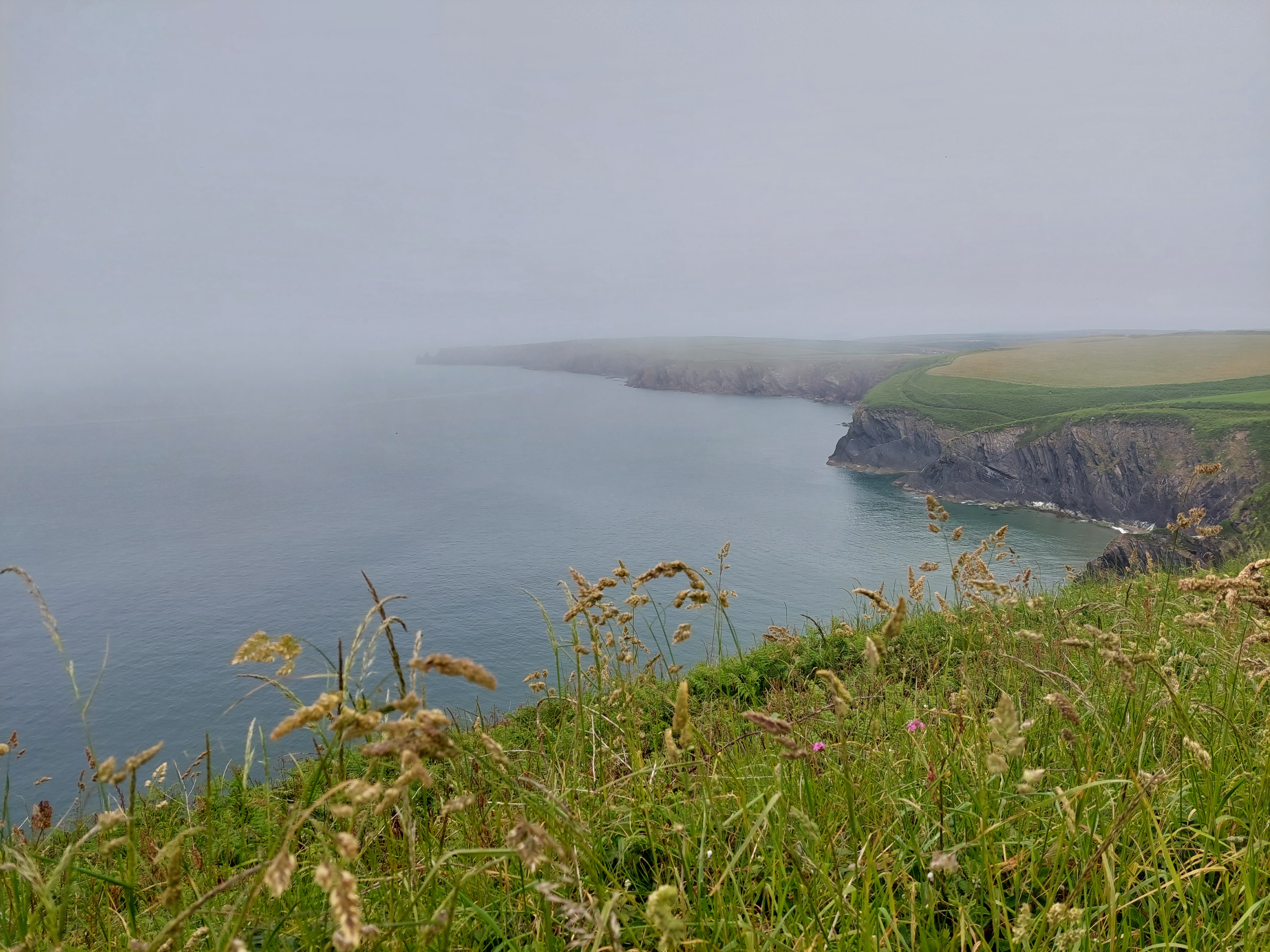
Rather a leisurely start (walking commenced at 11:20)! Quite a long way to drive to the area where I finished in 2022 – also somewhat delayed by going rather wrong on the way! Anyway parked at the National Trust car park at St Martin’s Haven. There were loads of cars (and I was a bit concerned it was going to be really busy!) but it wasn’t. Turned out this was where you could get boat trips to Skomer Island. I was in the middle of the section of coast path I was going to do, so didn’t start with a touching point. It was misty and humid when I set off.

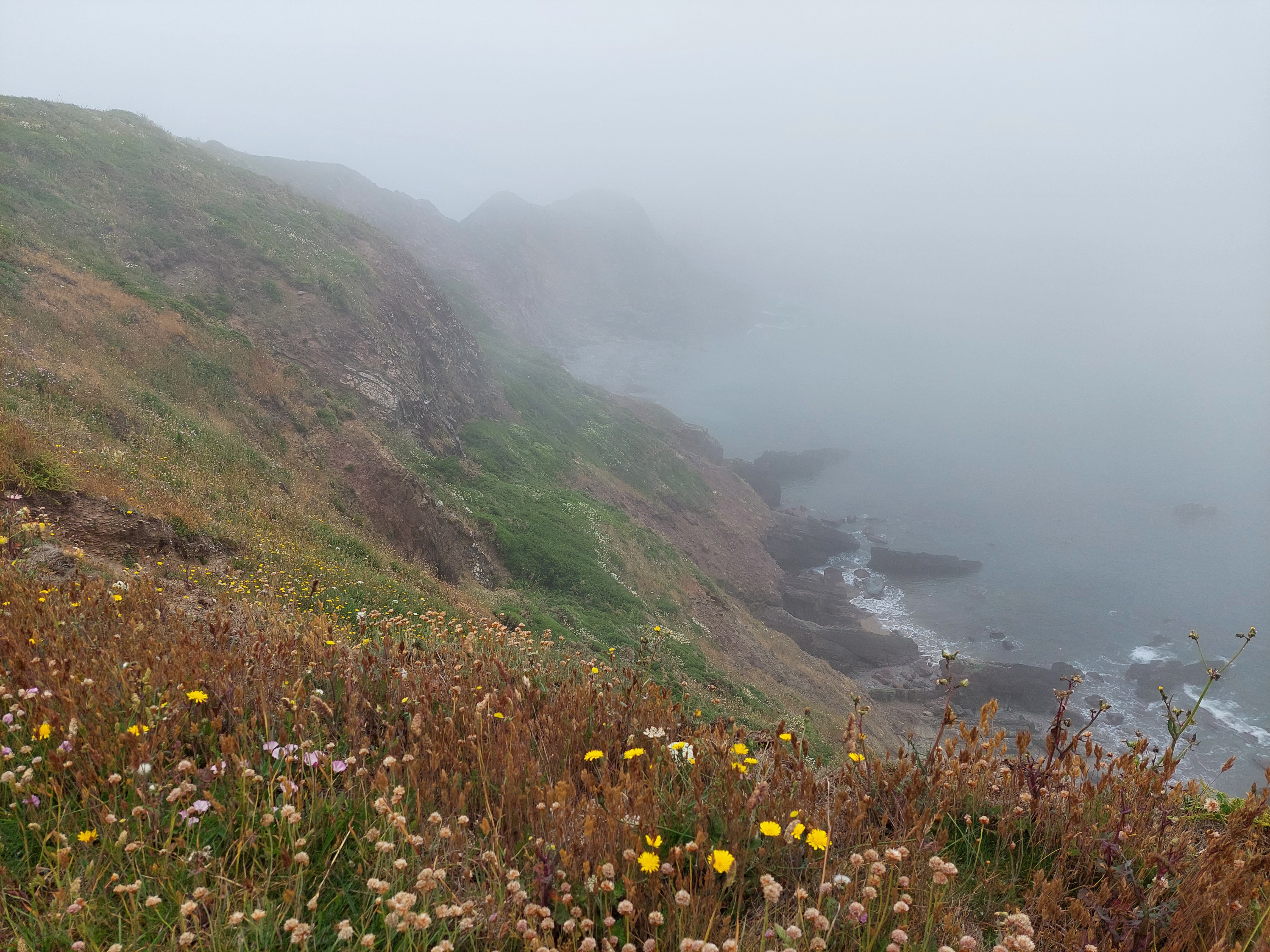

It was a bit eerie with the billowing mist, but the initial section had wide grassy paths and was very straightforward. I was a bit concerned about the fresh cow dung and a few horse flies (it was in this area I had succumbed to what I think was a horse fly bite which stopped walking earlier than I had planned in 2022). I carefully avoided all the fresher looking cow pats!
After about a mile, it became more typical coast path, rougher and a bit overgrown. I stopped and had a coffee break, perching on a convenient rock just before the path deteriorated. The scenery was impressive if rather misty. I had studied the map carefully and decided to cut back over to the other side (and the point I had stopped on the trail last year!). Also I have done this walk before (about 10 years ago!) and had a memorable bullock encounter on the other cut through which I did not want to repeat. At this point, I set up a touching point for when I continue. This rather mystified a couple who were having a snack by the gate to the inland path. The track came out by some toilets and a café. I used the former, and made plans to use the latter when I take up the trail again.

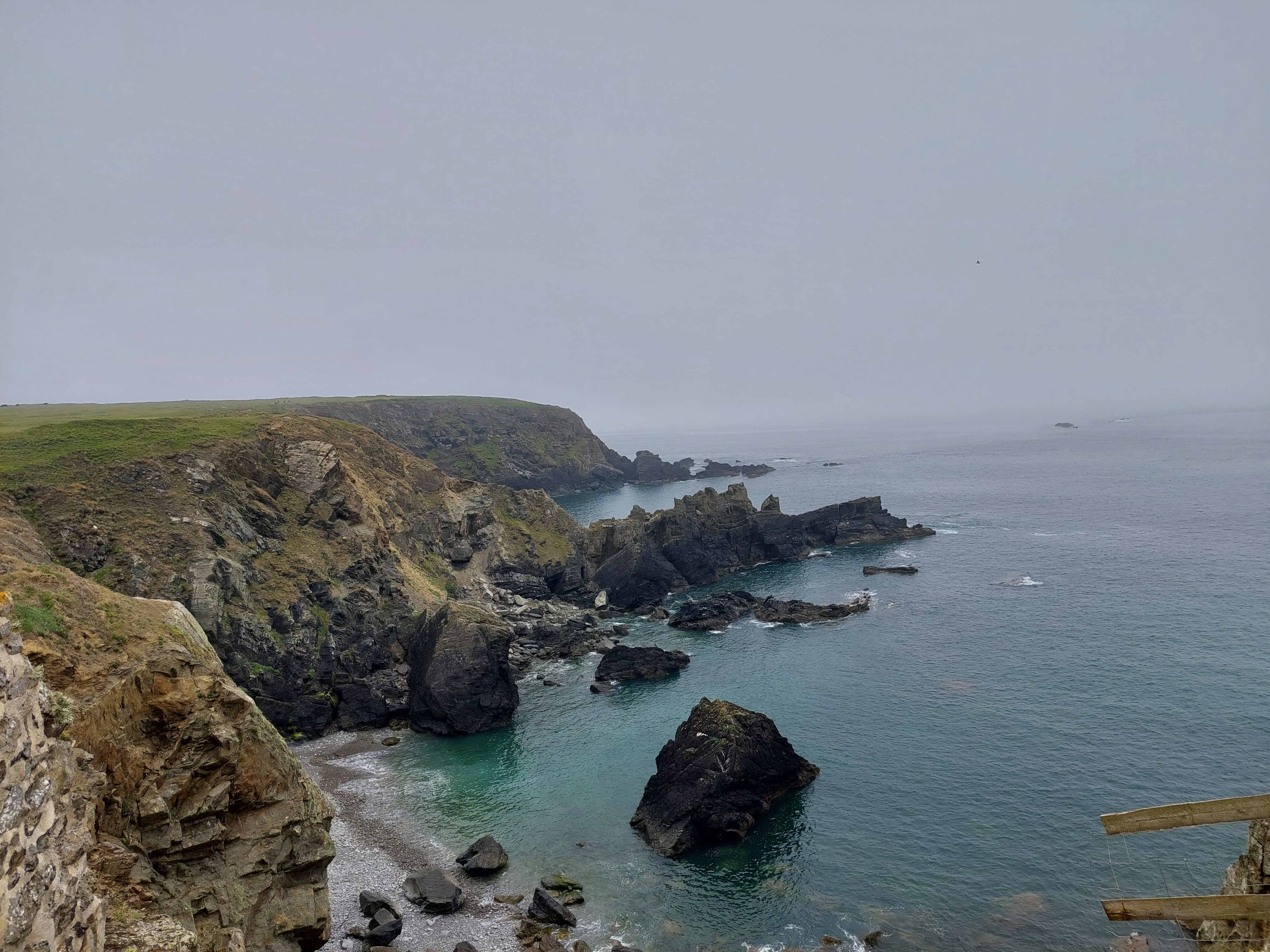
After a track across a field, I was then on a side road, and the road down to Martin’s Haven walking back towards Marloes for about ¾ of a mile before turning down a track I had used before which led down to the coast path. It was good to connect with my coast path sign touching point, before heading back towards St Martin’s Haven. Again I was struggling to find somewhere to stop for lunch as the path was very narrow and overgrown. Eventually after a couple of up and down bits, I found a grassy mound. This afforded a view, which improved as the mist briefly lifted whilst I ate my lunch. I was rather distracted by some black and white birds on the sea (?puffins?). Unfortunately the number of ants increased as I was eating and watching the birds, and I realised I was sitting very near an ants nest. Numerous ants then had to be evicted from my rucksack and seat pad.


The walk continued much as before and within about half an hour the mist had rolled back in. The scenery was lovely but it was humid and the path was surprisingly overgrown. Eventually it wound down to sea level and a small bay where the boat trips came in and out. I walked back up the road to the car park!