Magnificent Mwnt, dolphins, seals and home

Day Fifty two to Fifty four (26-28 Sept) Walk Day 24 and 25

Day 52 Llangrannog to Aberporth Walk Day 26 Sept

Phone stats: 19981 steps, 8.44 miles, walking time 3hr 16 minutes

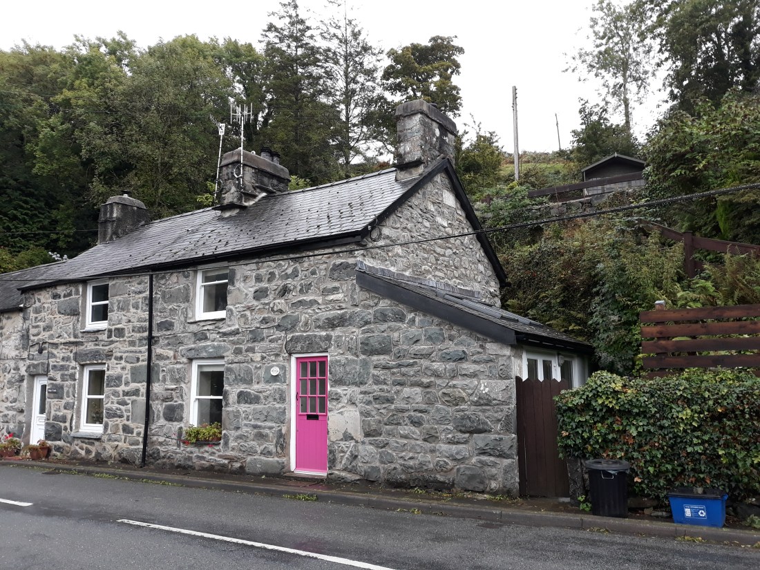
The morning began with a return visit from the heffer!
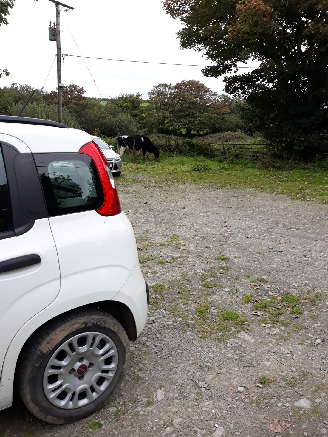
20180926_094645

Unusually this day’s walk started from base camp and had a bus ride in the middle. I walked from base camp out to the coast, and then over the ridge to Llangrannog, where I had finished yesterday. I communed with St Carannog’s statue which looks over the bay. The descent was quite steep, and there was enough time to enjoy a coffee in Llangrannog before getting the Cardi bach bus to Aberporth. Whilst I was enjoying the coffee in the warm sunshine, the peace was somewhat shattered by a school party but it was fun to see the children enjoying the beach.

When I got to Aberporth, I did some sorting out for tomorrow and established an end point for tomorrow’s walk at this splendid dolphin statue touching point, and also to be clear where the bus stops were to get the bus to Gwbert (there was one bus a day so it was important not to mess up!). Eventually I set off proper, round the beach and then on an inclusive access section of coast path – which was fab  and relatively easy going. I was pleased to see this having enjoyed another inclusive action section at Druidston in Pembrokeshire on previous welsh holidays. This included passing some very well placed converted railway carriages, which were being used as holiday lets.

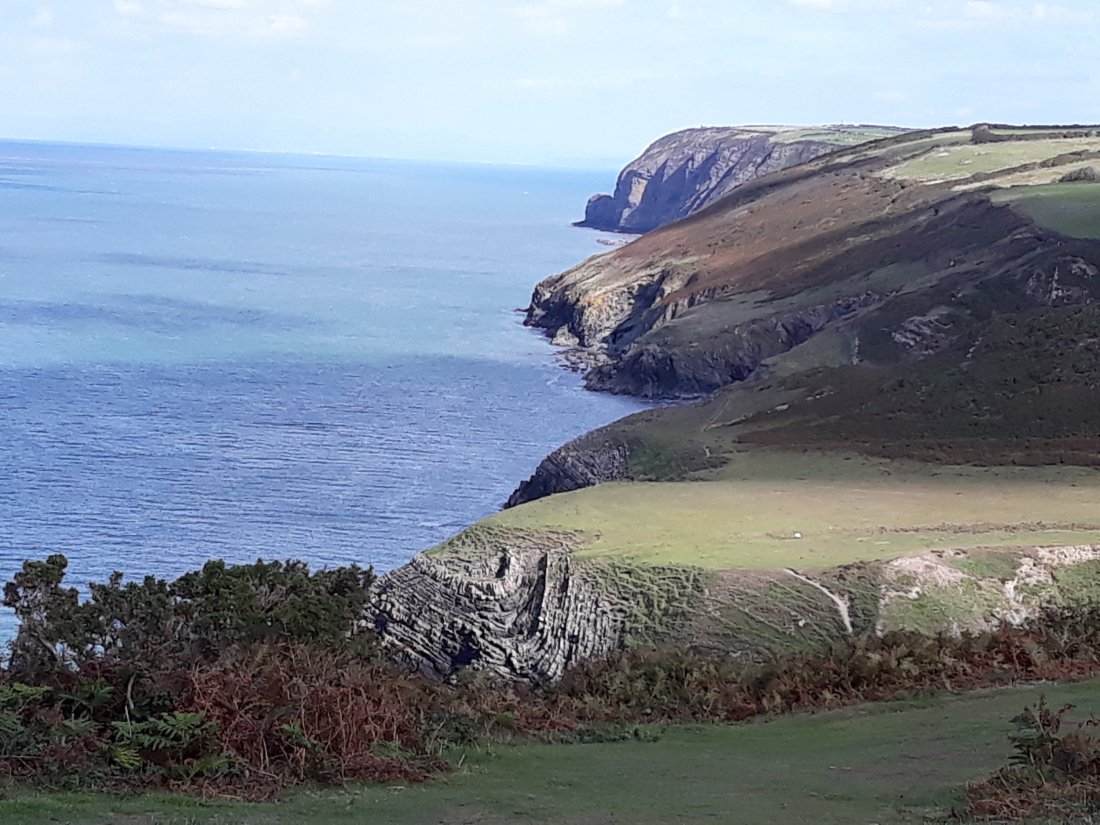
The inclusive access path ended, and more normal path quality resumed. It eventually came out on the beach at Tresarth – I had hoped to have some lunch there – but the café was heaving so I carried on (it was a lovely day and lunch time!). This meant tackling the first big ascent of the day (in the photo below the right hand one of the cliffs – base camp is beyond the horizon on the left hand one of the cliffs). I had a breather and a snack half way up on the edge of the path. The path was very narrow and the edge was close on the ascent – thankfully wider and less exposed on the way down. The views were amazing and it was warm and sunny.
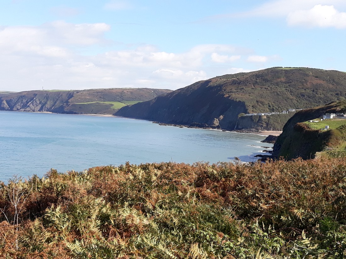
20180926_130631

About 3pm I reached the national trust café at Penbryn, following a descent through another wooded valley and had a very welcome welsh cheddar and chutney sandwich. I was a bit concerned about the ascent back up to base camp, but there was no need, as it was more of a farm track than the earlier path. I was soon working my way back, and it was good to see base camp come into view down a hedged track! The heffer had gone!


Day 53 Gwbert to Aberporth Sept 27th  Walk Day 25

Phone stats: 25827 steps, 10.91 miles, walking time 4hr 16 minutes

Another early start, to enable me to get the bus from Aberporth to Gwbert. It was a beautiful morning, and turned out to be the only day I walked entirely in a T-shirt with no fleece or waterproof over the top! After an eventful bus ride (where the driver had to back a long way when we met a huge double tanker on a narrow lane) – I was ready to go from Gwbert at 10:45 – having established a touching point for another day by the entrance to the Cliff Hotel. Gwbert was another of the destinations for childhood holidays in Wales – I did remember this one!

It was about ¾ of a mile of up on the road, and then out to join the coast through fields. The conditions were calm, warm and sunny. Once we reached the coast, I was soon spotting dolphins, and helped another couple of walkers to see the dolphins (one of them had never seen them before in the wild and was very excited). I have seen dolphins in this area of the Ceredigion coast often! The first mile of the coastal section of the path was easy going and then it got much more strenuous, narrow and up and down. The journey was enriched by being able to see the mountains round Cardigan bay, including Yr Wyddfa, clearly in the distance in the clarity of a stunning day.

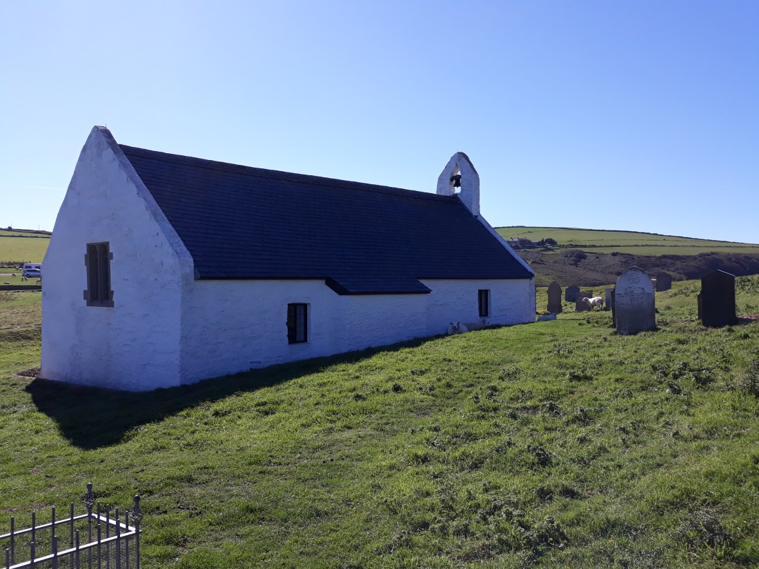
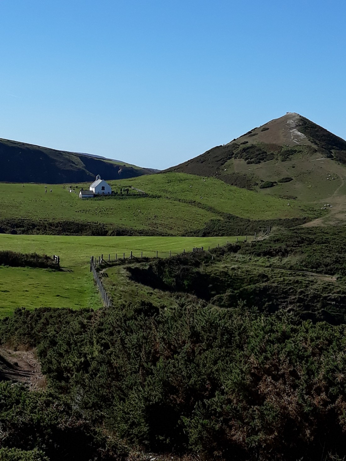
After about an hour, the magnificent Mwnt came into view. This is one of the most beautiful places I know, and has a special place in my heart. I had an icecream at the National Trust booth, and used the facilities, and then went to the churchyard. This is one of the two places where my dear friend Jane is remembered, and spent some time there. I first came with her to Mwnt during my first year at Theological College in 2003, and a number of times subsequently. It is good to give thanks for how much her friendship enriched my life, and it was important that this was part of my walking journey.

20180927_12293020180927_12294020180927_12540820180927_133244

I visited the church of the Holy Cross, and had a chat with a couple about my walk. I realised I was only about 1/3 of the way I needed to travel so I walked on – looking back until the church was no longer visible behind. The going was strenuous, narrow, clinging to the cliffs and lots of ups and downs, and progress was slow. I had lunch about an hour further on and watched the seals swimming in crystal clear blue sea. I am not going to lie this was a challenging walk! And I was on the narrow cliff path from Mwnt heading towards Aberporth for 2 and a half hours. I was very relieved after two false dawns to reach the treelined valley route out. Again another beautiful autumnal colours valley – looking across to the DERA base and firing range on the next ridge. I wondered how it was going to work out as I was the other side of the valley to where I needed to be! But as is the way with these things it did work out, without too much more ascent.

Once I had made my way round the base, it was about a mile of descent back to the front at Aberporth. I touched the glorious dolphin statue touching point to mark the end of my walk. I put my rucksack, boots, poles and stuff in the car, and then went down on the beach and paddled my tired feet in the sea. It was very cold but refreshing.

It had been a fantastic and beyond beautiful final day.

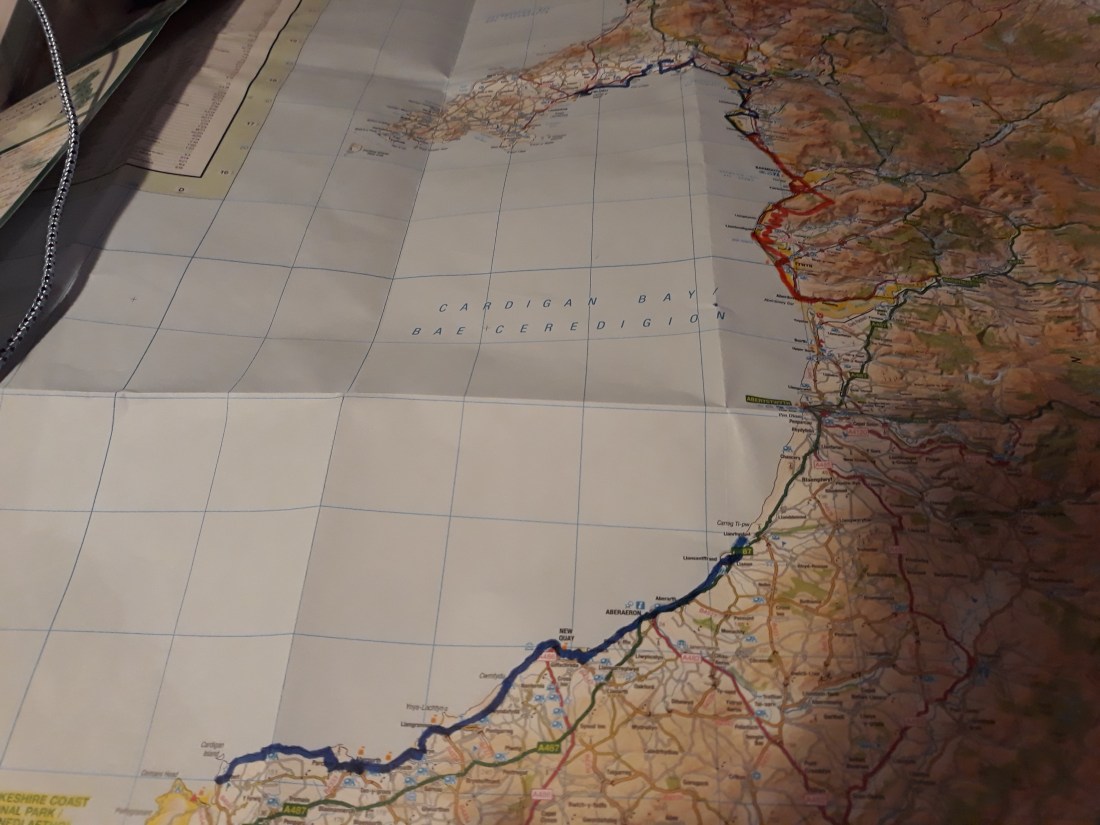
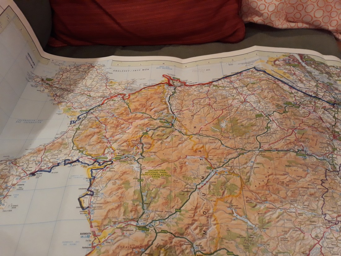
I went home – refuelled and did the maths…. My final totals are a staggering 558,118 steps and 237 miles… Here’s the maps – the first is my whole trip and the second what I have covered this week.
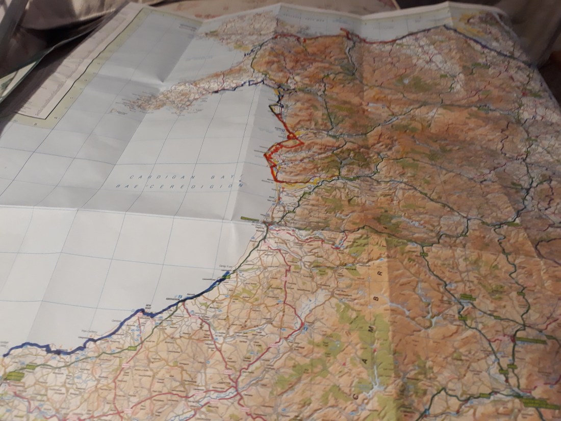
20180927_21145920180927_211612

Day 54 Travelling home

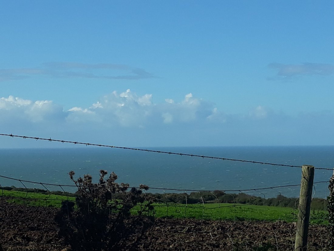
After packing up and clearing base camp. I was on the road bright and early, I was keen not to end up on the M25 at the wrong time on a Friday. It was cooler but still bright and sunny. My final glimpses of the Ceredigion coast as I turned east was blessed with a  clear view of the mountains beyond. I thanked God for that, which brought me deep joy.

The journey was uneventful and long! Thoughts turned to when I could continue the journey I have started on the Wales Coast Path – I have only done just over a quarter of it. Maybe I can pick up next September where I left off at Gwbert.

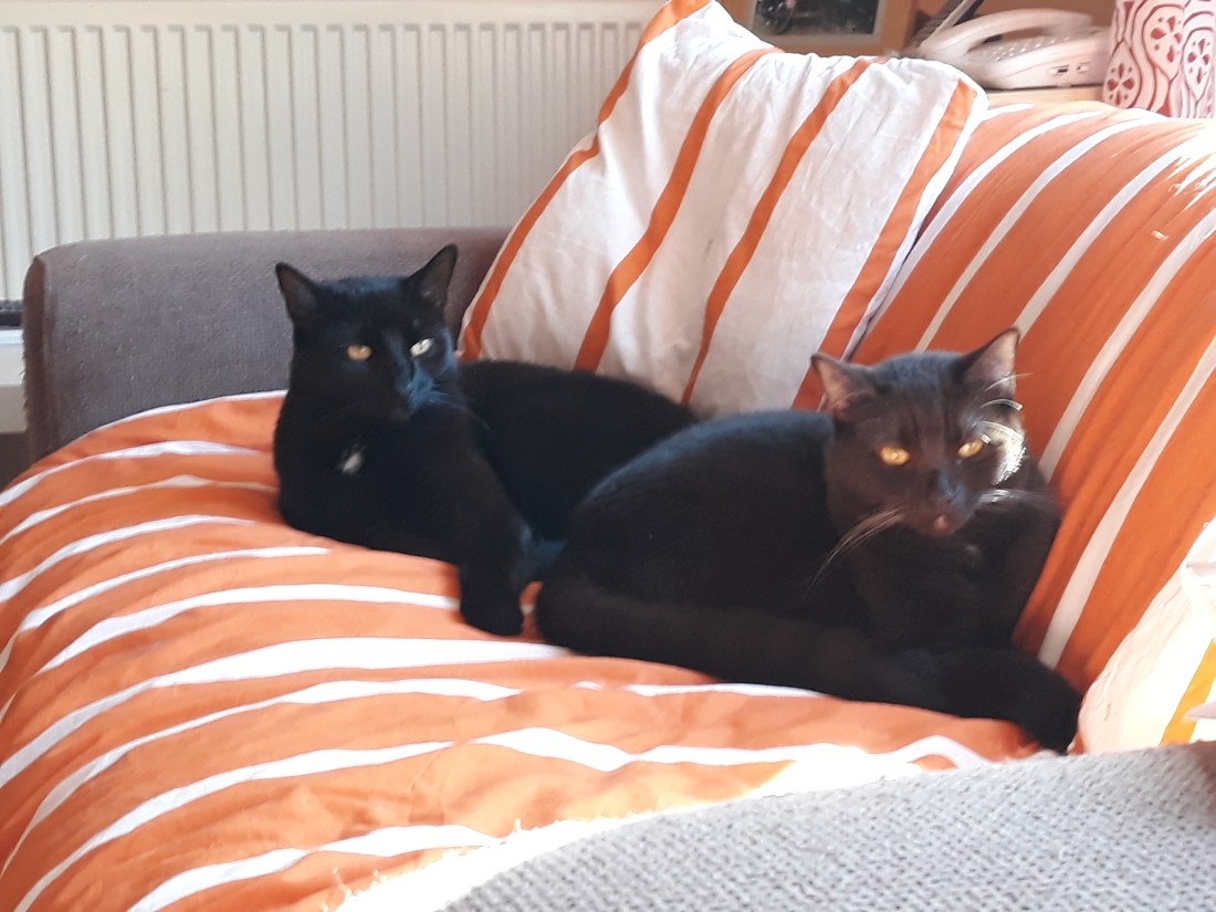
The magnitude of the distance I have walked only really sank in – when I realised my drive home was just 8 miles more than I had walked over the past six weeks! So I was on the M25 approaching Reigate when I got to the 237 mile point… The cats appear to be pleased to see me and are currently staying close.
20180928_183428

And when they were up they were up, and when they were down they were down

Day forty nine to fifty one (23-25 Sept) Walk Day 22 and 23

Day 49 Day of rest

Another leisurely Sunday! I went to church in Penbryn, and what was billed as an 11:15 communion, turned out to be a baptism (with a puppet). The fact it was a baptism was obvious as soon as I reached the car park! There were two great bits of scripture read, but very little attempt to explain them. The high point was singing Calon Lan in welsh. I am no welsh speaker (and I am sure I sounded like the policeman in ‘allo ‘allo!) but this is a spiritual experience to sing and I find the ideas behind the words challenging but inspiring. Here’s a link to Katharine Jenkins singing it with the translation.

https://www.youtube.com/watch?v=EadntTQ0AkA

I went on to a very scenic lunch in a beach hut café in Aberporth, which was served on entirely recyclable containers including wood utensils (similar to lolly sticks). I then retreated to base camp for a session of knitting and watching the new Star Trek series.

Day 50 Aberaeron to New Quay Sept 24th Walk Day 22

Phone stats: 14500 steps, 7.3 miles, walking time 3hr 1 minute

It was cool but the sunshine was very welcome. I drove to Aberaeron, and was soon on the trail after touching the touching point I established on Saturday morning. The route rose gently out of the town, and in the distance views of the hills and wide expanse of the coastline (and the path I have travelled opened out!). It was distant but by the end of the day I was pretty sure I could see Yr Wydffa, and the outline of the Llein peninsula and Bardsey, opening out the trail I have travelled. Looking forward, New Quay was in view for most of the day, which was encouraging too.

The route got steeper and rose up and down a number of times. It was also quite warm, and my efforts to dress appropriately were not entirely successful (and I ended up carrying a lot of kit!). I had a coffee stop shortly after a very scenic holiday village, and then the route went down virtually to beach level, where a stream cut through a section of zigzag strata. It was then a bit of a struggle back up and then a more gentle climb, before winding down to Llanina and past the inevitable static caravan park. Eventually I reached the beach, and had my lunch sitting on a rock watching the waves (which were very Robinson Crusoe-esq).

The final mile or so around the beach was a delight and I was much reminded of a previous visit to New Quay with Jane and Jasper (a cavalier king Charles dog). We had a short break near Aberaeron on October 2007. It was a significant time in Jane’s first round of cancer treatment, and I distinctly remembered taking the elderly Jasper on to the beach down a slope, and a café with a terrace (both still there). Jane loved this part of Wales, and it is good remembering her and our times together.

I struggled up the hill to connect with the bus back to Aberaeron, using a curry house as the touching post (as that was near to where the coast path will go tomorrow). I waited in the sun for about 20 minutes and then the bus came. It is always very satisfying to see the journey back!

When I got back to the base camp – there was a cow in the garden!

Day 50 New Quay to Llangrannog Sept 25th Walk Day 24

Phone stats: 26146 steps, 11.04 miles, walking time 4hr 20 minutes

The cow was still in the garden when I left for the day. I drove to the free car park in Llangrannog, and walked down to the bus stop.
Today I was using the Cardi Bach Bus for the first time (which runs twice a day to connect the remote places between Aberteifi and New Quay and to help walkers!) This turned out to be quite a stomach churning experience, as the driver took the bus down some lanes I would have thought twice about driving down… I am not the best bus traveller.

I was back in New Quay by 10:30, and touching the curry house and heading off uphill. The initial ascent was pretty near the edge and up higher than previously! But then the next mile or so out to the coast guard station was reasonably ok. And then….. Up and down precipitous cliff walking. Stunning, scary and exhilarating. Due to the tricky conditions, it took nearly 3 hours to get the 3.5 miles to get to Cwmtydu, with seals and a couple of seal pups on route too. I could see the dolphin watching boats but didn’t see any dolphins myself (I was concentrating on my footing)

There were options on what to do next, and the next bit of the cliff path had a serious health warning, so I took a delightful alternative route inland, clinging to the high edge of a tree filled valley. This first involved climbing out of Cwmtydu, on one of the roads the bus had used earlier! I had lunch at the start of the tree filled valley section. The path finding was a bit challenging, but ordnance survey map app was really helpful along side the Ceridigion council footprint signs. I was conscious that I was also a bit of a spent force (and had already done 9 and a half miles), at the point the inland route was due to rejoin the coast path, I took an ‘unauthorised’ road route back to Llangrannog, which also ended near where the car was parked.

I returned home to find the cow had gone from the garden, and in fact all the cows in the neighbouring field had also been moved too!

Rain……. and lots of it!

Sorry having techy difficulties, so lots of individual pictures…

Day forty six to forty eight (20-22 Sept) Walk Day 21

Day 46 Sept 20 Wet Day!

The weather forecast was awful and it lived up to the yellow weather warning! The winds of storm Ali were replaced by the torrential rain of storm Bronagh. It was a self-evident truth that walking was not a sensible plan. I went for a brief drive over to Fairbourne to enjoy a ride on the steam trains there.

The weather deteriorated whilst I was there, but it did enable me to reflect on how high my climb had been on Monday as the tree line at the top of this photo is where I ended up! The drive back was not very pleasant, so I decided to stay at base camp for the rest of the day.

I did some reading, walk planning and packing towards transit day. I moved the touching point back to the car – the end is in sight. I can see I will have to miss a couple of possible sections of the walk, so I can finish where I had hoped. On Saturday, weather permitting I will walk from Aberaeron to Llanrhystud in whichever direction best suits the wind! Ceredigion here I come!

Day 47 Transit day Sept 21

I was on the road by about 9:30, and then I realised just how wet it was. There was a lot of obvious flooding round the river Dovey! Then the bridge I wanted to use was shut (pont dyfi) – I followed some other cars down a road heading in approximately the right direction, which eventually came out on the road I needed. Satnav was most unimpressed. There were a couple of patches with water on the road, but it was passable with care. Fortunately once I got beyond Machynlleth, the road seemed to establish itself on slightly higher ground which was a relief. I had a break in a very nice café and then went into Aberystwyth to do some food shopping! I made gentle progress and had lunch looking at the beach from the car at Aberaeron. It was very windy still, cool and occasionally wet with heavy showers.

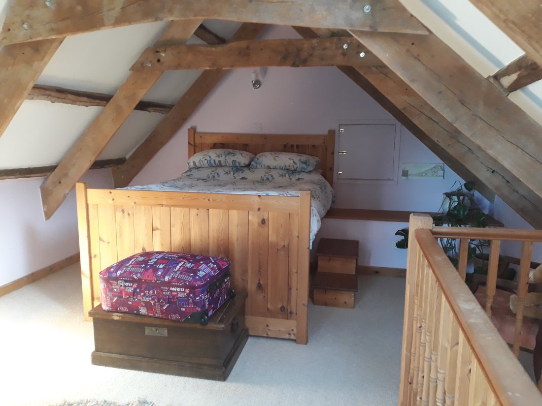
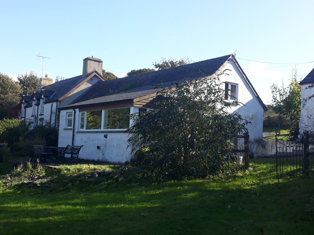
I arrived at my new base camp – which is attached to a farm house, about 40 minutes further on from Aberaeron. It is about 3 miles down some single-track roads with passing places (with mud and sometimes grass growing up the middle). It is in a fantastic position with sea views, near to a path to the coast path (about ½ a mile away). I am slightly concerned that the bed is rather high up, but it has proved to be very comfortable.

Day 48 Aberaeron to Llanrhystud Sept 22nd Walk Day 21

Phone stats: 22023 steps, 9.3 miles, walking time 3hr 30 minutes

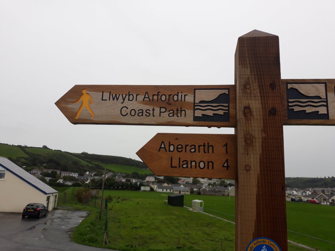
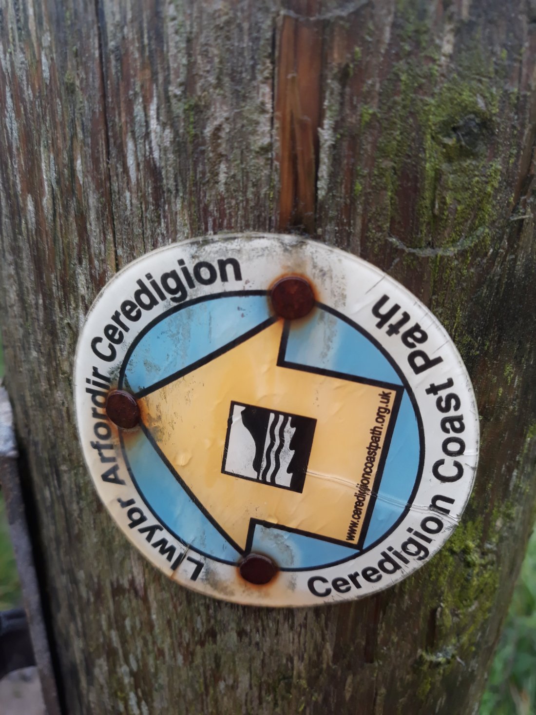
The weather forecast was not exactly good, but it wasn’t anything like as bad as Thursday. I drove to Aberaeron, and I decided to walk from there – I did get an early start, well wrapped up as it was cool, and encased in waterproofs. In the first couple of hours of the walk, there was occasional drizzle. After that the rain was more persistent. (At the start I established a new start touching post as I intend to walk from Aberaeron to New Quay on Monday). Interestingly there are 2 new symbols being used for this part of the walk (I think the Ceredigion coast path is older than the complete Welsh Coast path!)

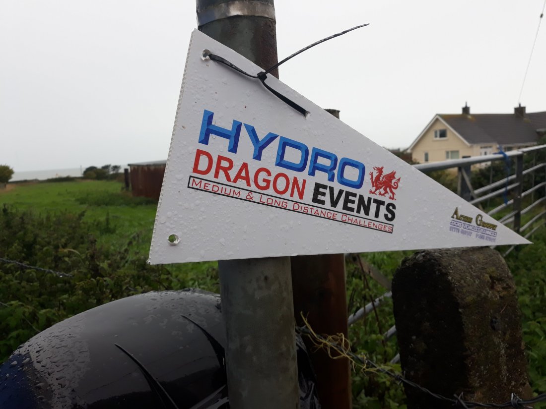
From virtually the very start when I saw people acting as marshalls, I realised I was walking on part of the route of a bigger event. During the course of my walk, first runners and then a selection of walkers overtook me. After having hardly seen anyone on most of my walking endeavours last week, it was a bit of a surprise to see so many people (about 40 by the end of it!). I was very encouraging as they were doing an impressive challenge from Hydro Dragon Events from New Quay to Aberystwyth – which has to be at least 25 miles probably closer to 30! As I came into LLanrhystud, the race organisers assumed I was one of theirs and offered me refreshments, before the final 10 mile section to Aberystwyth.

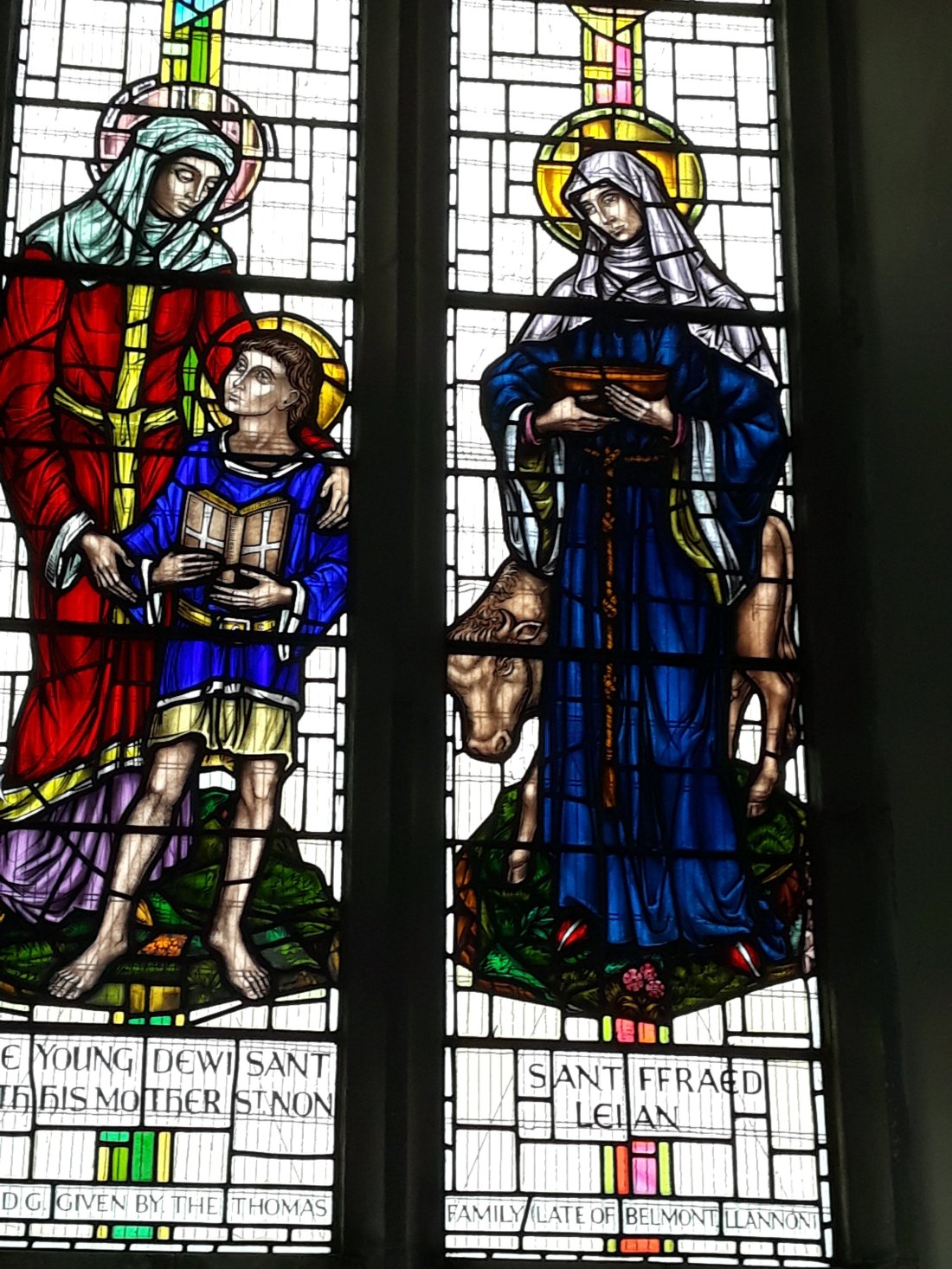
The walk was mainly on low cliffs near the beach, I had to take a longish detour into a village, as there was no way to cross one of the gorged streams, this meant I got to visit Llansantffraed church, which had some interesting stained glass. The Abba fan in me – loved their external poster too.

There were 2 tricky sections, early on there was a higher path and the going got a bit slippery on the downward slopes, and then about ½ a mile on stones above a beach near the end – which again were slippery so I took it slowly.

I established a touching point for another time, when I left the coast path, and walked on to the bus stop. I was just getting organised, and hadn’t even got my poles secured to my rucksack when a bus arrived. It was my first transcymru bus, and it took the driver three goes to get me to understand that it was free, which was a surprise! (It was a combination of accents, and me not expecting that answer!). I walked back

Windy and windier!

Day Forty four and forty five (18-19 Sept) Walk Days 19 and 20

Day 44 Llwyngwril to Tonfanau Sept 18th Walk Day 19

Phone stats: 17107 steps, 7.23 miles, walking time 2hr 56 minutes

Walking into a high wind!

Began the day with some further joy in yarn bombing at Llwyngwril. I got the train to Llwyngwril, touched my knitted cow touching point, and after contemplating some more knitted and crochet wonders, and a further closed church – I headed steeply up hill.

This slideshow requires JavaScript.

The path “zigzagged” up and down the side of this hill for several miles (which was quite strenuous) and my progress was not improved by the wind (and the path was abit indistinct at times – Ordnance survey map app was a real boon to navigation). This turned into a 2 bull day. The first being the most scary. In the following picture, I have added the line of the path in white and the blue arrow points to the beautiful but large black bull in the paddock! He just looked at me thankfully as I passed but it was much too close to comfort to a standing and very much awake bull! The second bull occurred later on and was surrounded by friends and family (and sitting down thankfully).

As well as the wind, it rained repeatedly (and I was glad I had set off in my waterproofs). Eventually after at least 3 ups and downs, the path led up and over the ridge and down into the valley beyond, which did eventually give a bit of rest bite from the wind. I crossed the main road near Rhosfein, and then started a section which skirted on the sheltered side of one hill and then the exposed side of the second hill. The latter turned out to be quite a challenging path about 1/3 of the way up the hill. It was rough going and overgrown in places. I eventually found a spot out of the wind to have some lunch, and watched the train heading back to Aberdovey from my vantage point.

Yet again I looked to be closer to where I wanted to be than I actually was. The track ran up and into a disused quarry and then I got a bit confused as to how to exit the quarry. I worked it out eventually – by this stage the sun was out which was very welcome. I wound down near to Tonfanau station. I needed to decide whether to proceed or have a lengthy wait for the next train. The route on to Towyn would have involved about two and a half miles of walking,  full into the wind across a low marshy area, and I just didn’t feel I could do it in time to reconnect sensibly with the next train (and I was tired from the opposing wind, as I had used a lot of energy to get to this point!). I established a touching point and then I spent 45 minutes at Tonfanau station sitting in the sun and wind, contemplating the meaning of life and watching the world go by….

Day 45 Aberdovey to Tonfanau

Phone stats: 20485 steps, 8.65 miles, walking time 3hr 10  minutes

Even higher wind from Storm Ali!

Decided to walk with the wind at my back so walked the opposite way round to normal (Sea on the left!). This meant driving to Tonfanau – parking the car near the touching point from yesterday and then getting the train back to Aberdovey and setting off from base camp about 10 minutes later (and establishing a starting touching point). As I was about to set off I realised I was going to need to carry a pair of shoes as I hadn’t left any in the car (and I don’t like driving in my hiking boots). oops!

The walk started on the beach and the first mile was about three quarters into the wind which made it very hard going. I tried the shelter of the dunes for a bit but eventually braved the beach, and found it tricky to keep the blowing sand out of my eyes! Eventually as we passed the end of the headland, the direction of travel came more in line with the direction of the wind. It would be fair to say I was significantly wind assisted (and such a contrast to yesterday). I made good progress arriving at Towyn in time for an early lunch (and to miss the worst of the rain). My premise based on o-level geography was the worst of the rain was likely to hit as the clouds and wind hit the hills and it was a narrow passing front, as I was mostly at sea level it wasn’t going to rain for long.

There was a reasonably comical section just before I left the beach to go into the town where I had risen onto a rough promenade. I had an air of Buster Keaton in a wind machine, as I struggled to stay on the path, with my waterproof trousers doing a good impersonations of sails. My walking poles were too light to manage the conditions too.

It was not a good day to explore the delights of Towyn as it turned out to be early closing. I did get in the church for once. Then I realised I had strayed from the path and had to walk back the way I had come through the town – before branching out into the low marshy area behind the beach that I hadn’t fancied full into the wind yesterday.

It was not great as the direction of travel was about 1/3 off the trajectory of the wind, and I couldn’t use my poles as the wind was too strong. The path was indistinct for at least two thirds of this section, so again it was relying on the ordnance survey map app, and it was lumpy, bumpy, damp and squidgy terrain. I was SO glad I had not attempted it into the wind yesterday! I eventually crossed a very splendid pedestrian and cycle bridge and walked up the road to the touching point of yesterday. The car was another 100 yards further on. I was very glad to see it (and to get out off the wind!)

I had hoped that tomorrow I would start to walk from the other side of the Dovey estuary but the weather forecast is dire!!! (I am approximately underneath where Birmingham is written). Looks highly likely that I will be staying in the dry watching the rain at base camp….20180919_182646

Climbing and yarn bombing

Day Forty two and forty three (16-17 Sept) Walk Day 18

Day 42 Day of rest

Very leisurely start to the day and then a five minute walk in the rain to attend St Peter’s Aberdovey for 11:15 for what turned out to be a communion service (almost entirely in English).  There was a priest with a worship leader taking the service, which was good to see. The sermon was based on Mark 8:27-38, and the preacher quoted Bishop Robert Paterson (who I have met) about the way of suffering, God working in power through weakness and the importance of mission. The quote was something like – Sharing the good news of Jesus Christ is for everyone, and ministry is always the servant of mission! He ended with a proverb! – Don’t be afraid of growing slowly, simply be afraid of not growing at all…

Whatever I had clearly shown my true colours and at the door the priest had already worked out I was ordained!!!

After getting a paper, a very gentle day unfolded, the beautifully acted ‘Remains of the day’ and the owls are now sitting on a snowy branch!

Day 43 Morfa Mawdach to Llwyngwril

Phone stats: 20783 steps, 8.8 miles, walking time 3hr 23 minutes

Highest point 912ft!

Up early to drive to the station to catch the train from Llwyngwril back to Morfa Mawdach. Found a convenient car park and a toilet – and encountered lots of interesting knitting on the station! More of that when I walked back into the village later.  A ten minute train ride, and then touching point touched and off I went. The first two miles, were out on a dyke to the beach at Fairbourne, and then back into the village.

After another convenient toilet stop, I headed into Friog and the beginning of the long uphill section began. I have been to Friog before (the first of the May half term Wales holidays when I was a child). Again like Criccieth – it didn’t instantly strike a chord of recognition. There was a lot of slate spoil, and I certainly remember a blue lake in the quarry above the village (which I saw signs too). I carried on ascending at times very steeply! I met a couple en route I had met on the train a few days ago, and we discussed our relative progress!

After about an hour of climbing, I had a coffee break, but the climb continued eventually coming out near a very isolated half derelict farm house where there was me, evidence of forestry, 2 deserted yellow diggers and lots of lots of sheep…. I was in the cloud level and heavy rain persisted for about half an hour! The highest point was 912 feet up! The route across the top was easy going under foot on a tarmac track following the undulating contours. Eventually I came down from the heights, passed a farm with a spectacular view, and the tarmac track gave way to a grassy path. This reminded me of the fabulous paths near Heddon’s gate in North Devon, and Noss Mayo – and the sort Poldark rides his horse on. I eventually found a relatively sheltered rock to sit on for lunch, as by this stage the wind had got up.

Turning the next corner – Llwyngril came into sight, complete with the 2 inevitable static caravan parks. There was a gentle descent down paths with stone wall boundaries – I went a bit wrong about a mile out, and descended a track to give me a longer stretch on the main road through the village. This enabled me to enjoy more of the yarn bombing (they were raising money for their community centre). I was most entertained by this, just up my street, reminding me of the heady days of the knitted house community project in Hilmarton (I contributed a knitted window box for that enterprise). I particularly liked the badger in a red jeep, the monster from Cader Idris, and the bridge troll. I crossed the bridge by the village shop and then used a knitted cow as the touching post for the day. I will finish off the yarn bombing trail when I resume walking tomorrow!

This slideshow requires JavaScript.

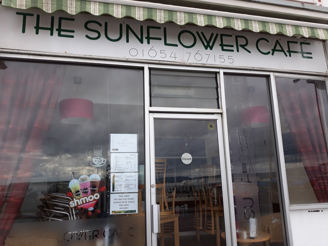
I drove back to base camp, and as I was walking back from where I have to park the car to the cottage – I noticed the name of one of the local cafes in Aberdovey! Christ Church has a fantastic sunflower cafe every wednesday morning, and it has just celebrated it’s third birthday.

20180917_152618

Beautiful beaches and tricky stiles….

Day thirty seven to forty one (11th-14th  Sept) Walk Day 16 and 17

Day 37 Walk Day 16 Harlech to Dyffryn Ardudwy

Phone stats: 27590 steps, 11.7 miles, walking time 4hr 13 minutes

Slightly delayed start, as I waited for the rain to stop. I did sort out my house insurance whilst I was waiting and got a vastly better deal from Ecclesiastical (about a 1/5 of what my previous insurer had wanted after the flood!)

When the rain had stopped, I started the day at Harlech beach car park just down the road from the touching post at the station … So when I come back later I will complete the loop, touch the start point and walk the missing bit of the path. The first mile or so was on Harlech beach and the tide was right in. When I got to the steps I needed to climb, they were still being bashed by the high tide – so I had a coffee so the water could recede abit – which it did and I managed to dodge the waves to get to the bottom of the stairs.

What followed was a stiff climb up to Llanfair and down to Llandanwg. As there was an open café I succumbed to another coffee! At this point I was hoping to have a good look at St Tanwg’s church near the beach – as it is a good example of an early medieval church (and would help my church history class in the new year) but again it was locked. A big loop around the estuary of the river artro followed. More dykes and fast flowing rivers…Made good progress and ended up having lunch on a bench on Llandebr station. Dithered for abit but decided to carry on…

A long section around another aerodrome followed, and then a lonely section across a wet land nature reserve, which turned into a dunes based reserve. There were a few brave souls wild camping and eventually I got back to a magnificent sandy beach, near shell island. I was rewarded for my efforts by the sun shining and views across Snowdonia opening out. I was getting conscious of the times of the trains (which are at 2 hour intervals) so the section across the beach was at a pace.

Morfa Dyffryn includes one of the oldest naturist beaches in the UK, it was first established in the 1930s. I was just reaching the end of that section, when I saw a naturist with his fully clothed companion! Shortly after that, I found the path out through the dunes to Dyffryn Ardudwy station, saw a stoat and caught the train with 3 minutes to spare… I touched the bench on the station but didn’t have time to take a picture (so I did that when I returned on Saturday morning!). I got back to Harlech station, touched the starting touching point then and did a final ½ mile back to the car to complete the section.

In the evening, I marked up my progress on the Wales map – here is a summary of the story so far

Week 1 BLUE (5 walking days) 43.42 miles

Week 2 RED (6 walking days) 55.51 miles

Week 3-4 BLUE (5 walking days) 57.32 miles

TOTAL (16 walking days) 156.25 miles

20180911_20024220180911_200424

Day 38-40 Sept 12-14

Took a trip to Sidmouth to do some important stuff with my mum, and then returned to Wales to set up a new based camp at Aberdovey.

20180914_160424

Day 41 Walk Day 17 Dyffryn Ardudwy to Morfa Mawddach Sept 15

Phone stats: 14870 steps, 9.23 miles, walking time 3hr 20 minutes

Decided to let the train take the strain as I had done a lot of driving in the last few days. I walked to the station in Aberdovey and got the train just after 9am – it took over an hour to get back to Dyffryn Ardudwy but I was rewarded with fantastic views from the train, which winds around the coast. I missed a heavy shower too. I touched the bench touching post on the station and set off back to the route. I was soon making reasonable progress across a low section and fields. I had been contemplating that I had not had any solitary bull encounters or really difficult stiles, and both of these promptly featured. Fortunately the bull was very sleepy and didn’t get up, and I did negotiate a number of the stiles (the dry stone wall variety of which I am not fond!).

It was a bit of relief to get back to the main road after a particularly awkward dry stone wall stile, I had a breather and a coffee from my flask, and then did the 2 mile section of road. During this the heavens opened, and I got rather wet shortly after I had passed a church in Llanaber, by the time I had got down to the long sea front at Barmouth the rain had stopped. I wound my way into Barmouth, and had lunch in a café – there were lots to choose from!. I decided to cross the bridge for trains, bicycles and pedestrians only to finish the day. I am also not very fond of pier like structures and this was very much one of those with gaps and a mile long. I know it is ridiculous but I don’t like being able to see the water below between the planks!

I touched a touching point where the coast path turns off just before Morfa Mawddach station, and got the train (having a longish chat with a family I had met earlier on the train).

20180915_144845

Rest and giraffe and No 6 festival!

Day thirty five and thirty six (9th-10th  Sept) Walk Day 15

Day 35 Day of Rest Sept 9th

Had a leisurely start to the day and walked along to the church in Harlech (St Tanwg’s) (a 10 minute stroll from base camp, and with views of the beach and Harlech castle to enjoy on the way). The service was at 9:30 – it was not clear what it was going to be but it turned out to be bilingual communion, and reminded me quite  a lot of worship at Theological College (which was in Llandaff in Cardiff where we often had bilingual worship). It was from the 2004 book, and I enjoyed immensely that where it was possible Tad Tony signed. It was particularly interesting during the hymns, and I shall be using the sign for alleluia at some point soon! The sermon was very helpful too (and I took the time to say that to Tad Tony afterwards!), and was all about being open and allowing space in the noise and busyness of life… It was about taking time and letting God in…

I had a very leisurely day after that, and I have been finding these Sunday days of rest, particularly refreshing. I read a bit, I did some embroidery, some route planning and watched some telly!

Day 36 Walk Day 15 Porthmadog to Harlech Sept 10th

Phone stats: 32251 steps, 13.6 miles, walking time 4hr 59 minutes

Awake early so took the chance to take an early drive to Porthmadog and was walking by 9:10. I touched the touching point I established at the start of Saturday and set off. It started well with a section next to the steam railway line (to Blaenau Festiniog) and was rewarded with a very close encounter with a passing steam train. Then there was a nature reserve and suggestions of otters, so I was on otter watch after that (no sightings of course!). Then it all got a bit unusual.

I set off on the route round the portmerion estate. It started well, but then I started encountering temporary fencing and the way was guided past a whole load of tents being packed up after the end of the No 6 Festival

https://festivalnumber6.com/music/

Then rows of toilets and showers, and then I started encountering security guards! At one point the path was illuminated – which was very smart! But this was no doubt to help campers back to their tents at night rather than to light the path of coastal path walkers. Shortly after this, when I was very near the heart of it (and the smell of bacon sandwiches was overwhelming) – the signs for the coastal path disappeared. About 20 minutes passed as I wandered about, mystifying security guards and eventually found a lady in the welfare area, who helpfully guided me back to the drive of portmerion, so I could rejoin the path! Taking me through a restricted area to do it. All of this wasted some time, but increased my experience of festivals! There were areas where regimented rows of similar tents were being vacated (no doubt you hired your tent with your ticket) and another area with yurts. I was pleased to see there wasn’t much rubbish around and good recycling bins were available too! All the people leaving caused a bit of traffic issue, and as the next section was along the main road that was not totally great…

After about a mile and a half (and after encounters of the giraffe kind) I had turned off to cross the new bridge at Pont Briwet – I had a quick coffee to admire this feat of engineering and it was very good news (as the coast path walk book had a 9 mile loop to a higher crossing that I could avoid). It was then out, up and around a rocky outcrop and a long section on a dyke above great otter/water fowl country. Saw lots of birds – no otters. There were lots of excellent views across to Portmerion and ahead to Harlech and its castle too!

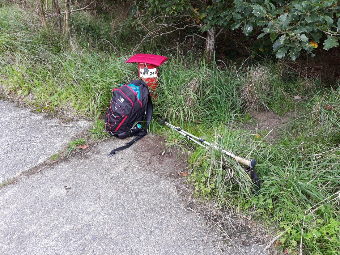
Eventually came to a section running up and over a couple of small hills, and then running between 2 hills and the coast.  I should have stopped and had lunch at this point, but I carried on and then there were farm tracks, and fields with cows, and an amenity site. It was not so scenic and I ended up having lunch sat on an odd red post, labelled BH24. I encountered on a track like the Canadian road near East Surrey Hospital. At least it was out of the wind. The final section was across fields, and then along the main road. I bought a hot chocolate from the garage as I came into Harlech, and then had a 45 minute wait for the train back to Porthmadog (I had set up a touching point before entering the station). Fortunately there was a section of platform that was covered as this is when is started to rain. I had an interesting discussion with a couple who had been to visit the castle.

20180910_143934

Aspects of this day (certainly my encounters with the No 6 festival) were a bit unusual to put it mildly. I have never mystified security guards before by wanting to walk the coast path.

Sunny weather – wet weather

Day thirty one to thirty four (5th-8th Sept) Walk Day 13 and 14

Day 31 Walk Day 13 Pwllheli to Afon Wen Pandy

Phone stats: 19870 steps, 8.4 miles, walking time 3hr 2 minutes

Parked the car in Pwllheli (around the back of the fun fair) touched it as the touching point, and set off! It was warm and sunny. The walk started off walking around the marina and then there was about 4 miles on the beach taking in Morfa Aberech. It was delightful and at times warm enough to walk without a fleece. At the far end of the bay I climbed onto the low headland to be rewarded with a 270 degree vista of mountains. Breathtaking.

I had lunch a bit farther along the path after the inevitable array of caravan parks and a park which had once been Butlins Pwllheli. The views were glorious throughout this section and for want of sounding like Greg Wallace…. Walking doesn’t get much better than this.

I was then heading inland back up to the main road for a couple of miles, and was feeling rather weary (and too hot!) so in the end succumbed to the lure of a bus stop I passed (using that as the end of the walk for the day) – this was just beyond the village of Afon Wen, and the bus stop was called Afon Wen Pandy!

Day 32 and 33 – Necessary trip back home for a health update. All good. A very long time spent in the car on both days!!! Note to self. DO NOT trust satnav to pick a sensible route when you are in this part of Wales….Good to see Ronni and Jimmy and pick up a few things I had forgotten (including the bird book).  Settled in to a new base camp (on the edge of Harlech!)

20180908_164944

Day 34 Walk Day 14 Porthmadog to LLanystumdwy (about a mile short of Afon Wen Pandy)

Phone stats: 23687 steps, 10 miles, walking time 3hr 41 minutes

It was seriously wet as I drove back to Porthmadog. I had motivational issues. I had just missed a bus back to Afon Wen Pandy (and the prospect of waiting half an hour was not good). I knew if I went in a coffee shop, I would probably not walk, so I decided to walk the route the wrong way and start from Porthmadog. This would also mean I would arrive at Criccieth at lunch time (well that was the theory anyway). It started ok, but when the path got near to the coast, it got very bracing! I decided to adapt the route in view of the prevailing conditions, (high wind, heavy rain). The planned route included a couple of miles of the beach at Morfa Bychan, I avoided this by walking through a static caravan park and the village instead. I also took a path up on to the headland, to cut off a corner, I am not sure that was in reality a good idea and the path went higher than I realised.

Surprisingly a church came into view, and I really thought my luck was in, I would be able to have a break from the rain inside. Sadly it was locked, so I ended up having a coffee in the graveyard. It was VERY wet at this point (and all of me was wet despite waterproofs!). The final section into Criccieth after another climb over another headland, included a sheltered section next to the railway line (which was very welcome) and by this stage the rain had gone more drizzly. I had been on a family holiday to Criccieth when I was at primary school. I have to say I didn’t recognise it. I decamped into a café for a very nice lunch, though I did leave quite a puddle on the floor from my waterproofs.

This slideshow requires JavaScript.

I decided as it was dry to head back to Afon Wen Pandy, so went along a low section of cliff and another good area for wildlife and birds, which eventually cut back in land to LLanystumdwy. As I was approaching the village, the rain started again, and as I was just edging over the 10 mile mark, I decided to cut my losses and not to do the mile back on the main road to where I had stopped on Wednesday. Forgive me! I marked a touching post and called it a day and got a bus back to Porthmadog. Back at base camp I confirmed I was completely and entirely wet after the days exertions! But to be fair this is Wales and this is the first time in 14 days I have got anything like this wet….

North Wales coast path section completed and then what?

Day twenty eight to thirty (2nd – 4th Sept) Walk Day 12 – Exploring the Lleyn peninsula in the car

Day 28 Day of rest

Overslept, so it was a real rush to get to the church for 9:30 (a 20 minute drive away!), and having only had one cup of coffee! Not helped by me thinking when I looked at my watch when I woke up it was 7:30 when it was in fact 8:30. The weather was extremely wet and most of the view was blotted out(!) and it stayed that way all day. Church turned out to be congregation led morning prayer from the ‘green book’. We thought about the importance of bringing peace and making peace. On the way back I harvested a paper and some croissants from the Spar in Nefyn and had some proper coffee and a very leisurely and very late breakfast.

As well as doing some craft, and catching up on Redrock on iplayer!, I did some strategic planning on what to do next, and looked at the public transport options for the next bit of the coast path. I am 4 days off the pace of the walk book (not surprising given my starting level of fitness!), and with other things meaning in the next 2 weeks I am going to lose some time to necessary other matters, I decided to do one more walk on the North Wales trail (which will complete that section) then switch to the other coast of the Lleyn. I will spend some time on Tuesday exploring the Lleyn in the car (so I don’t miss it completely). I have also found some arriva trains (and a couple of buses to help!) and I am staying only 8 miles away from Pwllheli, where I will pick up the trail then head towards the Meirionnydd and Ceredigion sections of the trail!

20180902_115302Day 29  Walk day 12 Y Felinheli to Dinas Dinlle
Phone stats: 32068 steps, 13.59 miles, walking time 4hr 53 minutes

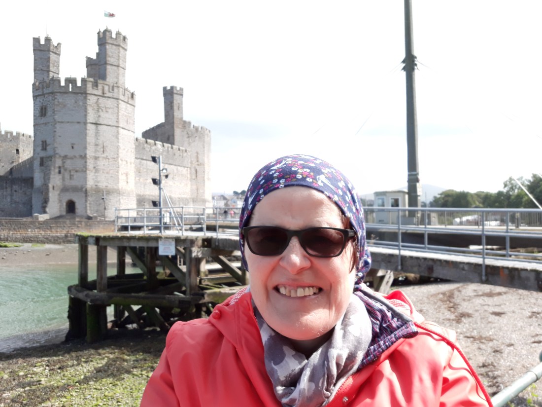
Parked at Dinas Dinlle and got two buses back to Y Felinheli. It had been raining (and was distinctly chilly 11C) when I left the base camp, so I set off in my full waterproofs for the first time. The double bus thing, again, meant quite a late start (10:45). I posted my post cards in the touching point (a post box) and made good progress on the walk into Caernafon. It was nearly all on a combined cycleway/footpath, with glimpses of the menai straights and Anglesey through the trees. I saw the most scenically placed supermarket I have ever seen (Morrisons in Caernafon has an amazing view), and I had a nice coffee (and carrot cake) in a theatre coffee shop in Caernafon. Caernafon marked my completion of the North Wales Section of the coastal path (all 103 miles as Alison has walked!!)

20180903_125538From this point on the path was on a minor road through a huge nature reserve, with lots of wet land and interesting birds. The weather had perked up, the sun was out even it was not exactly tropically hot! As the road moved away from Caernafon there was a row of mountains unfolding (and the cloud lifted from the highest ones). The stretch of mountains was for about 180 degrees (and my pictures don’t do it justice). I realised I must be looking at Y Wydffa (Snowdon), which I confirmed later from the map and a helpful guide in Dinas Dinlle. The view was extremely uplifting – and spoke of our creator God, and the stories of Moses and the israelites, where the presence of God was a cloud over the mountain came to mind

To be honest glorious as it was, I had slight misjudged the length of this section. There was a then a long cut inland with a helpful bench with the most fabulous view of the mountains, where I had a snack and aroused the interest of the local cows. Then more in the nature reserve, and finally 3 sides of a rectangle, a long section on a dyke, then on a road passed a caravan park and Caernafon airport (very reminiscent of Redhill aerodrome!), and then finally the home straight down the sea front to where I had parked the car. The view down the sea front was amazing, mountains ahead and the sea doing it’s stuff, but to be honest it was a bit of a struggle – and I wasn’t surprised when I consulted my phone, that it was nearly 2 miles more than I had done before! Note to self be more careful when combining different sections!

I used the car as the touching point – so that will provide some continuity when I begin walking again on the south side of the LLeyn on Wednesday.

20180903_171151

Day 30 Exploring the Lleyn Penisula

I did some car touring, enjoying the beautiful scenery of the Lleyn peninsula on a bright but chilly day – This included Aberdaron with its pilgrim church (associated with RS Thomas) and a stroll on the beach, Abersoch (scene of some childhood memories with smelly sand!), and lunch near Porth Dinllaen, with my NT membership proving very useful. It was good to enjoy the beauty of this part of the world at a more leisurely pace.

This slideshow requires JavaScript.

When through the woods and forest glades I wander

Day twenty five to twenty seven (30 August – 1st Sept) Walk Days 10 and 11

Day 25 Walk day 10 Llanfairfechan to the edge of Bangor

Phone stats: 27059 steps, 11.4 miles, walking time 4hr 19 minutes

Parked the car again near a bus stop in Bangor, (about 3 miles from base camp) and got the bus back to where I finished at Llanfairfechan. Touched the touching point bus stop, and did about a mile in the village – going under the A55 (which was the closest I got to it all day). There was a café on the beach and I succumbed. Just as well as there were no more opportunities for refreshment on the route for the rest of the day. Fortunately this was the day I was also allowed to use my rucksack again (and I made sure it was as light as possible but it did have some lunch packed inside). There was a very misleading sign on the sea front that said it was 6 miles to Bangor, as the dragon flies perhaps but certainly not as the coast path goes!

The first part of the day was a lovely route clinging to the edge of the coast as the protection of Anglesey made an impact. It was surprisingly isolated (except near to where people could park). I met a lovely chap and had a 10 minute conversation on this remote bit. He advised taking it slowly and savouring the walk opportunity. I do have some issues as to what to do after Monday as I will need to make some tactical decisions on which bits of the coast path to do.  I will also be slipping out of the arriva bus area which is going to make linear walking much more challenging. Through out this period it was all walking paths only (and apart from a bit hopping from paving slab to paving slab on the beach at one point) it was straightforward, and nice not to be dodging fast moving cyclists.

After a picnic lunch, the inland route to avoid the grounds of Penrhyn Castle kicked in. Some roads, fields, a lot of to-ing and fro-ing over the railway (thankfully no role for the A55 in this!). I had a breather and a snack in the churchyard at Tal-y-bont (benches in churchyards always seem to feature on my recent trips to Suffolk). The last 2 miles back was a wooded valley cycle trail. I had joined the North wales pilgrim route at this point. I was rather tired, so bailed out with help from the arriva bus app about a mile from the car (and let the bus take the strain!).  I used a North Wales pilgrim route sign as the touching point…

Day 26

Shifting of base camp from Glasinfryn to Llithfaen near the start of the Lleyn Penisula. Did some shopping in Bangor and had a coffee before setting off properly (had run out of coffee in the holiday let so the need was very great!!) Stopped in Caernafon for groceries, and then whiled away a few hours enjoying the beach at Dinas Dinelle, sorted out where I am going to Church on Sunday (in Nefyn – a couple of miles away) and finally connected with some post cards.

The new residence is a terrace from the 1870s, half way up a steep hill. It also benefits from wifi, a washing machine and a bath – which are all very welcome. The view from the front is particularly awesome. It is well equipped but a bit 1970s! I am settled in and unpacked ready to get back on the trail tomorrow.


Day 27  Walk day 11 The edge of Bangor to Y Felinheli

Phone stats: 22068 steps, 9.32 miles, walking time 3hr 33 minutes

Parked at Y Felinheli and got two buses back to the edge of Bangor. This whole process and a bit of a more leisurely start to the day, meant I didn’t start walking until 10:45. I found the touching point north wales pilgrims way sign again and did the final mile on the cycle path and round Hirael bay. It was good by the pier (where I had had lunch 8 days earlier) to look back to see the Great Orme and Little Orme receding into the distance. What followed was delightful walking along the treelined path on the relatively sheltered coastline looking across to Anglesey. There was a section on the shore line and through a nature reserve that was rather hard going underfoot. The nature reserve was lots of short ups and downs and the path eventually came out by Bangor Football club (the weekend match had been played on Friday evening!). A mile or so on the road followed and then the joy of the Menai bridge. A section through an arboretum stretched on to the new bridge (for the A55) and again I went underneath it. It was rarely visible through the trees which was a good thing as it is not very pretty!

Thankfully a long section I was expecting on the road – was replaced by a further inspiring wooded section, including through Vaynol park. There was a lovely picnic bench where I had lunch and I was on red squirrel watch (after a sign alerted me to their presence), but I didn’t see any. Y Felinheli came into sight, but as is the way with things it seemed to take longer to get there! Used the post box by the car as the touching point for Monday’s start.

This slideshow requires JavaScript.

I have to make some decisions on what to do next after Monday’s walk (when I will walk from Y Felinheli past Caernafon to Dinas Dinelle (which is the very limit of the arriva bus provision!). But here are some stats and my route map (red in the past 6 walking days – blue for the previous 5 walking days!).

Week 1 BLUE (5 walking days) 43.42 miles

Week 2 RED (6 walking days) 55.51 miles

TOTAL (11 walking days) 98.93

20180901_171809.jpgIt was inspiring to get back to base camp to hear them singing ‘How great thou art’ at John McCain’s memorial service. The second verse always reminds me of my dad (we had this hymn at his funeral) and I am sure some of his passion for walking is a part of me along with his map reading! My soul has gloried in the wonder of this walk today!

When through the woods and forest glades I wander
And hear the birds sing sweetly in the trees;
When I look down from lofty mountain grandeur,
And hear the brook, and feel the gentle breeze: 

Then sings my soul, my Saviour God, to Thee,
How great Thou art! How great Thou art!
Then sings my soul, my Saviour God, to Thee,
How great Thou art! How great Thou art!