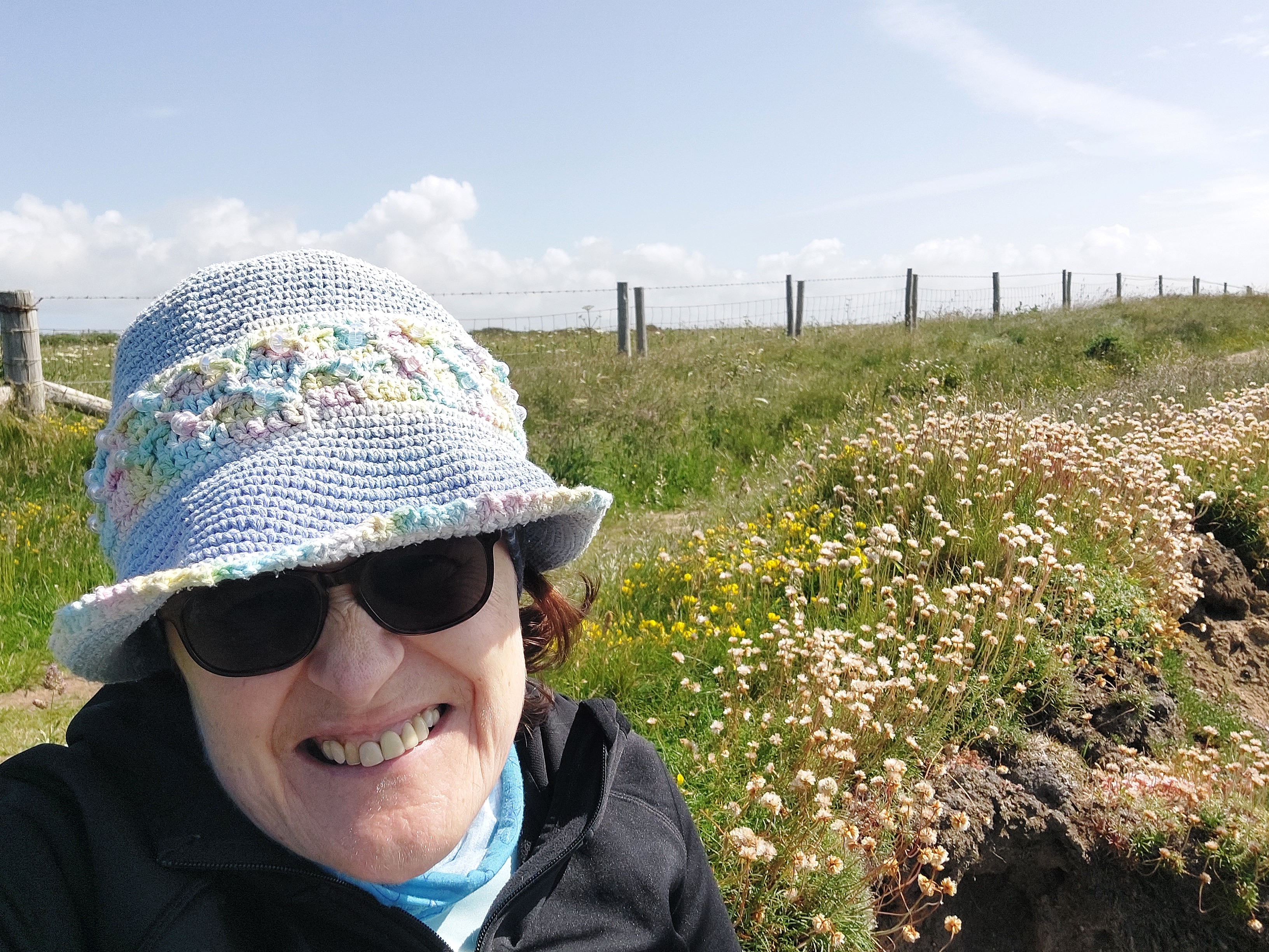
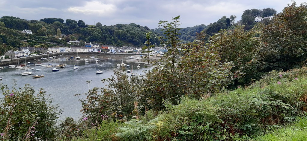
Beyond the Gribin, and Porth Clais and back again

Sunday 12th June

Solva circuit (furthest point on the coast path Porthymynawyd)

Total Steps: 14,753 – 8403 steps on the trail 6,350 off the trail

Total: 6.3 miles 3.4 on the trail, 2.9 miles off

Running Total: 11.5 miles – 6 miles on the trail, 5.5 miles off

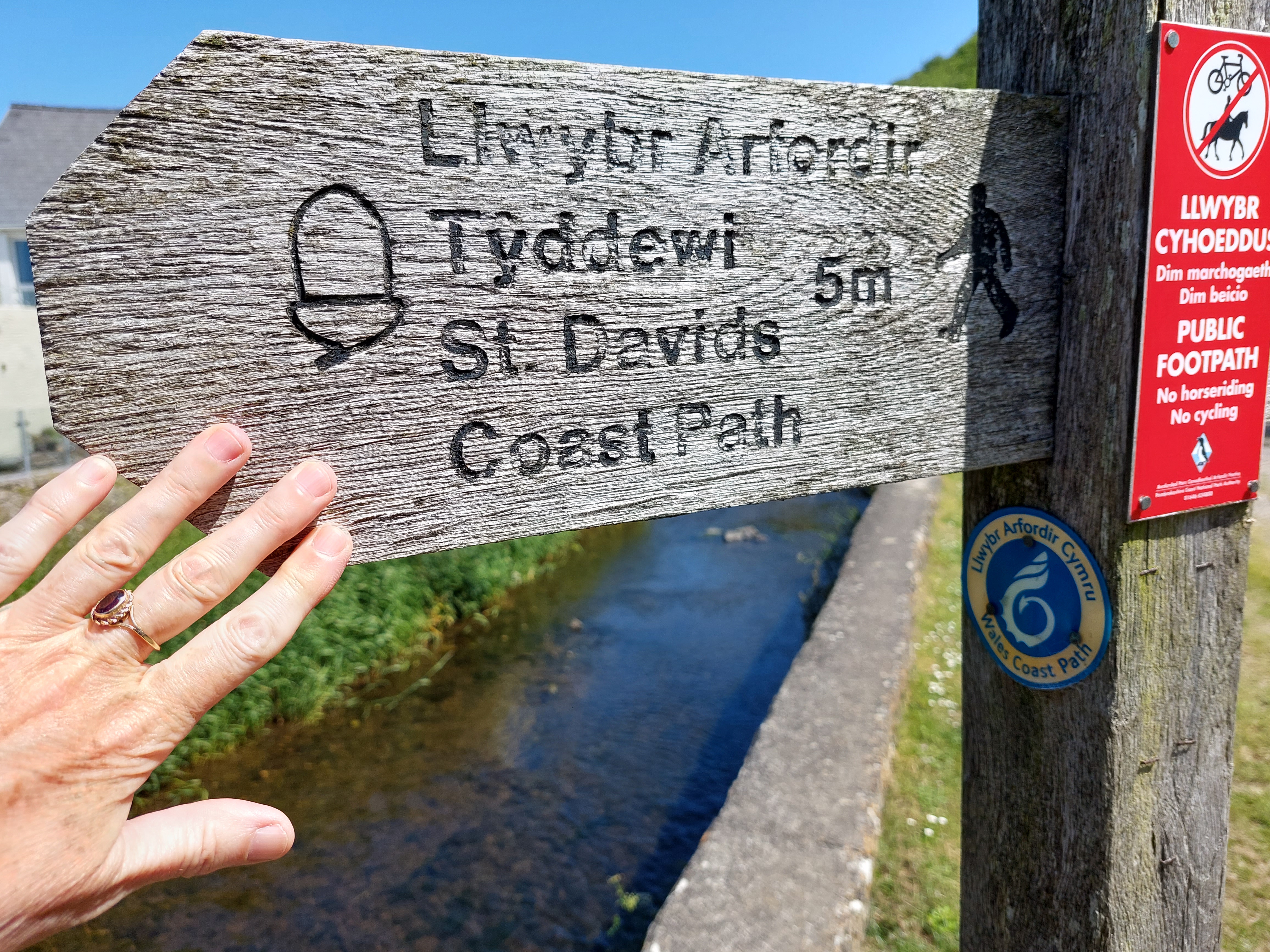
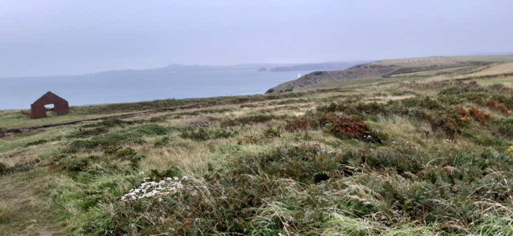
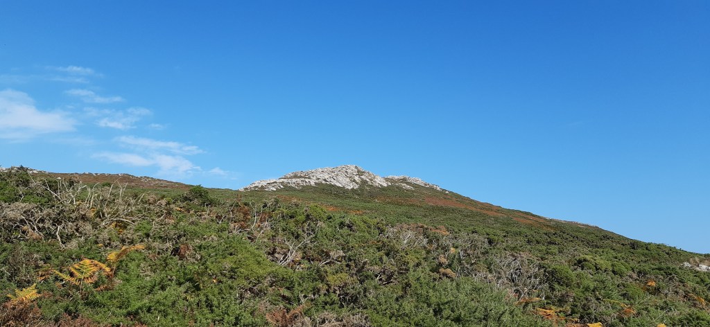
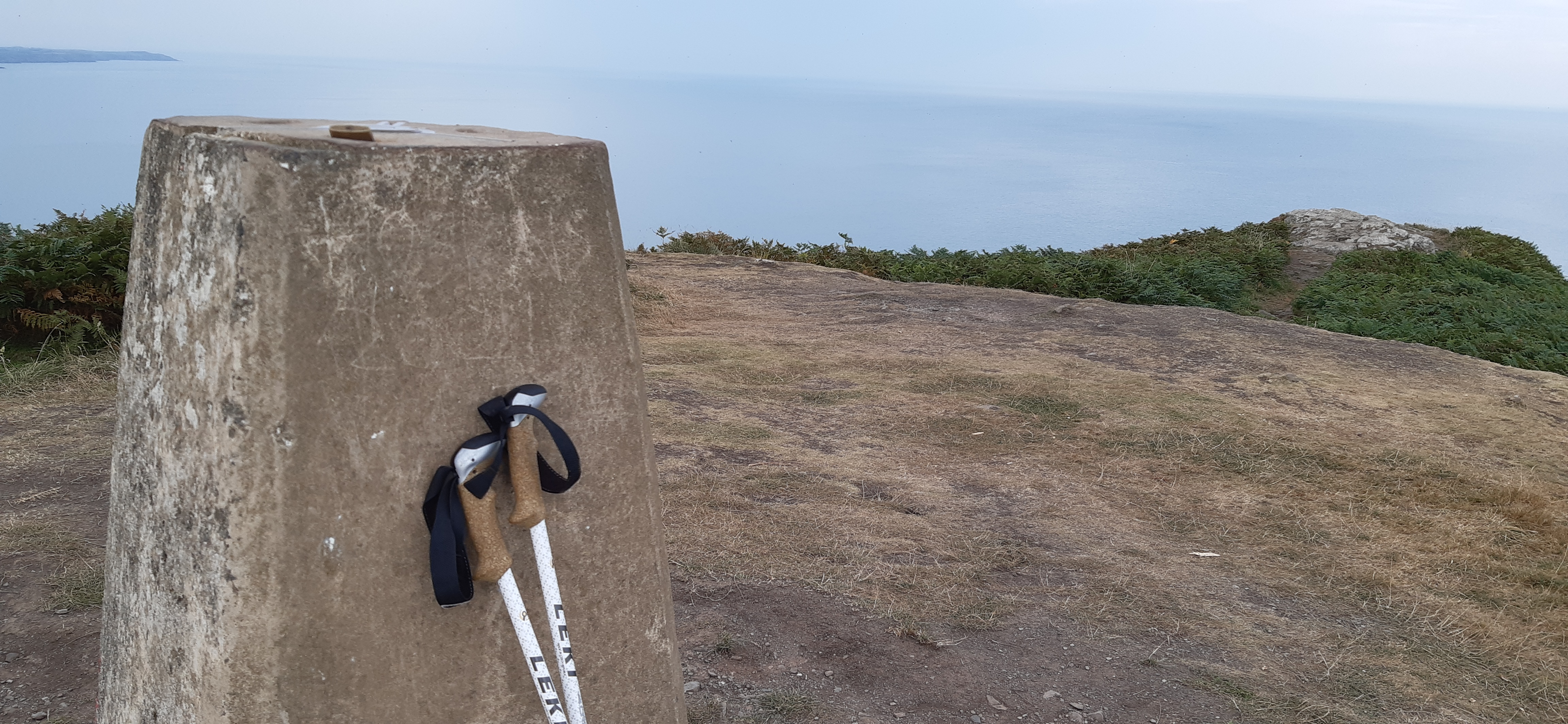
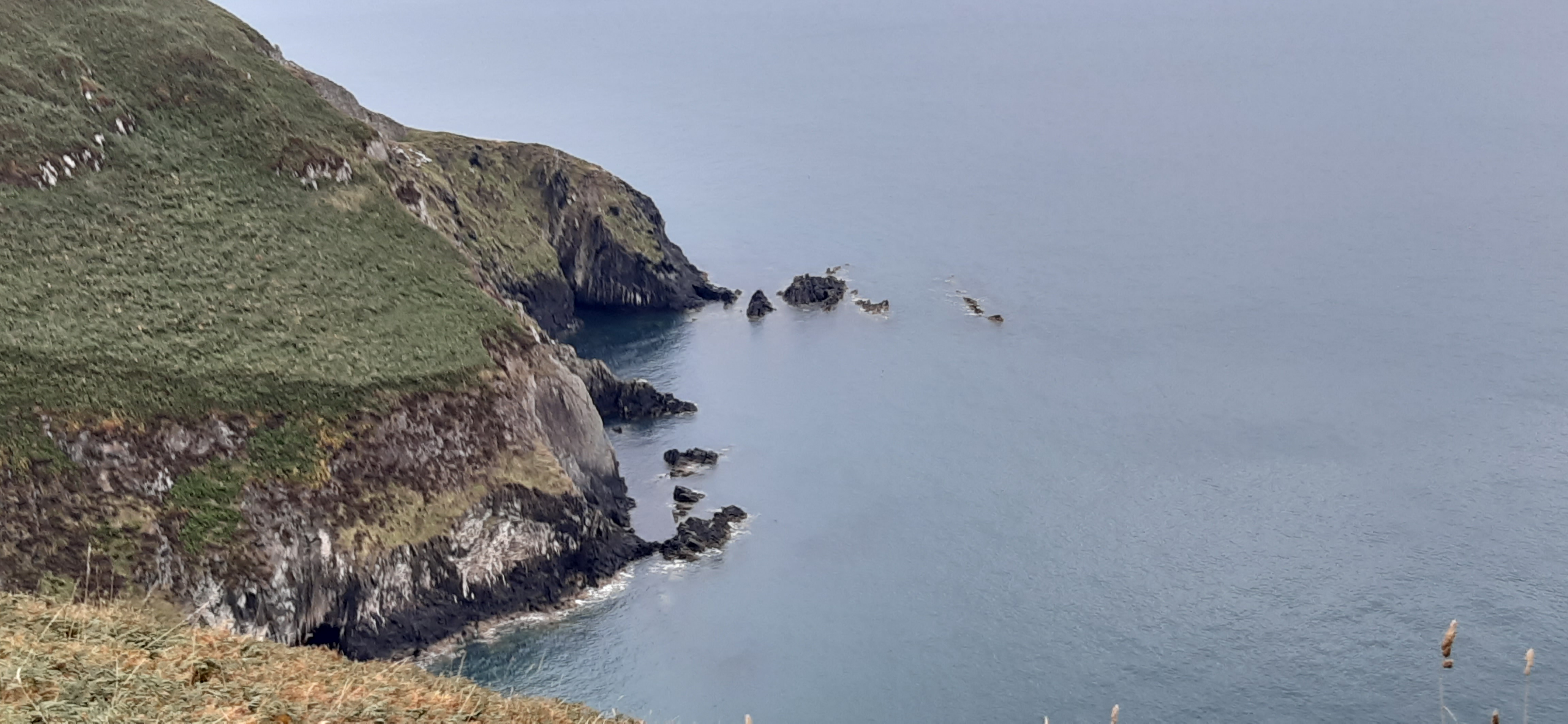
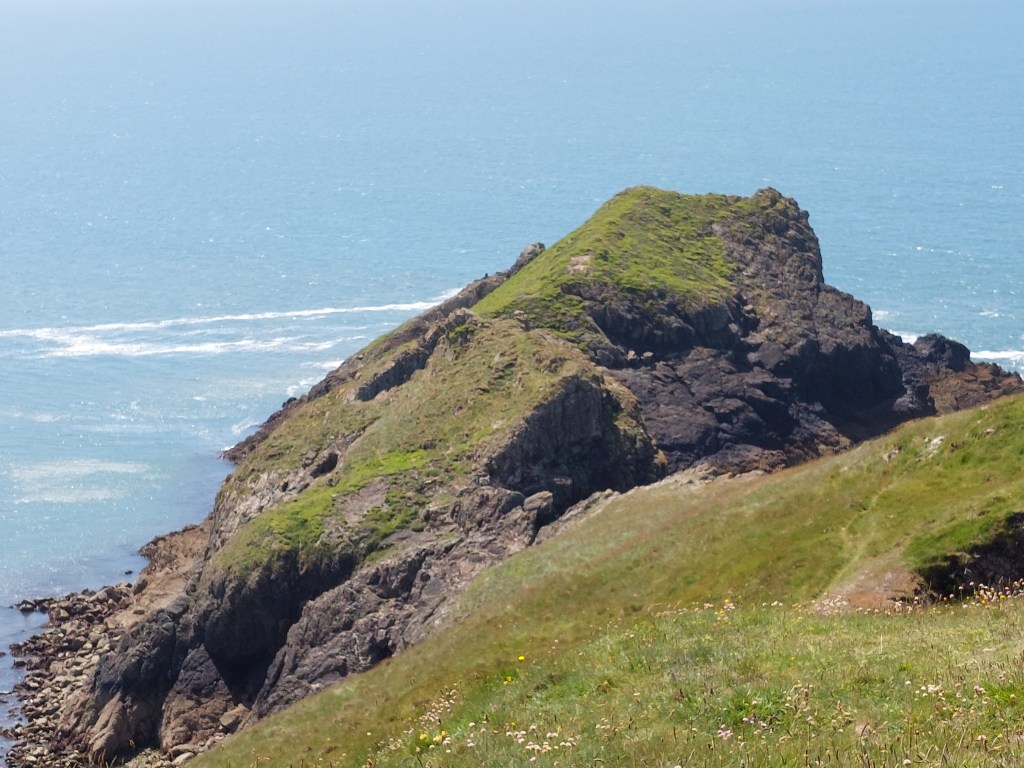
No bus options as it was Sunday, so did a circular walk from Solva and the opposite side to where I walked yesterday. I drove to the car park, and was all ready to go before 9:40am, meeting some of my neighbours from base camp before I got my boots on. I touched the touching point by the bridge. The initial outward path quickly deviated from the coast path, so I decided to count the steps when I get to the furthest point on the coast path and then walk back! Anyway the path took me up on to the Gribin – the view was great but it was a bit edgy and rather rocky! The path down to continue the walk was rocky, eroded and steep, and I took my time. I was conscious I was going to have to repeat this part of the walk going back up the path I had not enjoyed descending, and this rather weighed on my mind.

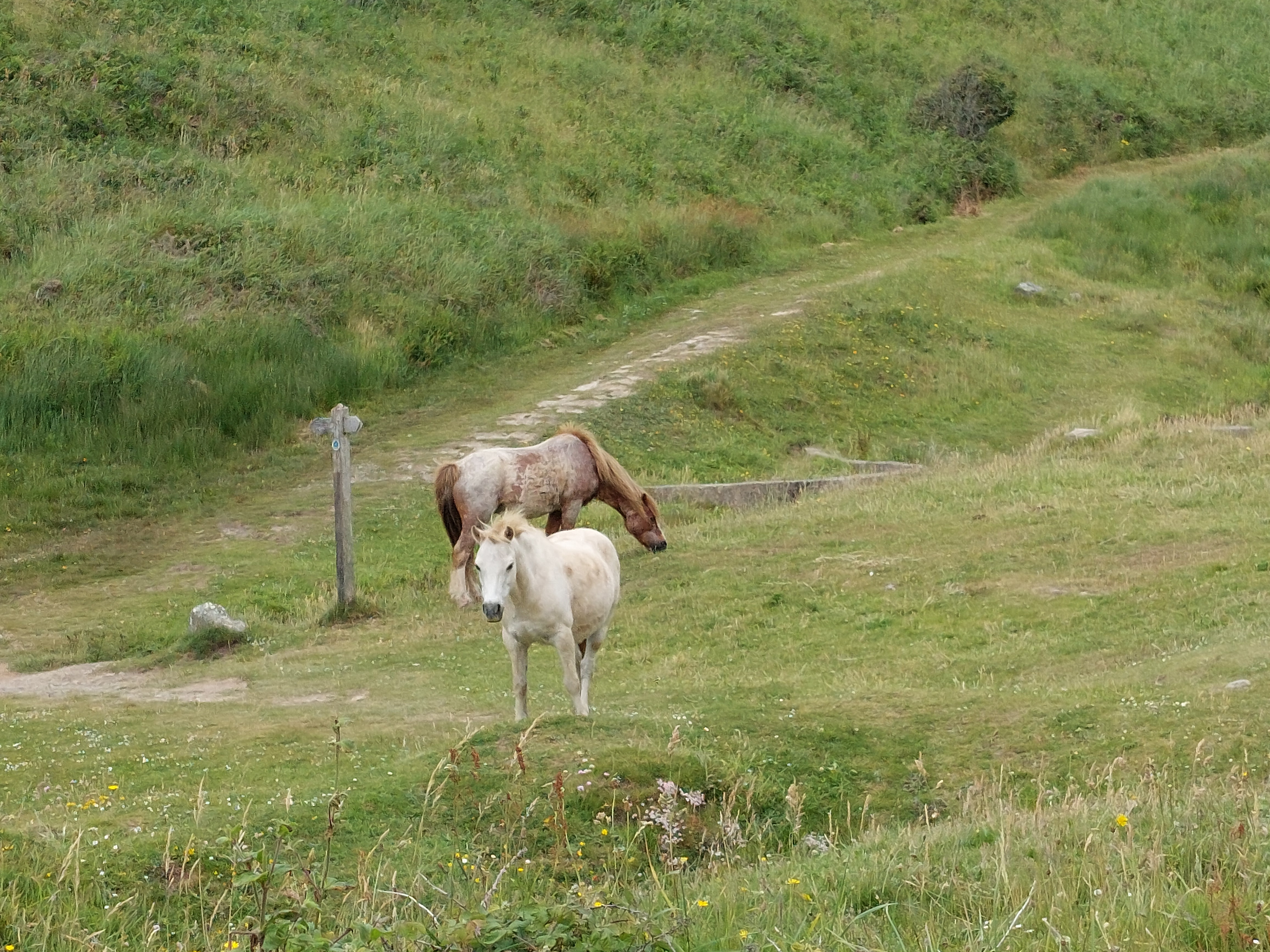
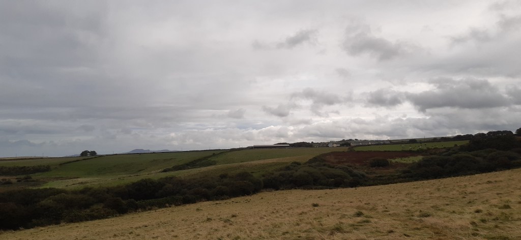
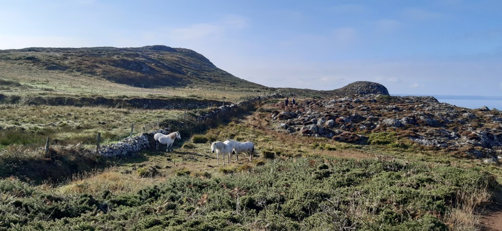
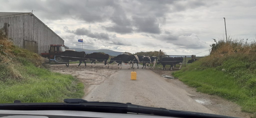
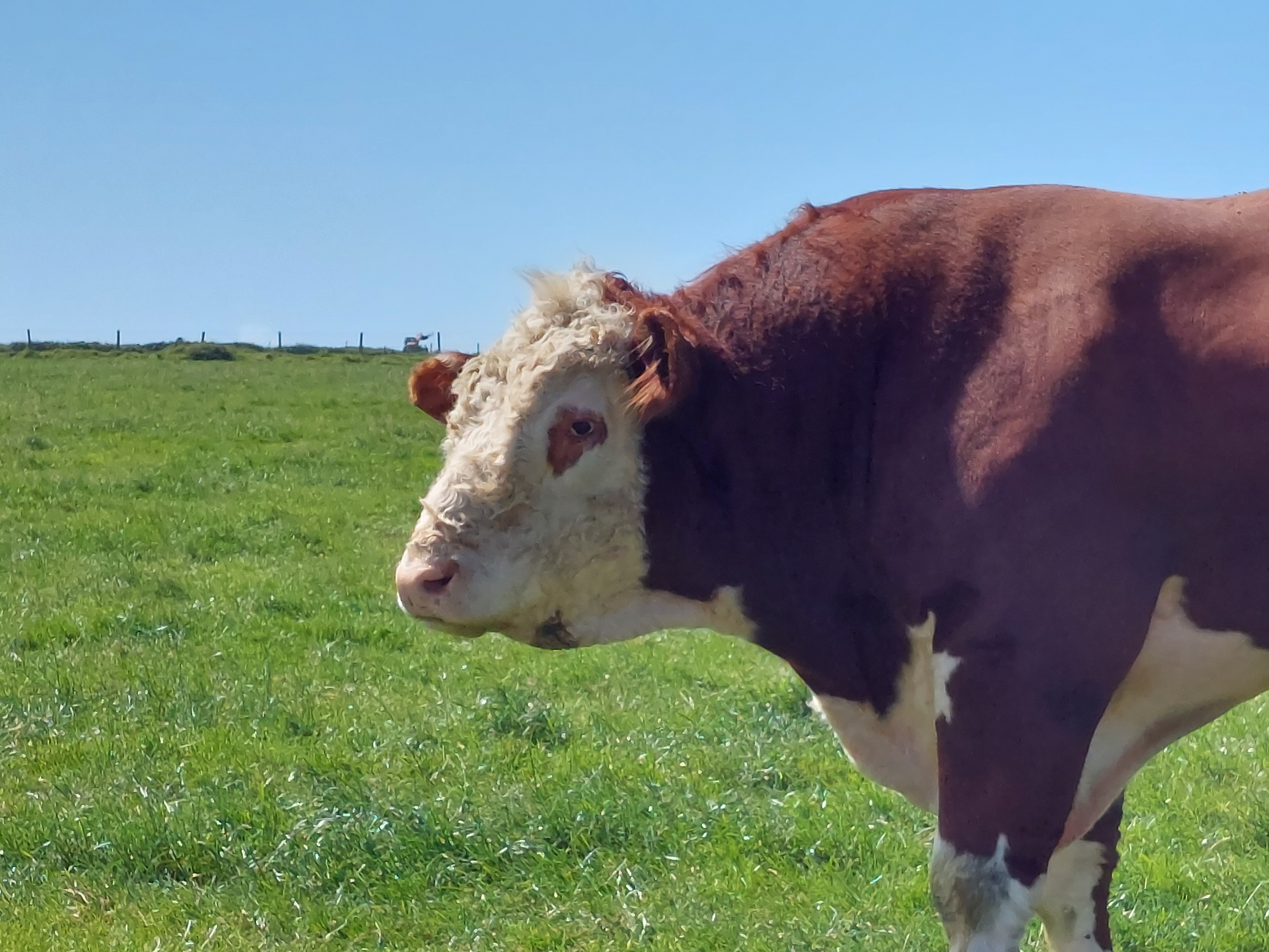
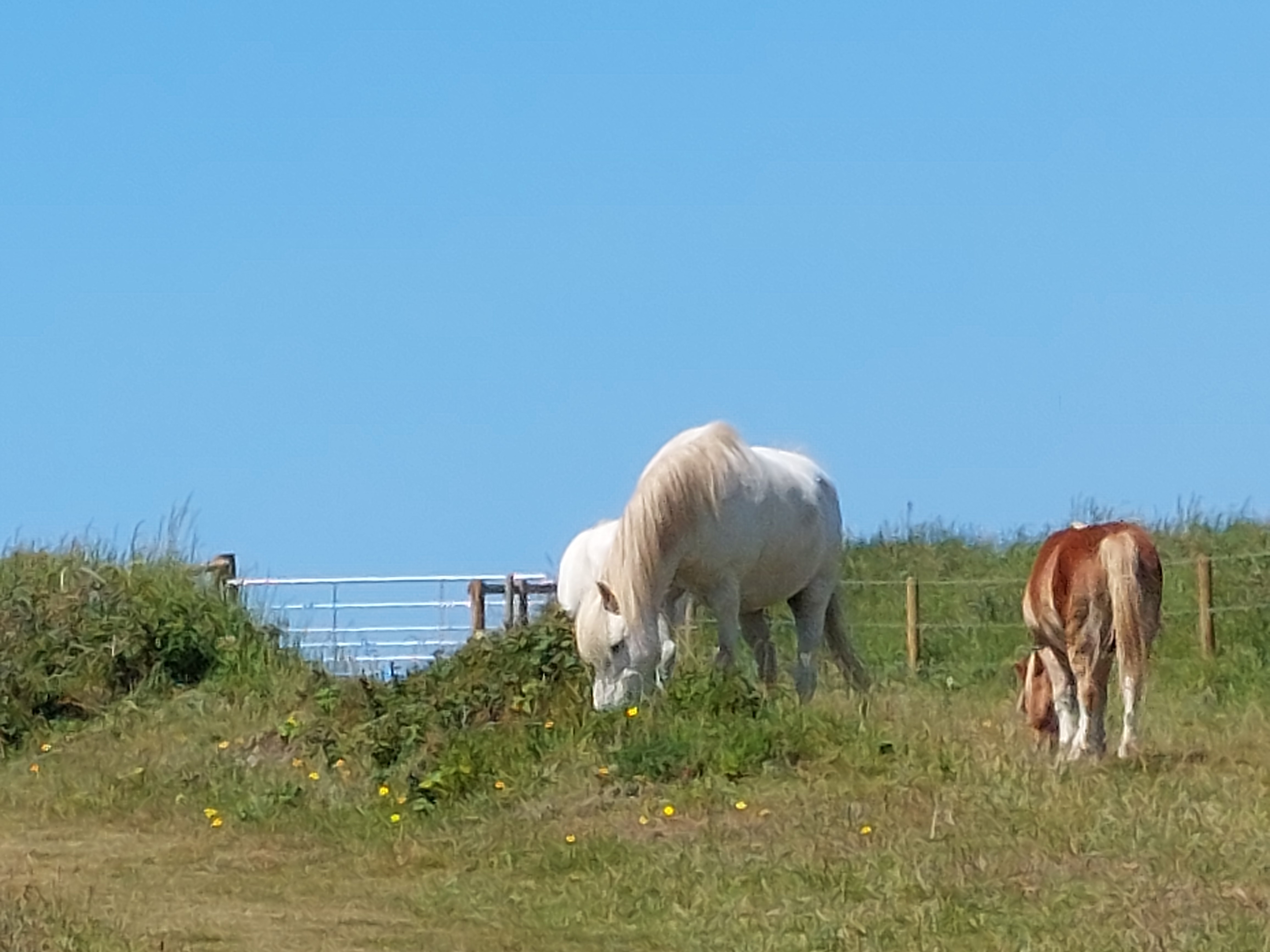
Anyway the inland outbound route, slowly climbed up the hill, to St Elvis’ farm. I had some doubts about this at the time, but I have been reassured there was a 6th century St Elvis! I enjoyed a path right next to a very impressive bull, whilst the Elvis ear worms were prolific! Later on this walk I also saw my first Pembrokeshire ponies too.  

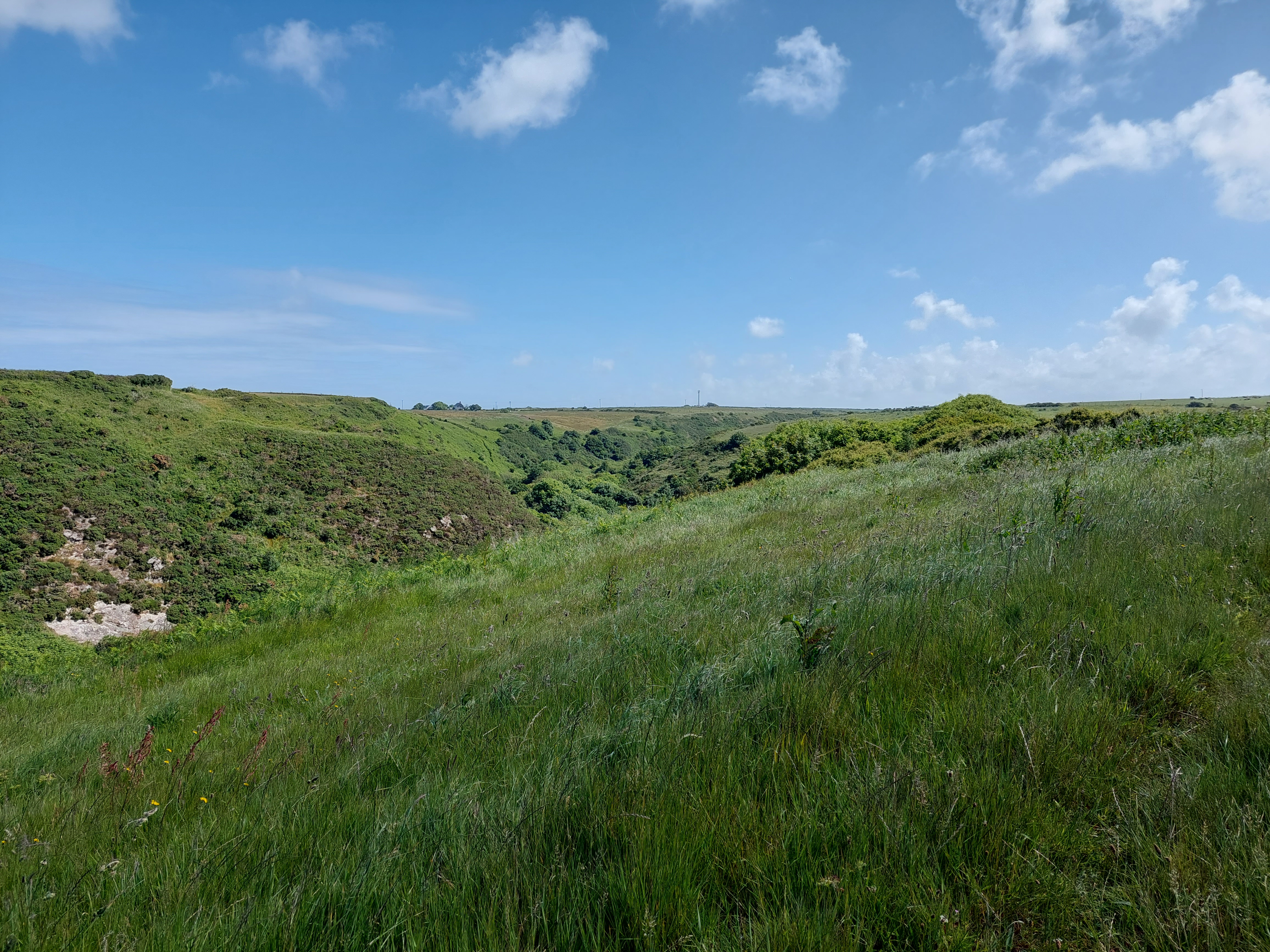
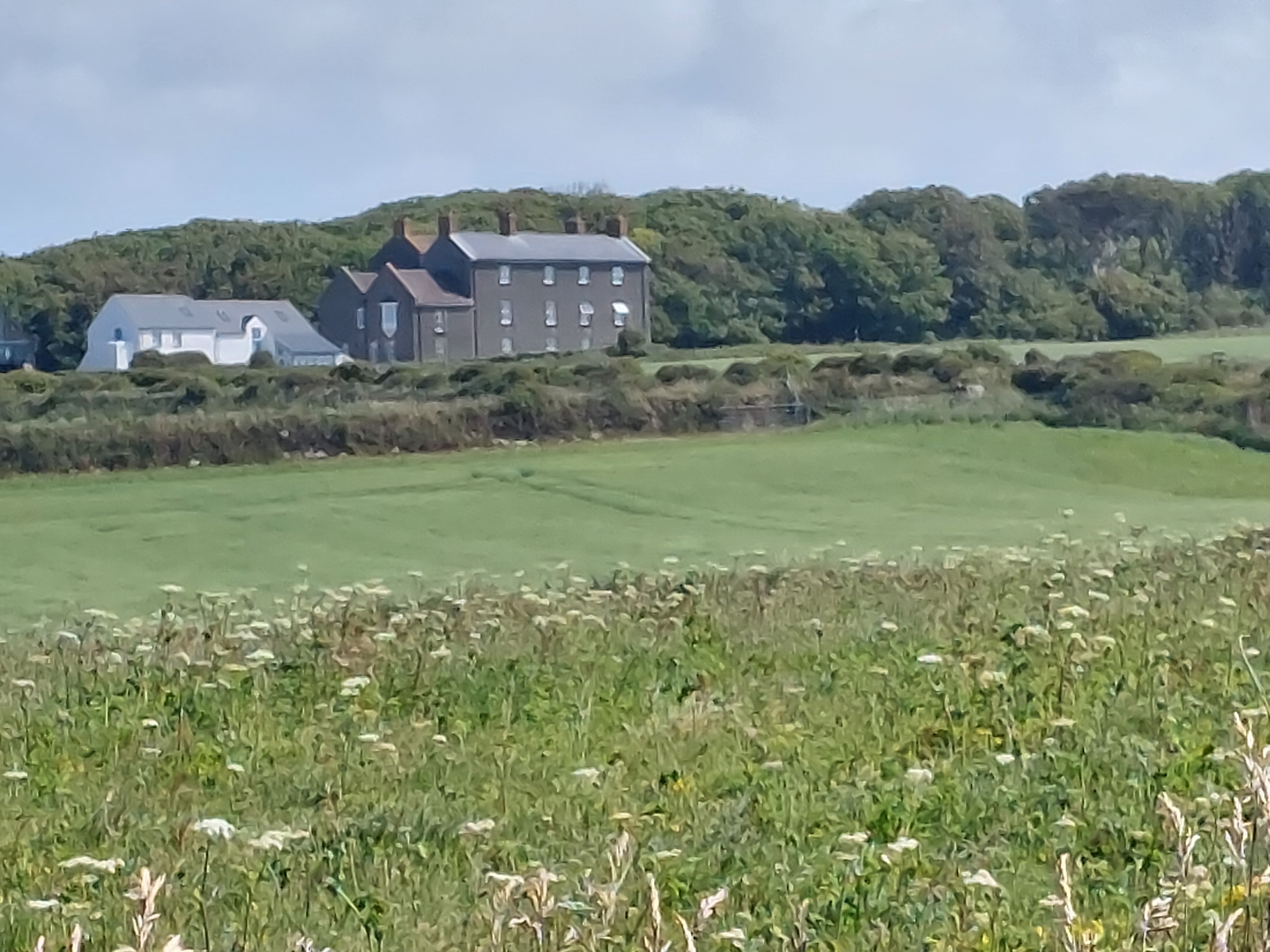
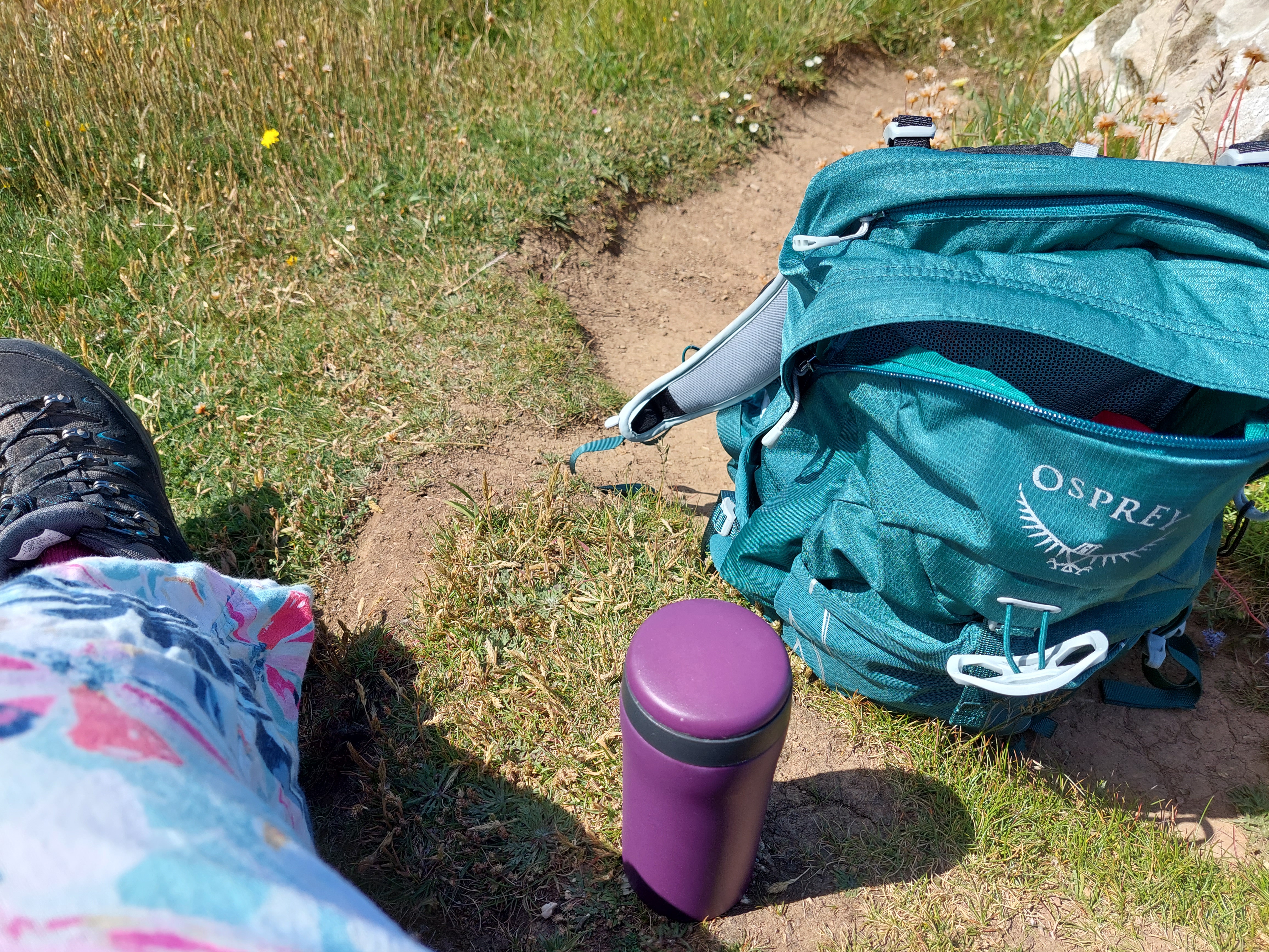
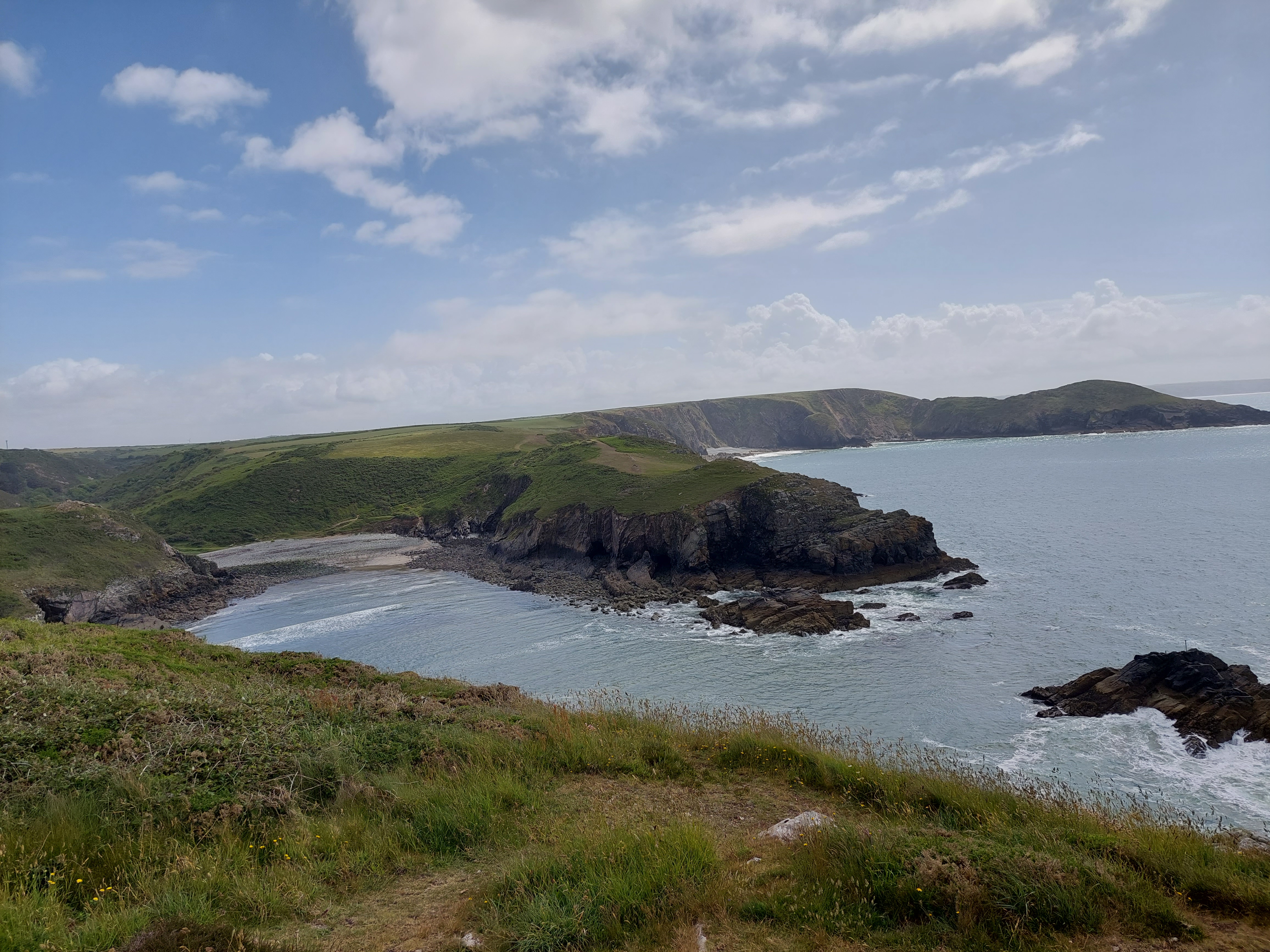
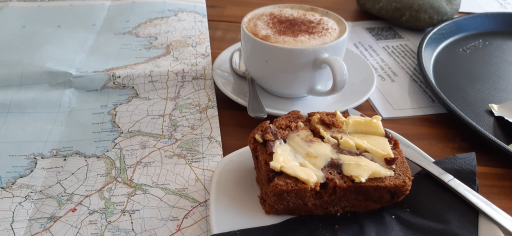
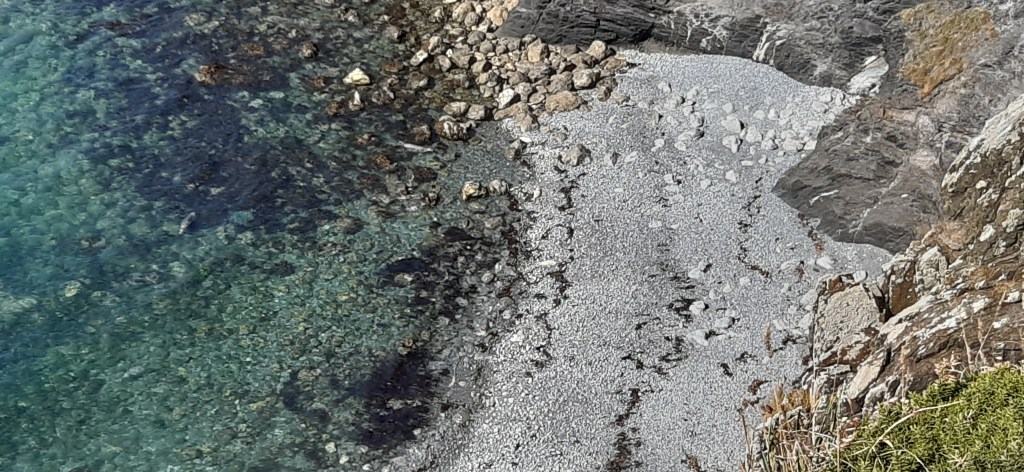
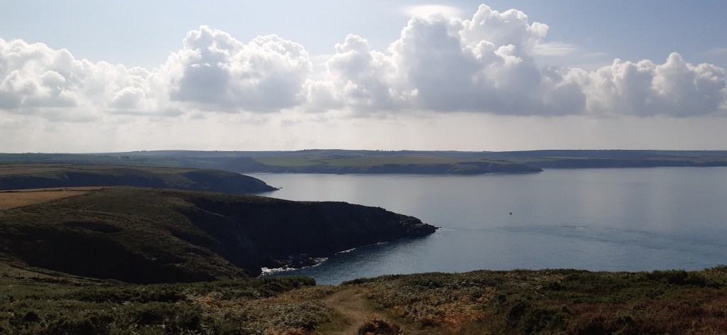
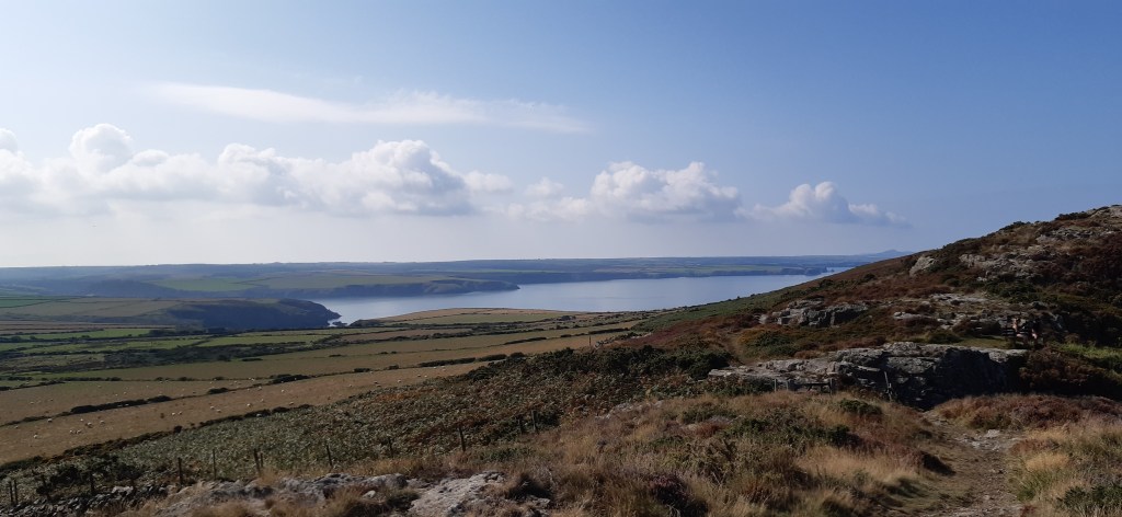
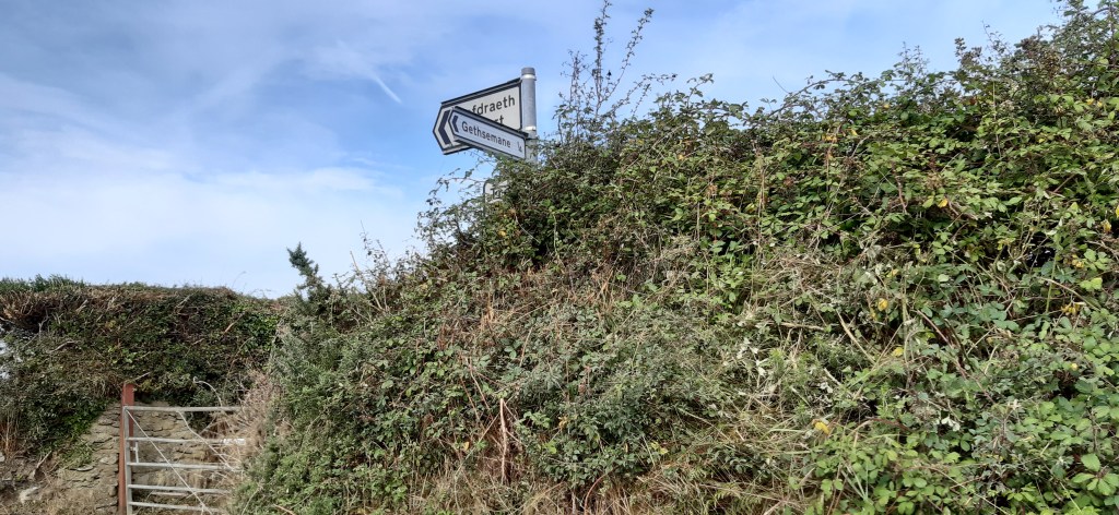
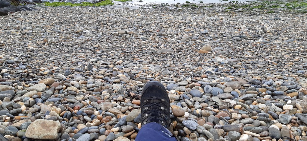
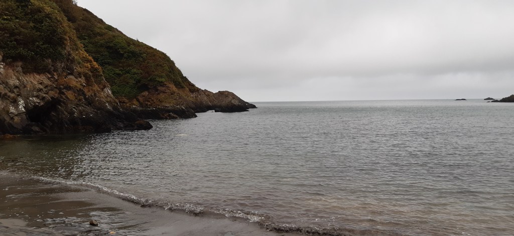
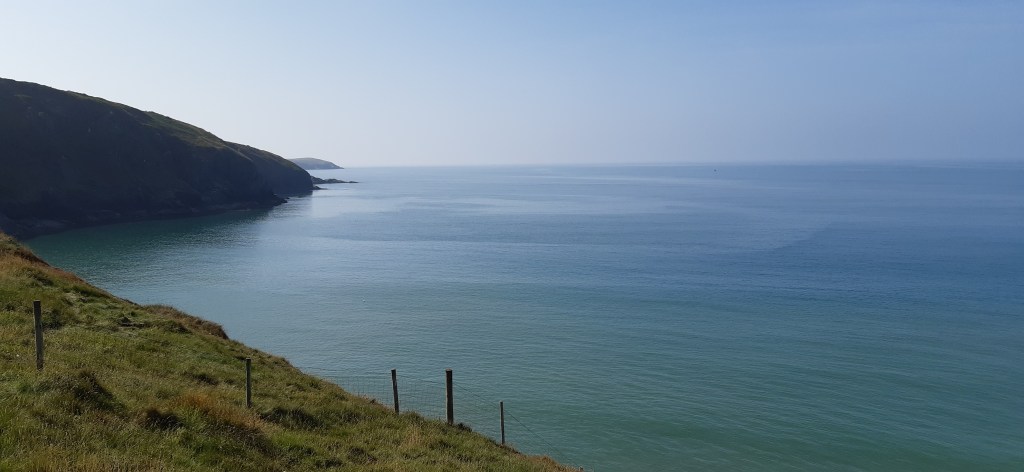
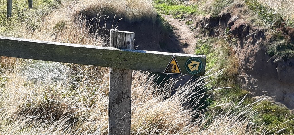
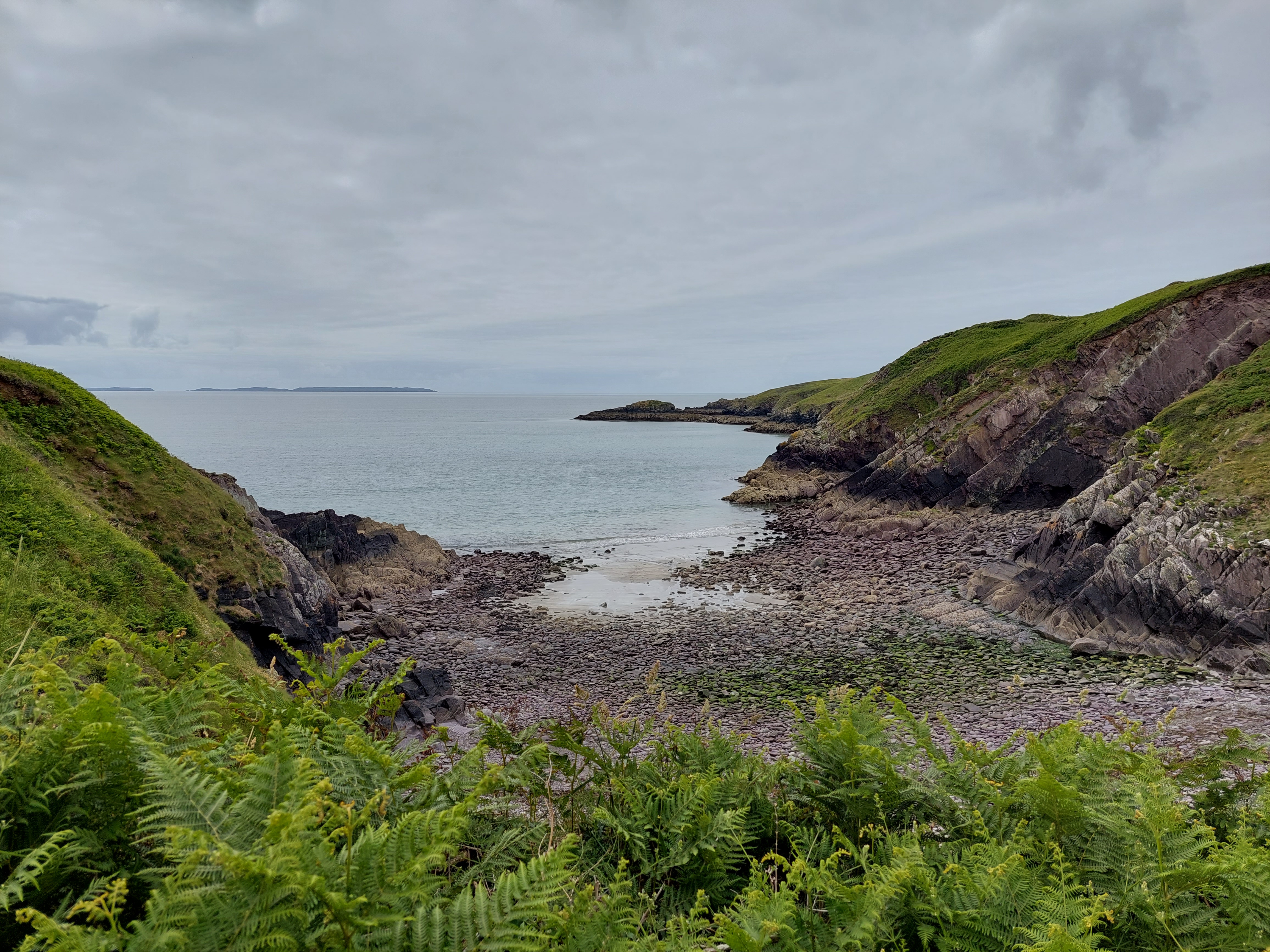
After the initial track, there was a long section on field paths and then a long stretch on an overgrown ‘green lane’. I briefly passed through the hamlet of Lochvane, and another stretch of ‘green lane’ followed. I had a coffee break in a field at the end sitting on the first style of this trip!. I descended down to the coast path at this point near Porthmynawyd (establishing a touching point) and people became much more numerous. The conditions were terrific, bright blue skies, sunshine and a good temperature for walking.

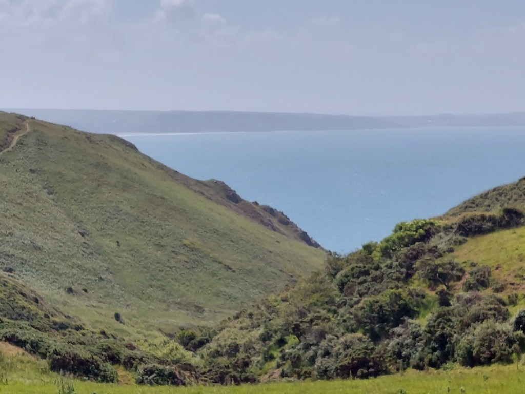
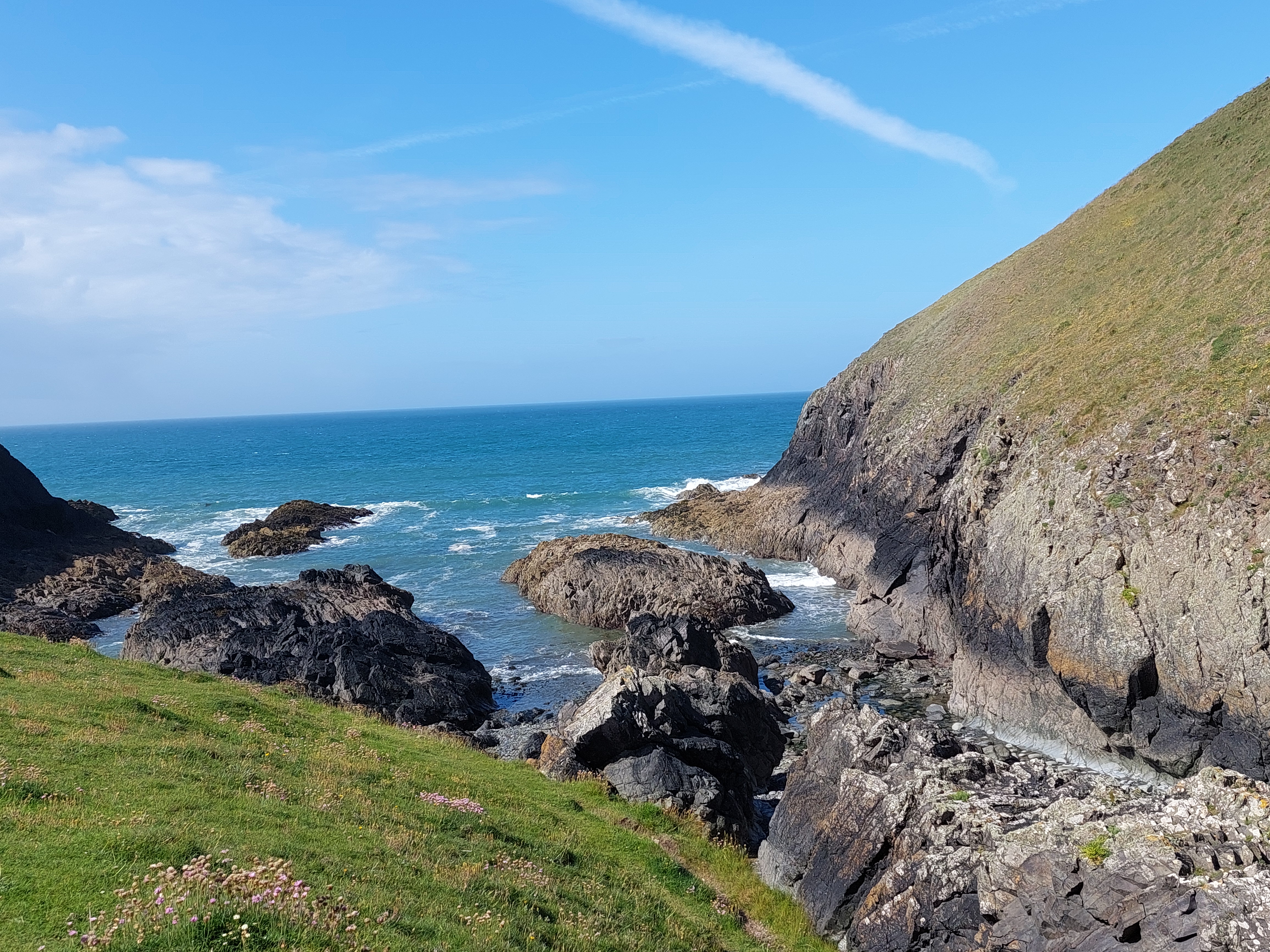
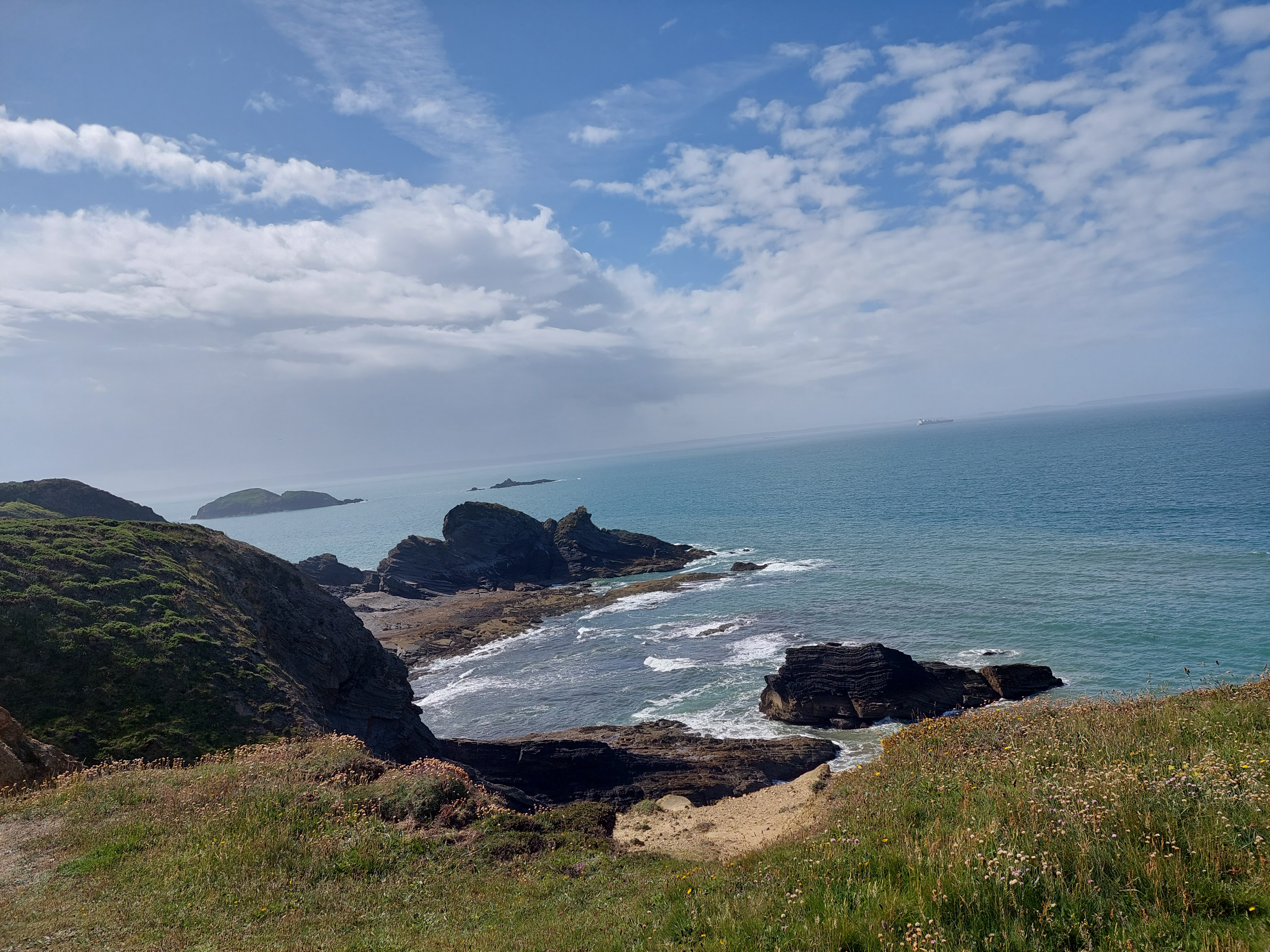
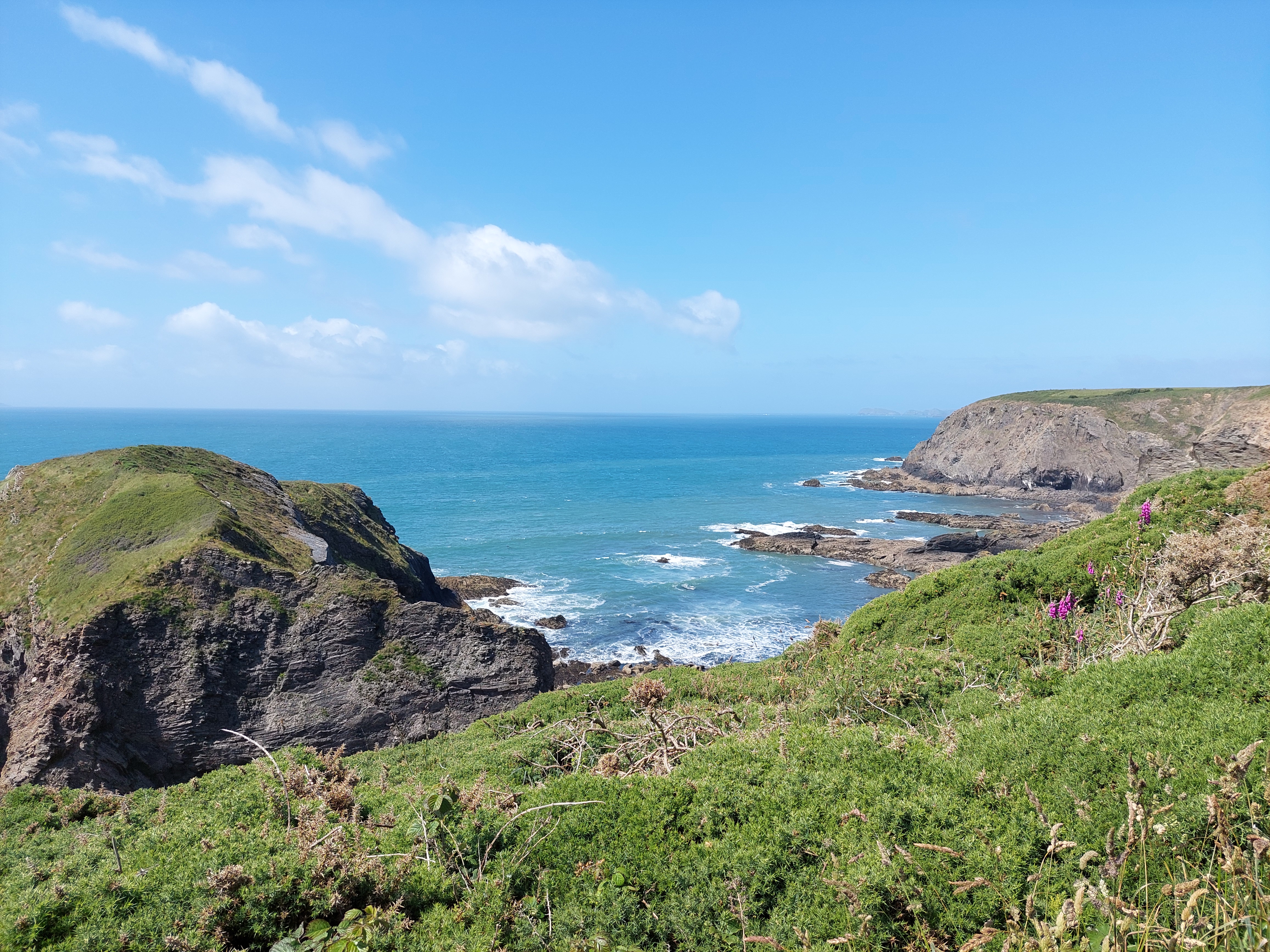
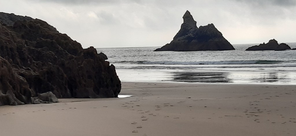
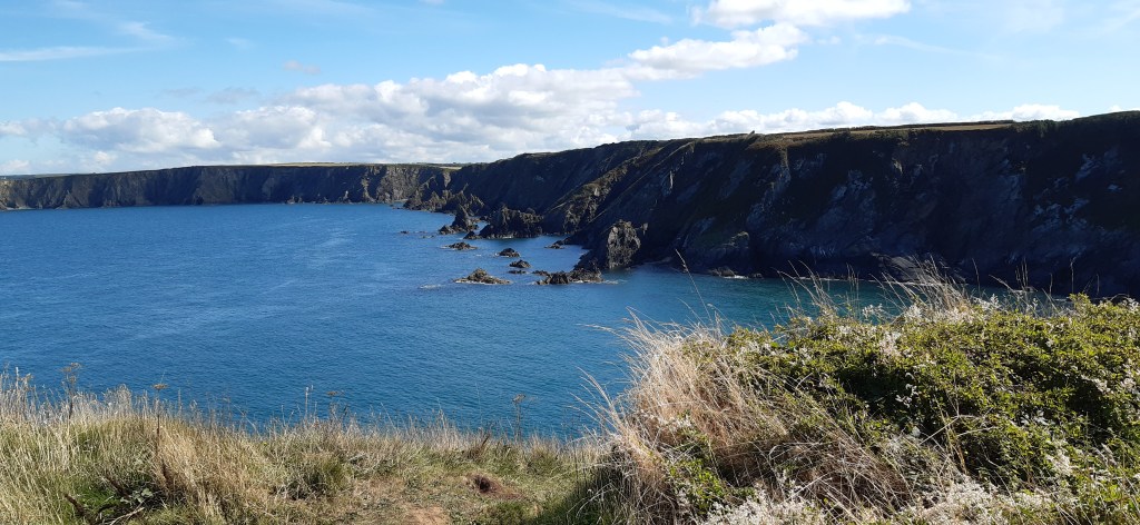
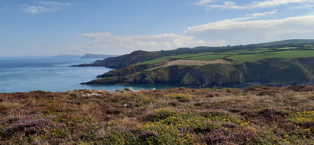
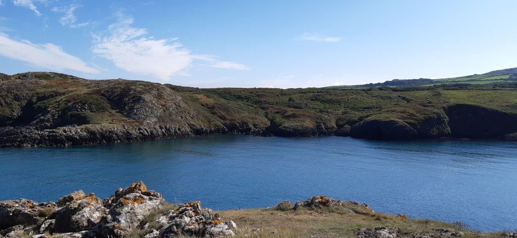
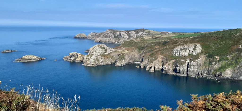
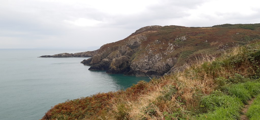
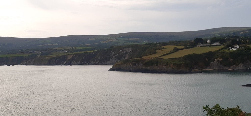
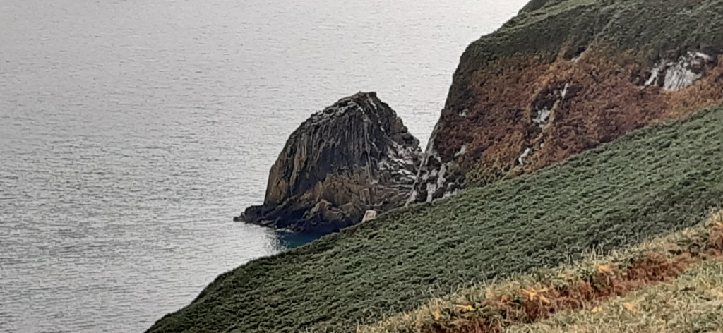
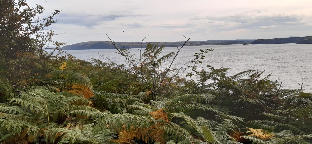
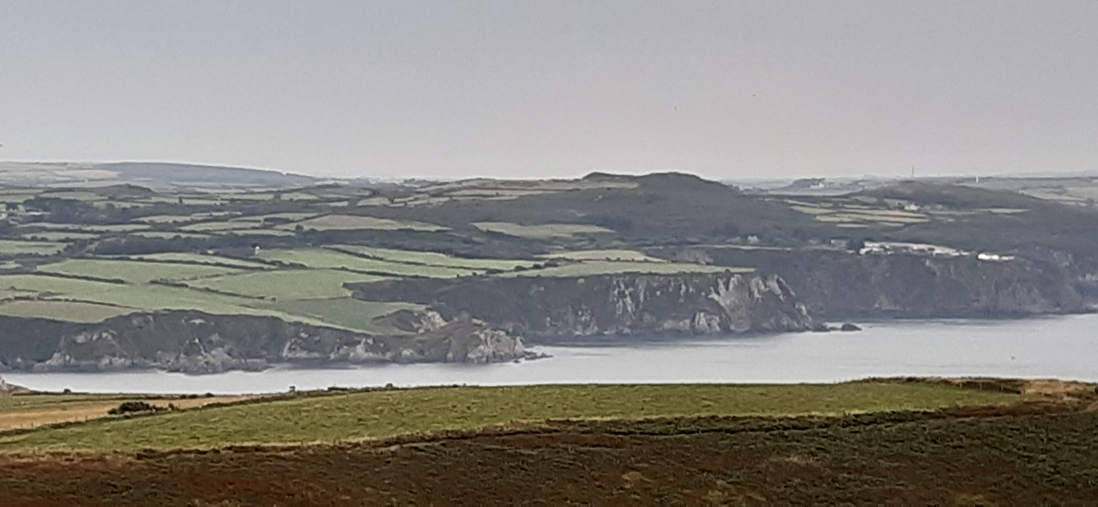
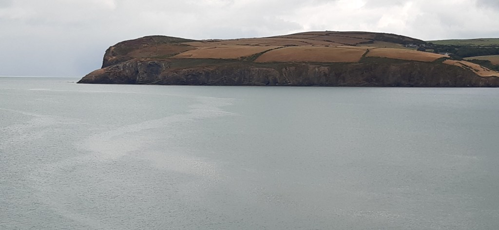
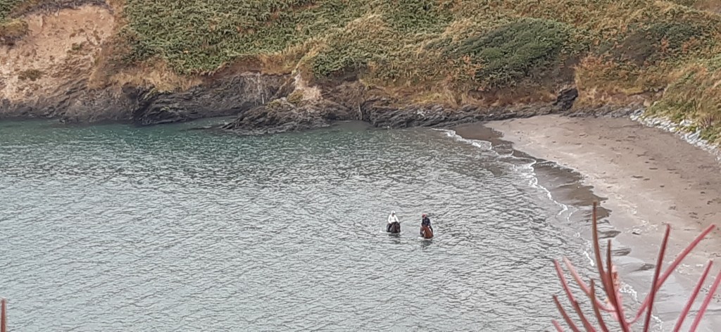
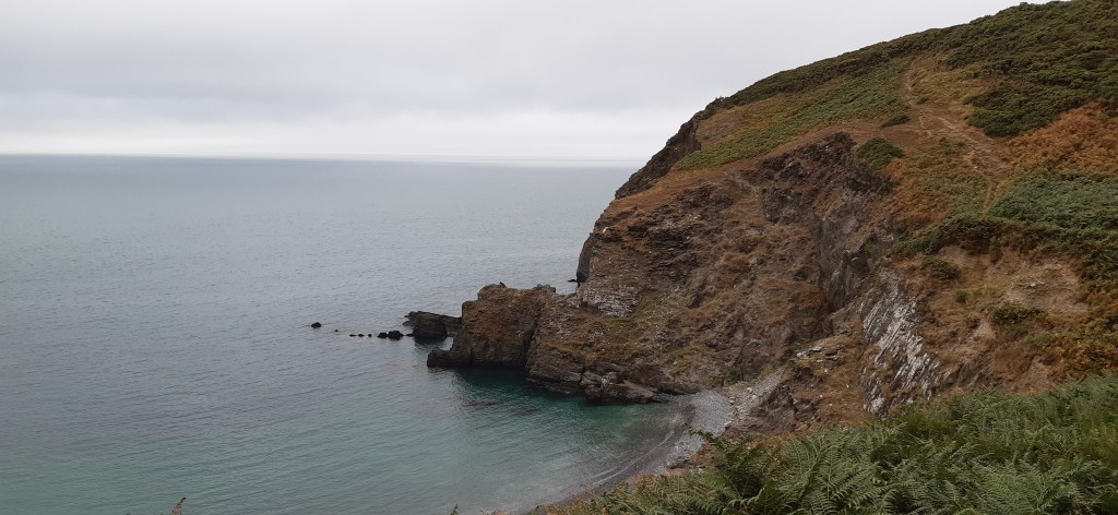
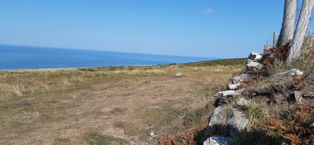
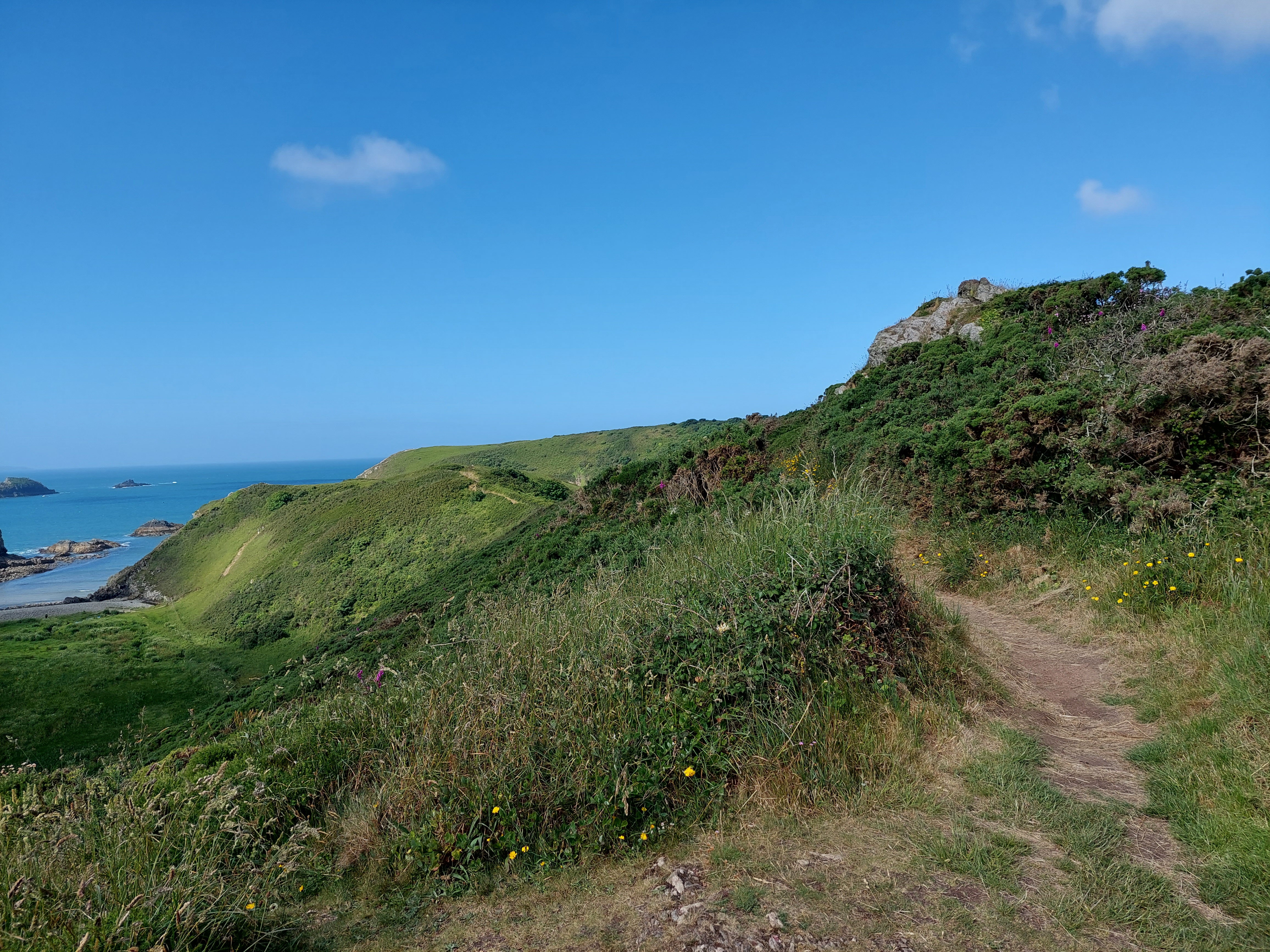
There was a stiff ascent to start with, and then a very pleasing section of undulating cliffs, starting with another fort site (no archaelogists) at Dinas Fach. I met at different points my neighbours again (and the ladies had even been in for a dip in the sea!). I got to a second long promontory (Dinas Fawr). I didn’t take the optional path on and off as it looked even more edgy then the Gribin had been.

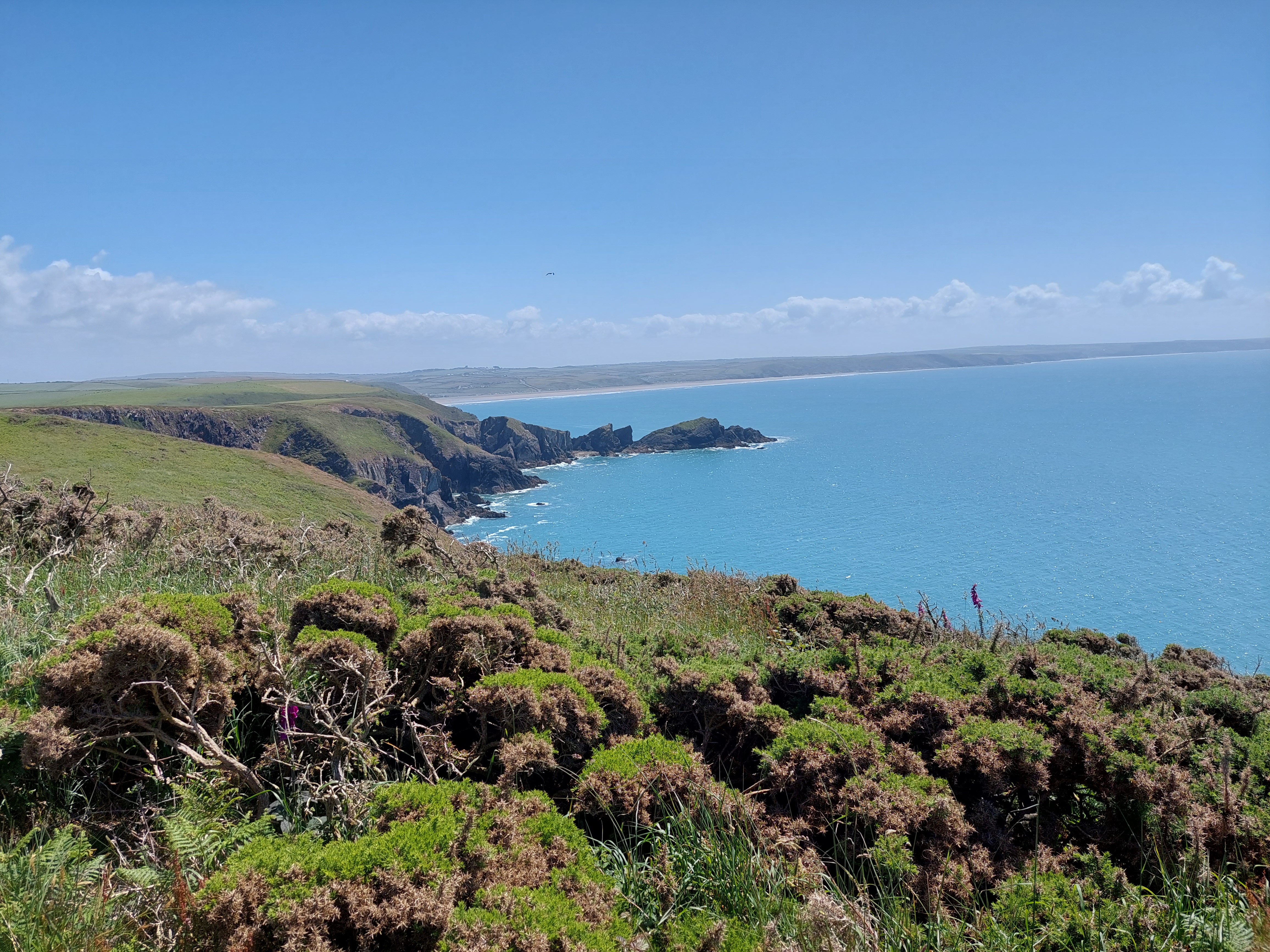
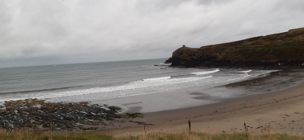
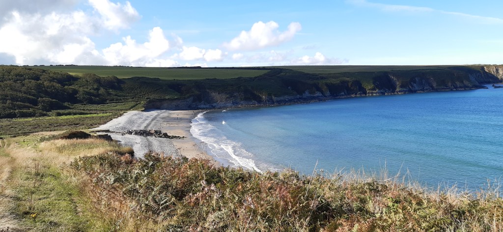
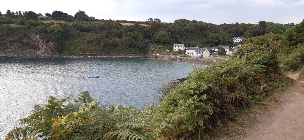
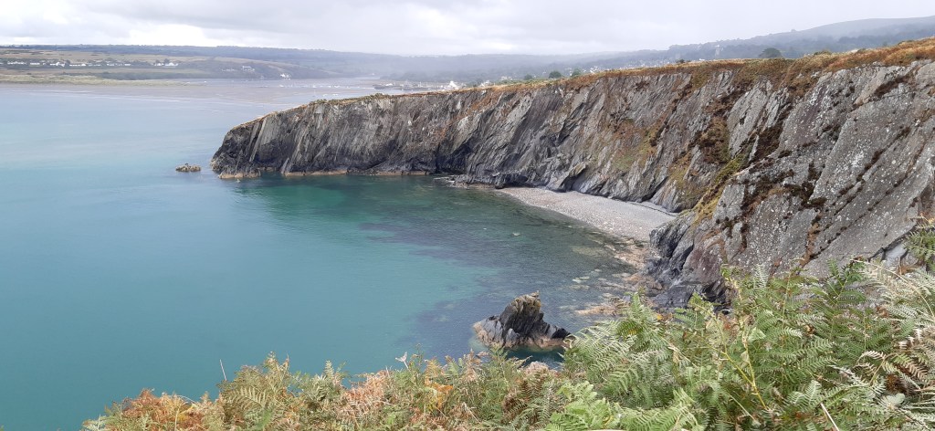
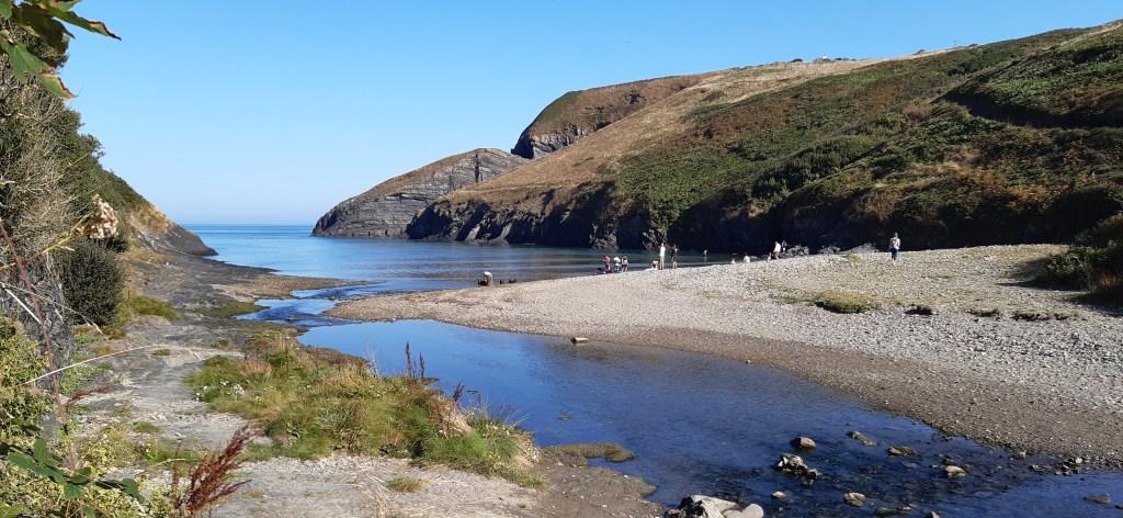
A particularly attractive stage of the coast path undulating down to Gwadn bay where I had initially turned off followed. I stopped for a second break to fortify myself for the climb back up the Gribin. It was steep but easier to get a grip going up. It was a relief to have negotiated it successfully. I was annoyed with myself that it had worried me! I wound back down to the village, which was very busy. I touched the touching point again, and indulged in a rum and raison ice cream. Yum!!!

Monday 13th June – Porth Clais to base camp (Upper Solva)

Total Steps: 16,812 –  12422 steps on the trail, 4390 off the trail

Total: 7.6 miles – 5.6 on the trail, 2 miles off

Running Total: 19.1 miles – 11.6 miles on the trail, 7.5 miles off

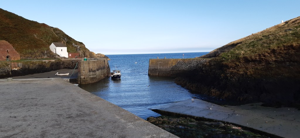
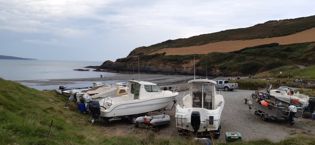
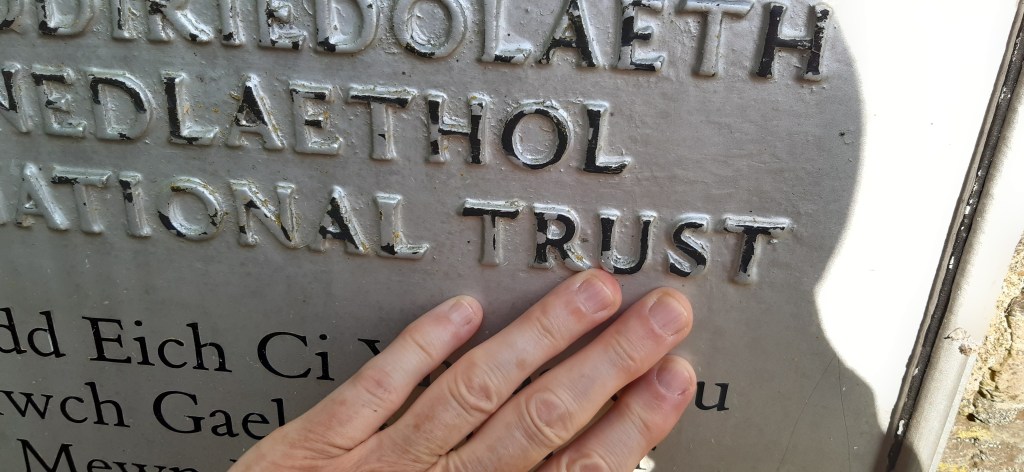
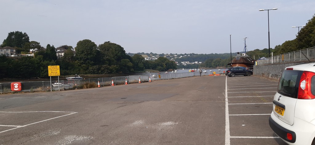
Some homework with the different bus companies paid dividends, I got the T11 at 9:41 from the bus stop about 10 minutes walk from the base camp to St David’s, and then the Celtic Coaster on to Porth Clais for the start of today’s walk. (The latter is not run by Richard Brothers who have the driver shortage). It was cooler and significantly cloudier but by 10:20am I was ready to go having availed myself of the National Trust facilities at Porth Clais. I used the Porth Clais bus stop as the touching point and off I went.

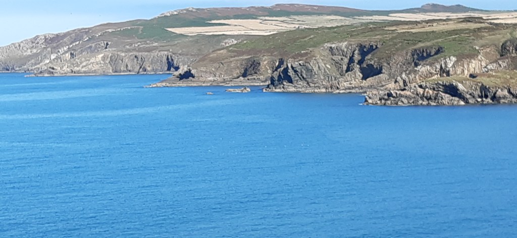
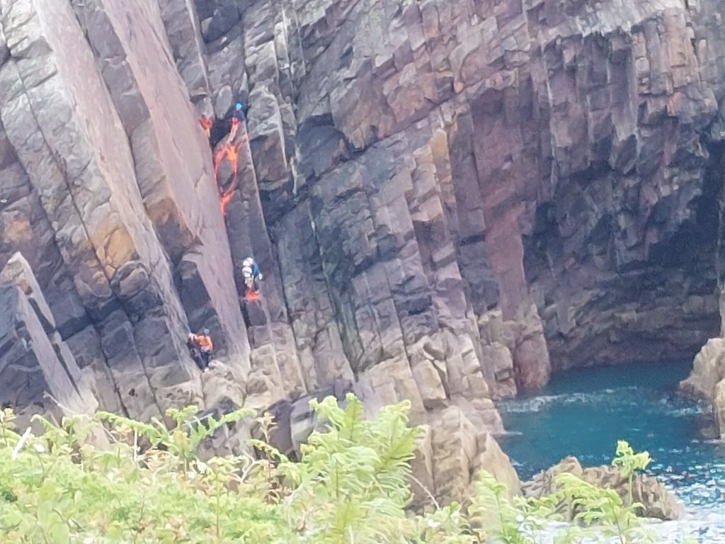
I wasn’t paying attention and started on the wrong path! After a straying into a caravan site and getting further away from the coast, I realised my mistake. Fortunately, I found a connecting path and was soon enjoying the delights of slightly lower cliffs than the last couple of days. I saw 2 lots of cliff climbers (the second lot being from Birmingham University) and a large group of ‘coasteerers’ initially on the rocks and then in canoes. I did think about doing such dangerous sports! I shan’t be trying them! There was again lots of people on the path. Interestingly several Americans, and four of my fellow travellers on the bus had been German.

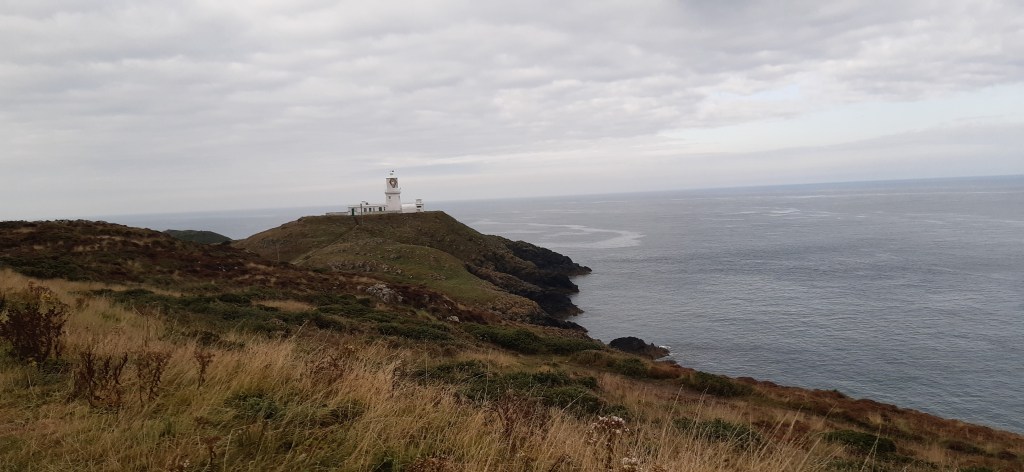
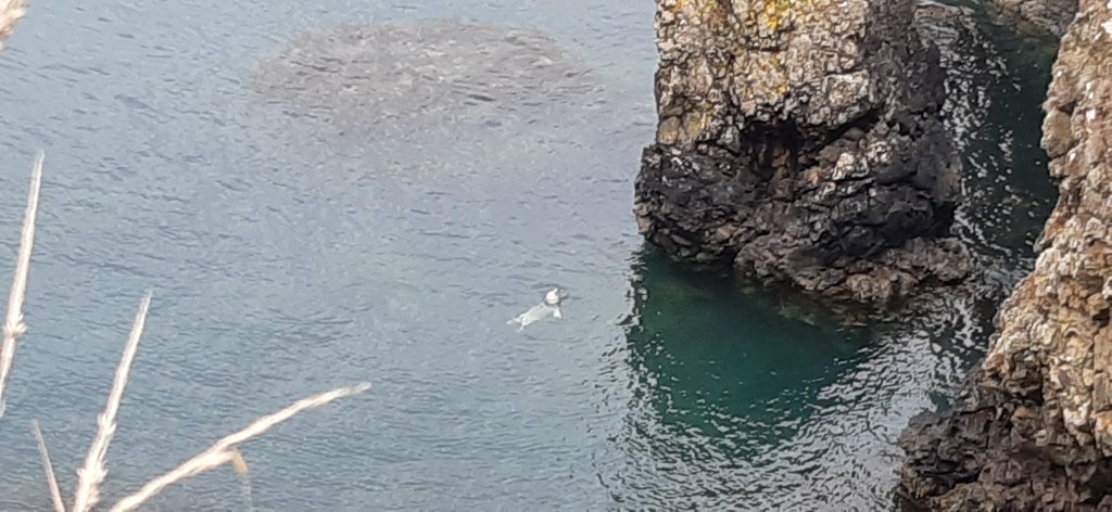
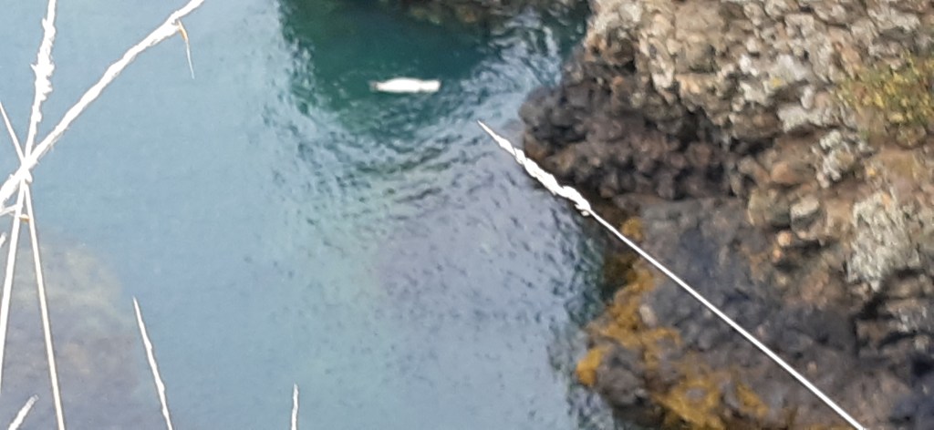
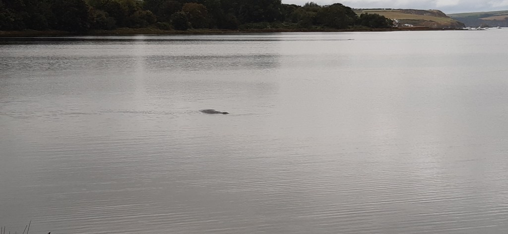
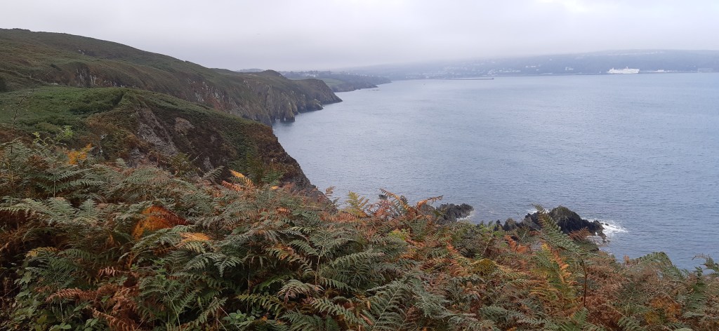
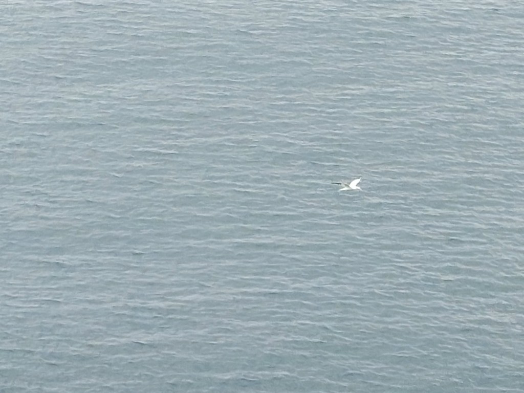
I stopped for coffee just round the bay from St Non’s retreat centre, and was delighted (and surprised) to see a solitary gannet. So much more majestic than ordinary gulls, and it did a characteristic vertical dive into the sea right in front of me. So that can be wildlife of the day.

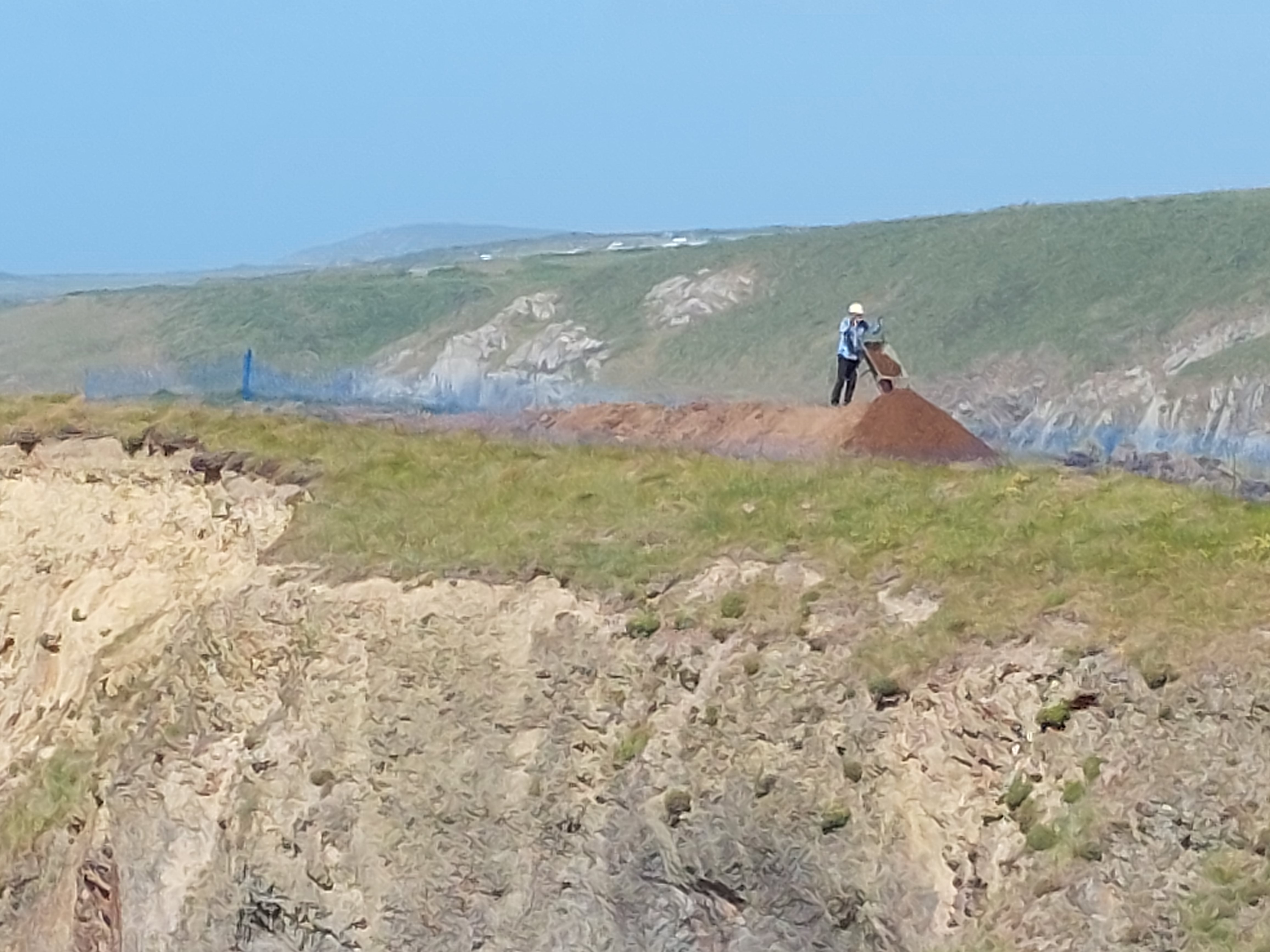
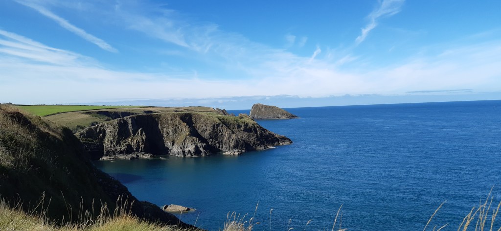
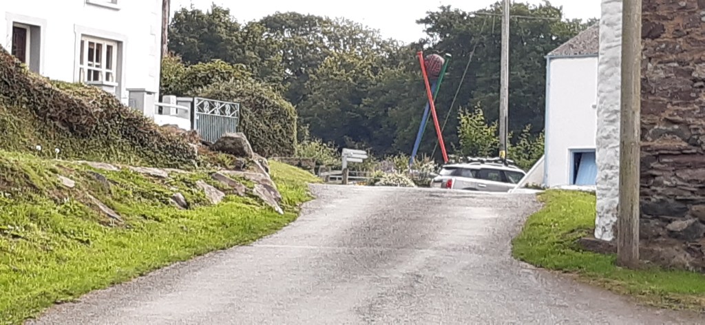
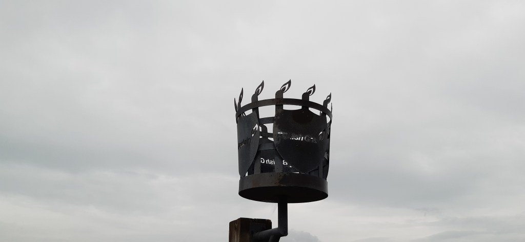
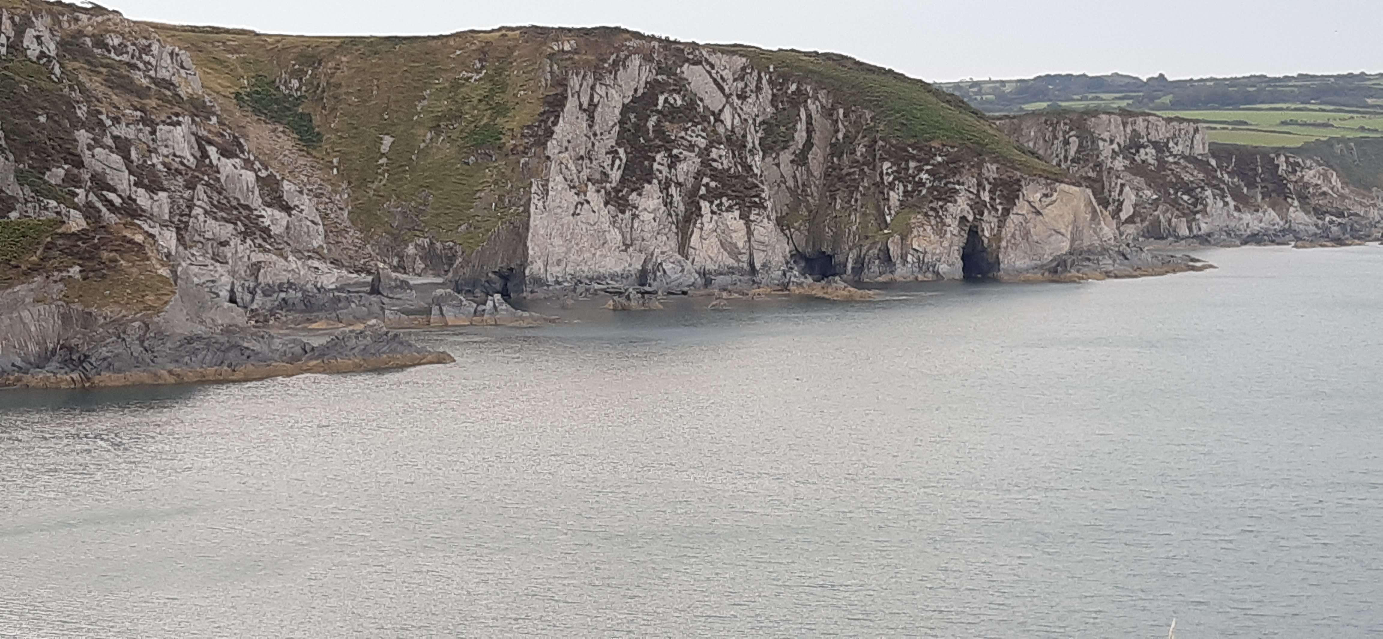
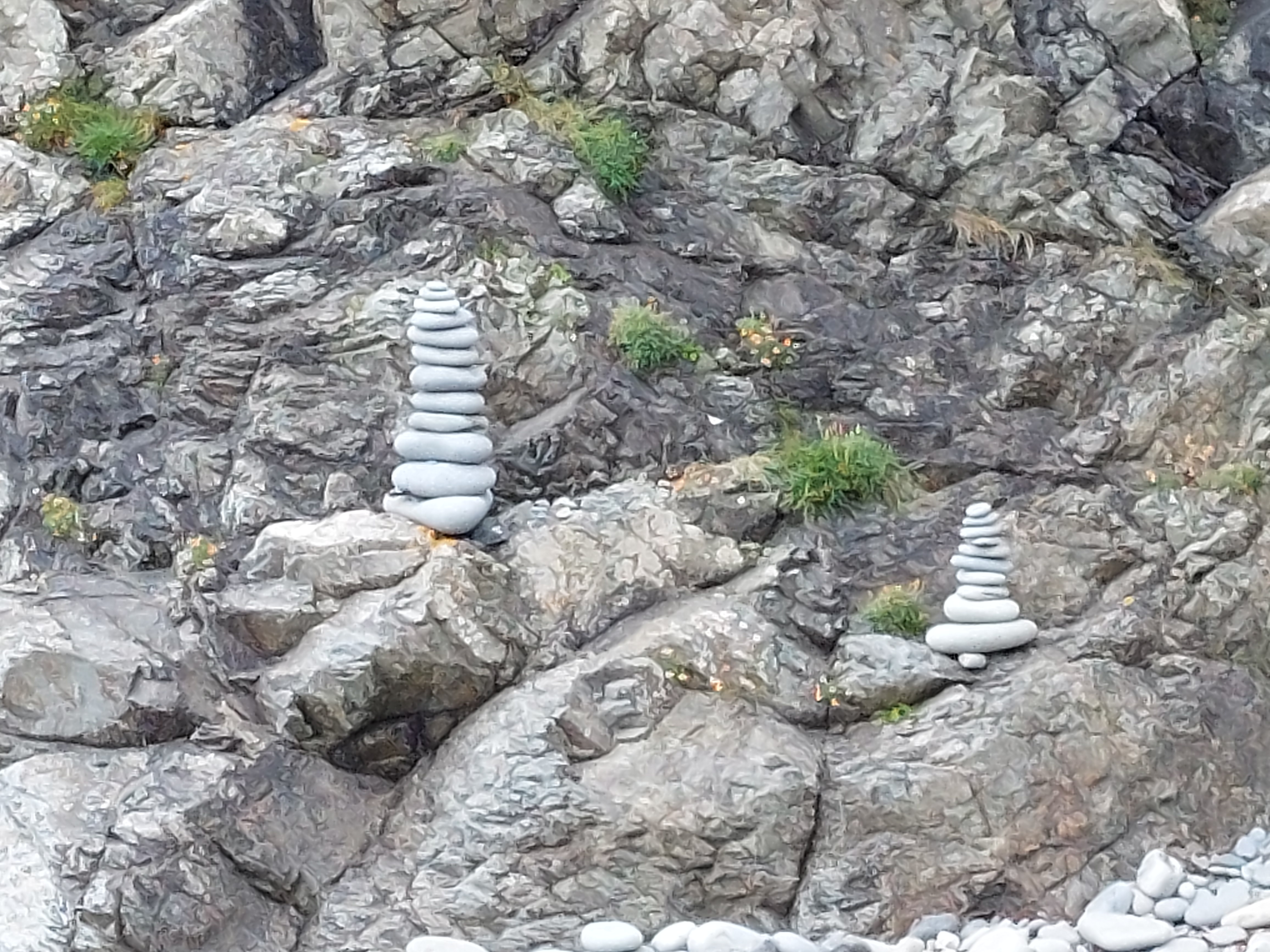
The route was rocky in places, and undulating but generally it kept height pretty well. I had to descend down at Caer Bwdy, and lost some height near Trelerw. There was a steep final descent into Porth y Rhaw (not as steep as the Gribbin), but this afforded more excellent views of the Archaelogical dig I saw on Saturday (no digging today), and how this point had been a fort back in the day.  Here I had set up a touching point on Saturday’s walk – which I duly touched. I had my lunch overlooking the inlet, and eventually spotted some stone sculptures.

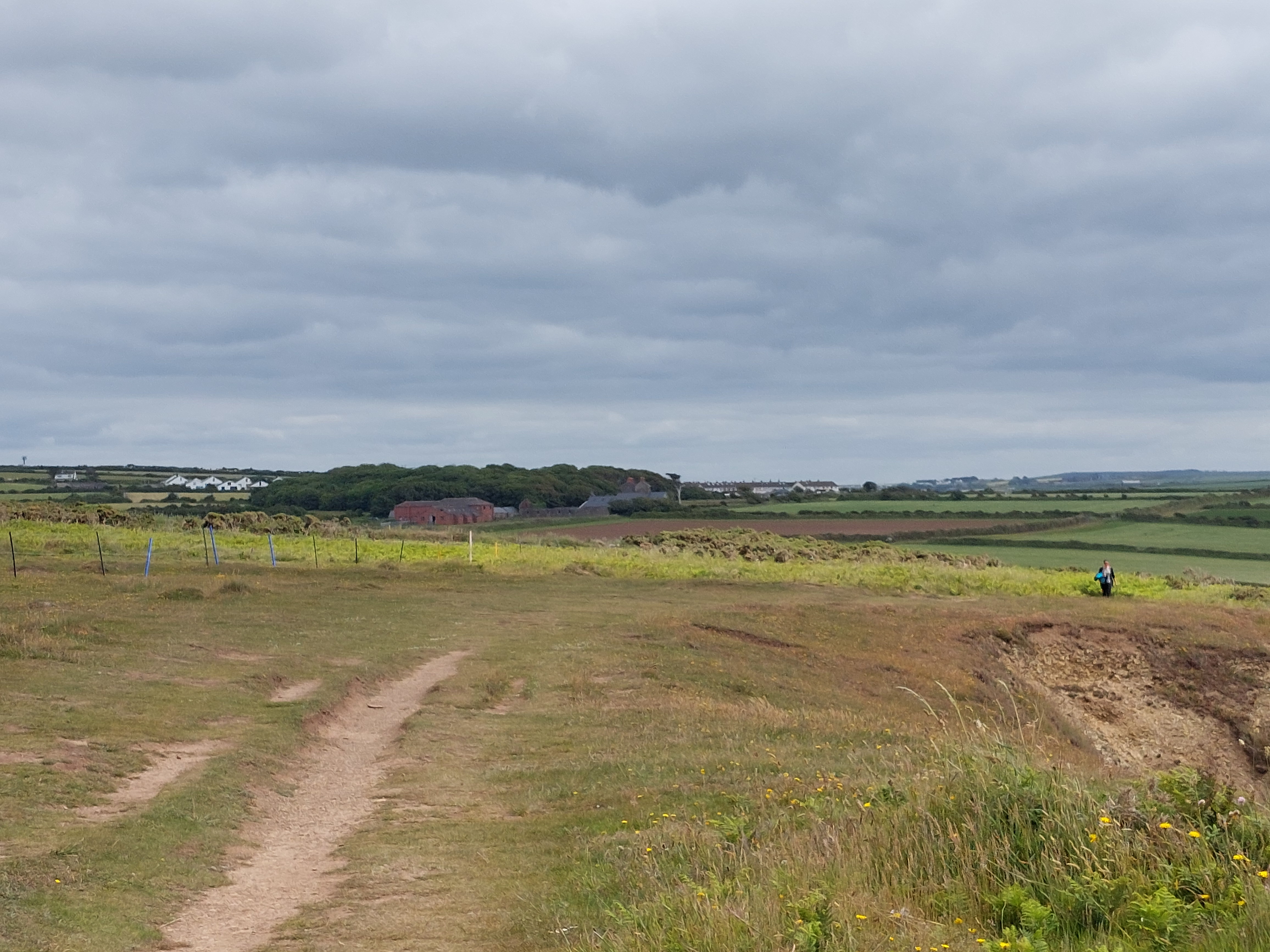
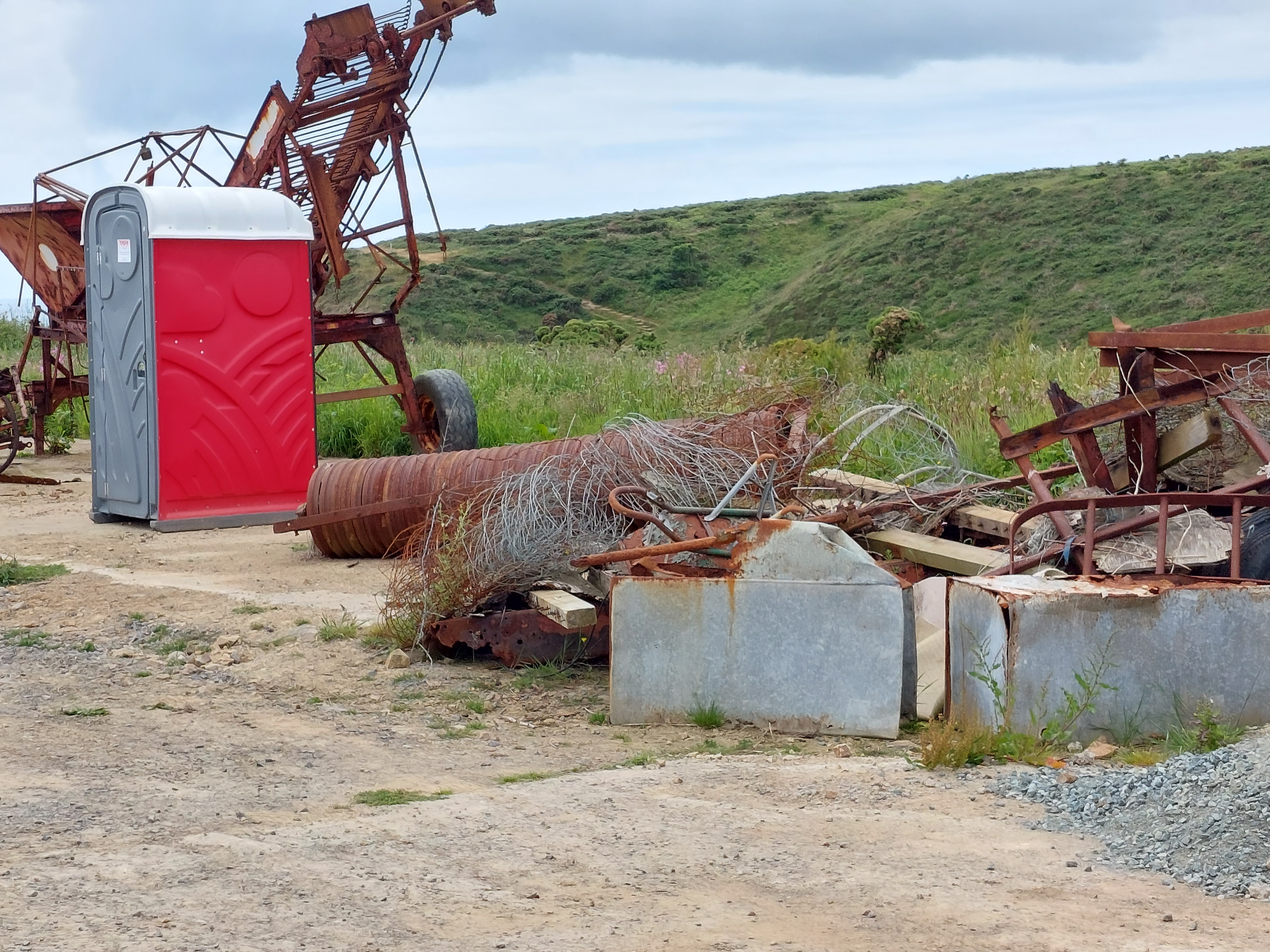
After lunch I walked back up to the holiday let, seeing more ponies and the archaeologist’s portaloo amongst various farm machinery long unused.

Back on the trail 2022

Porth y Rhaw – Solva

11,546 steps 5,769 steps on the trail 5,777 off

5.2 miles – 2.6 miles on the trail, 2.6 miles off

On 10th June – I returned to Pembrokeshire, for another session with the Welsh Coast Path. I finished at Abereiddy back in September 2021. It is good to be back, and this time in the more colourful June.

I have a number of things to contend with on this trip. I am not very fit and had several weeks off sick in the run up to Easter this year. Also, the walker’s buses (Strumble Shuttle, Puffin Shuttle etc.) are not operating fully due to driver shortages. I have to say if I had a bus driver’s license, I would think these walker’s buses have some of the most scenic routes around! When I say not operating fully, currently that means 1 day a week, which is going to mean more circular walks (as I did today to begin to stretch my legs!). This is going to test my resolve and navigating skills as well as trying to make the most of the other buses that are running!

I set up base camp, which is near Solva yesterday. After all the driving to get here I devised a circular walk from base camp. It was definitely not the day to start where I finished in September (as the next bit of the trail from Abereiddy is wild and isolated and long! Much too long for my current level of fitness)

The weather is set fair, with a stiff breeze and a good temperature for walking. I joined the coast path after about a mile of fields and footpaths arriving at Porth y Rhaw, and established a touching point. The initial section of the coast path, was relatively straightforward, and invigorating (I do love this kind of walking). I went at my own pace (which was not fast). My descent was particularly slow!! I had a good view back at the complex where base camp is too. Early on, I met a couple of archaeologists, and admired the digging going on at an ancient fort site sponsored by Cadw. Well, what I saw was people moving earth with wheel barrows rather than digging as such!

I had a very scenic coffee stop and saw a small brown snake on a less well trod part of the path, so that can be wildlife of the day (It hid before I could get the camera poised). The path eventually turned towards Solva and I enjoyed winding down into the centre (including a trip into one of Jane’s favourite shops – Window on Wales – to buy post cards). Solva is sufficiently bustling to have 2 public toilets, and I used the first one I got too. I established a finishing touching point (and intend to do another circuit from there tomorrow), just beyond a very familiar café and pub where Jane had post- ordination refreshments many years ago.  

The coast path was busy, with lots of people making the most of the conditions, and there were even more in and around Solva. I found a path up into the village without having to dice with death walking on the narrow main road! (and slowly did the last bit back up to base camp). There was one house painted with birds, and a particularly nice owl! It was a bit of a slog back up the hill. A good effort for a first walk – and now not too achy!  

The end of the trail (for now!)

On the trail 6515 steps, 4,611m, 2.8 miles

Circuit to get back to the car 7,084 steps, 4900m 3 miles

I had a difficult choice to face on what to do on my final day on the trail – the next section was 3 miles or 11 miles to the next exit point with the Strumble shuttle. The final 8 miles is pretty remote with no easy exits etc, and there were a number of things to consider. I was stiff after yesterday and the weather forecast (and the weather) was not ideal. The wind had got up and rain was forecast from late morning (and it did!). I decided to do the 3 miles (and a circuit to get back to the car)!

I drove to Abereiddy and established a touching point for when I take up the trail again at this point (the Abereiddy Strumble shuttle bus stop)! and then did the inland route first. The paths were a bit overgrown but it was quite pleasant initially on paths in fields, and then about a mile on the road back to Porthgain. I touched the touching point (life buoy) and used the facilities and climbed up the steps at the end of the quay. I found a place out of the wind amongst the remnants of the brick/slate works on the cliffs and areas that had been quarried for a coffee break. At this point the rain (of the horizontal sort) began in earnest.

I completed the rest of the cliff walk in pouring rain and high wind. It reminded me what luck I had had with the weather on this holiday!. There were dozens of ‘coasteer’ types in the ‘blue lagoon’. I returned to the car – extremely wet!

I drove the five miles from this point to St David’s, waving at bus stop touching point as I went past. Thankfully the rain turned to drizzle as after I parked up and went to the cathedral grounds to pay my respects. This is the second place Jane is remembered – and I had had some very fond memories earlier of us visiting the ‘blue lagoon’ and walking on the cliffs at Abereiddy previously (with Ginnie the dog!)

I returned back to base camp to attend to some necessary packing and organising (and the rain persisted!). I also did the necessary maths. This week I had done 35.8 miles on the trail and 13.2 miles linking up bits of the route on circular walks. Making a total of 49 miles, which adds to last weeks 46 miles – is 95 mile total (81.8 miles on the trail). All is at least 6% margin of error! Either way I am very pleased as much of it has been challenging going too and involved some uncharacteristic rock climbing!

I will return to this trail at some point

(but here are a few shots from what I did on my gentle route back on Saturday via a couple of favourites – Bosherston Lily ponds and Llansteffan)

A long and lovely walk to Porthgain

September 16th 2021

27,888 steps, 19,000m, 11.9 miles

The day began with a drive to Porthgain, my planned ending point for the day and then getting the Strumble shuttle bus back to the Woollen Mill where I left off yesterday. I was very early so had a bit of mooch around (establishing a touching point)- admiring the industrial history of bricks/slate production and the decaying buildings around the harbour. The bus came and it took about 25 minutes to get back to the wool mill. As it wasn’t very crowded, I had a coffee and a tasty piece of barabrith contemplating the day ahead. There hasn’t been much opportunity for on route coffee stops. All this meant a latish start heading off about 10:30!

It was warm and sunny and very still! Initially a nice walk down a lane to get back to the coast path – and then on to a beach Aber Mawr. This was a place that we found on the 2004 visit to this area – and was within walking distance of the holiday let back then. The path included a stony walk across the beach! Over the other side there was a zigzag path to regain height – it was cut very deep so I couldn’t see over the close vegetation and it was narrow so it was a bit claustrophobic. Then a lovely stretch with good views, seals and the rest. By the time I needed another rest (and my flask coffee) I had just done a step descent into the Pwllstrodur bay. The walk continued in the same vein as before and I reached Abercastle before I needed to have lunch. I did avail myself of the toilet, and had a chat with some chaps I had seen several times already who were eating their lunch!

I decided to have lunch once I had reached Castell Coch, the chaps passed me at this point. The path continued and Trefin came on to the horizon, but the path really only touched the far side of it – with 3 steep dips up and down before finally reaching the bay. I had a drink and some fruit on an available slate bench. My legs were beginning to feel it, but it was another 2 miles to go to get back to Porthgain, starting with the inevitable climb out of the bay.

This section was mostly reasonably accessible, with 2 steep short ups and downs, and I took a short cut back to Porthgain when it was presented! The chaps were just finishing off their pints in the Porthgain when I got back to the pub (via the touching point). It was about 4:15pm by then. They were determined to do another 10 miles (on difficult terrain! – rather them than me).

The final part of this day included some views back to where I had started on Strumble head just 2 days walking ago. Pretty awesome

I also took my best shot of seals!!! amazing to see the pups on the beach and adults swimming in the clear water! (and without having to lean to far over the edge!)

Strumble head invasion!

Sept 14th Strumble head to Carregwstad point

9,687 steps, 6,781m 4.2miles

Circuit to get back to the car!

13,074 steps 9,192m, 5.7 miles

Slightly ethereal light as I began at the car park at Strumble head. The touching point was set up as one of the smart new stone signs. It was a good temperature and I hoped it would stay dry (and underfoot was getting drier which makes things easier). The first mile of so wound along nicely, and then the path narrowed and the ups and downs set in. The scenery was completely stunning with plenty of seal sightings but it was getting increasingly difficult. There were two short steep dips down to footbridges. After yesterday’s tumble I was particularly careful on each of the 10 I crossed in the entire walk. The dips however involved a degree of rock climbing – which I am much better at going up than going down!

Eventually I had a brief coffee break by one of the short dips to give me inspiration and then a longer one when I finally reached the Carregwstad point memorial – which I was suddenly upon. I have to say this seems the most ridiculous place to try and mount an invasion. The terrain is challenging to put it mildly!!! This was also overlooking yesterday’s very seal filled bay – Aber Felin.

I could see but did not quite get back to the touching point from yesterday – And it seemed a long way round as I had a longish inland stretch ahead, so forgive me I didn’t go back to it. I started an inland loop, which slowly went up to the road. This started ok, but soon became a track used for milking cows and was rather squelchy and not a little smelly (as it was fully sunny by this point). I finally walked through Tre-Howell farm yard. First I was woofed at by Maria (an adult black Labrador) and then rather over enthusiastically greeted by Darcey (a growing puppy black Labrador). I was already a muddy mess from the track (see trousers below) so a few puppy paw prints were the least of my problems.

A section on the road that leads down to Strumble head followed, with nice views down to the coast. After about ¾ of a mile I took a track down to the coast path again (thus avoiding the bit with the rocky dips!). This started well but soon deteriorated. There were issues (much to the amusement of some bullocks) with a stile.  The first step was very high and it was all leaning towards me making it very difficult to assail. After some minutes trying to work out a cunning plan (and getting an electric shock off the cattle fence) as I explored the options. Eventually I moved a spare fence post to give me a few extra inches and then I managed to get over. Thankfully the bullocks were very well behaved!

Then the path seemed to be confused about whether it was a stream or not and I got even muddier! Eventually it came out on the coast path, and after a short distance, I found a beautiful lunch spot for much needed rest and sustenance!

I walked the path back to the car, and helped a couple with a small child in a carrier about the delights of the bus service – and lo one arrived (which was very lucky as they are only 3 times a day) – and they were whisked off to Fishguard. I touched the starting touching point for completeness to complete the loop!

I took a bit of time to recky the next bits of the bus service in the car and found that Tregwynt Woollen Mill – was near to a place I stayed for a week a long time ago (June 2004!). Eventually I drove back to Fishguard via Tescos near the ferry terminal and set too to wash my very muddy trousers!

In the evening I watched Andrew Cotter in conversation at Bath pavilions with Olive and Mabel online. Just fabulous!!!

Sept 13th Strumble head to Tregwynt Woollen Mill

21,435 steps , 15,005m, 9.4 miles

I drove back to Strumble head and set off shortly after 9am and the conditions were pretty perfect – sunny and a manageable temperature. The path wound around the cliffs with good views of the lighthouse for quite a long way and then more occasionally as I got higher and higher. It was quite challenging, with a couple of rocky climbs. There was a boggy area (which I hadn’t seen for a while) and I appeared to be climbing a stream at one point to get to the path. I also saw some lovely white horses (with the inevitable child of the 60’s ear worm of the signature tune of the White horses TV programme in my head for a mile of so).

There were several ups and downs and the terrain was getting more rocky underfoot. We started to ascend as the Pwll Deri Youth Hostel emerged on the horizon. Whilst circling porth Maenmelyn, it became apparent there were a huge number of seals in the sea and on the beach. Taking pictures was difficult for a variety of reasons (here is my best effort!).

The path was not easy either, and there was another very dippy bit with steps and a rocky climb up (which I was jolly glad to be climbing and not descending). Shortly after that I found a rocky area with a good view for a coffee break, before a stiff climb up to the youth hostel and out briefly on to the road.

The next section started well as the path maintained height to reach Penbwchdy headland. There were three rocky outcrops to contend with, which were increasingly difficult to navigate, and find the path. I was quite glad when I started to descend to lower levels stuff on the path ahead. Again there were a couple of ups and downs, and time was pressing on (I had a deadline to catch the bus at the mill). I decided to cut in land on a path at Pwllcrochan and then did just over a mile on the road, rounding the corner to be confronted with the mill and some giant knitting needles. I found the toilet, and contemplated the gift shop (lots of lovely things!) I arrived with time to spare (and ate my lunch before The Strumble shuttle bus arrived to schedule at 14:46!). I used the bus stop as a touching point to finish for the day. There was just me on the bus and it took nearly 20 minutes to get back up to Strumble head, which was very satisfying to think I had walked that far!!

Having said that I have resolved to do the bus first tomorrow from Porthgain back to the Woollen Mill, so I don’t have a deadline to meet on the walk!!

Steps from Lower Fishguard

Sept 12th

Rest!

Sept 13th On the trail Lower Fishguard to nr Carregwstad point

17,228 steps , 12,059m, 7.5 miles

In addition to get back to Lower Fishguard (plus a short section on the Strumble Shuttle!)

11,251 steps 7,300m 4.5 miles!

The route began with a long paved section through the various parts of Fishguard. It was quite energetic with lots of ups and down but very easy going and with nice views appearing between the trees and across the harbour. Took longer than I imagined, passed a statue of Jesus and I lost height through a long series of concrete steps down on to the front nearer the ferry terminal. Visited the toilets by the Ocean lab and then made my way round towards the foot bridge – this crossed the queues for the ferry terminal (and I can remember back in the day waiting for the Irish Ferry with Jane wondering where the footbridge went!) It led to a zigzag path initially with steps up to the Fishguard Hotel (which looked very sadly shut and the lower 2 floors boarded up) and then just zigzags winding up to Harbour Town above the ferry terminal.

Eventually I made it out onto the coast path and it rained for about 15 minutes at this point. There was a beacon – which on closer inspection had flames and ‘British Gas’ on it!! The cliff path was a reasonably straight forward section with bracken and heather and low cliffs. I found a coffee stop eventually as the path wound round the headland. It was good to see the ferry once again too!

Things were going well until the first exit option, after which the path got narrower and more up and down. I had a bit of a tumble on a slippery foot bridge. Just my dignity damaged fortunately! The path wound around the cliffs and there were lots of seals, pups and the sound of the pups calling for their mothers in the air. You could see the seals in places swimming below the surface of the water. This was particularly true of the whiter pups! It was quite hard going on the path (especially as it was all abit damp and more slippery!). But the lower points made for great seal watching!

I had already decided to take a cut back inland near Carregwastad point for today’s walk (This point is famous for the last attempt of an invasion), and I was glad of it. I establish a touching point on the coast path sigh. There was an easy path up to Llanwnda – where I found a picnic table for lunch. I wound down through Goodwick and found a bus stop and picked up the Strumble Shuttle to the top of town. I walked down to where the car was parked in the lower car park. All of which added another 4.5 miles – making this the longest walk I have done in quite a while!!!   

Mind the gap

Sept 11th Moylegrove to Newport Sands

14,200 steps , 10,000m, 6 miles! Plus a mile I didn’t count in on Tuesday but now linking the route

In the end I decided after careful studying of the Wales Coast walk book that I was not up for ‘several precipitous havens’ for the gap in the route I hadn’t done and opted to do a lane walk to join where I walked on Tuesday to where I have subsequently walked this week. In the end I drove to Moylegrove with a view to getting the bus back. (It turned out I had misread the timetable but more of that later). I decided to count the mile I did down to the path as part of this day to connect all the parts of the walk

It turned out that there was a very steep ascent out of the village (1 in 5 in places) and I was soon warmed up. I was very conscious that I was able to look up and around as I was walking on lanes rather than concentrating on my feet, and it was much easier going (apart from the first pull out of the village). The vast majority of the ascent was in the first couple of miles, and then a long slow descent to the coast at Newport Sands.

I found I was on the cycle route for a good chunk of this. This was a bit weird especially with passing packs of cyclists where the first person shouted ‘person’ to warn the rest. The more polite ones, then said ‘good morning’ as well – but this all made me jump a couple of times. I took in the joy of the colour and the hedgerows and the views emerging across to the PreseliHills.

Periodically I could also see the headland where I had my difficulties on Tuesday – and the series of undulations one after another follow the zigzag strata on the cliffs. Rather sobering! I was glad I had made the choice I had. There was also another bull (with his ladies) safely the other side of a fence!

I eventually found a coffee stop at the junction where the wedding decorated farm machinery had been last Saturday – and it was then I realised I had read the bus timetable incorrectly. I decided to aim for the 13:07 all the same to take me back to Newport (so I could do some shopping and have lunch) and then get the service going back to Moylegrove from there about 2:30! 

I found my touching point rock and I had enough time to contemplate the beach and have  a coffee and a flapjack before the Poppit Rocket whisked me first to Newport. I found the various things I needed in Newport, and a nice picnic area to eat my lunch – finished off with an ice cream from near the bus stop (Castle Hotel!). The Poppit Rocket took me back to Moylegrove (but this was a long enough journey to end up feeling queasy) so there was a short delay until I was feeling Ok to drive home

The drive home was delayed by some cows crossing the road – this was not far from the turning to Gethesemene I had also ignored earlier. Who knew Gethesemene was in Pembrokeshire?

I plotted out the miles for the week (which are a bit dodgy based on my steps app) but getting more accurate – I reckon that there is at least a 6% margin of error on the 46 miles I have totted up! Sabbath rest tomorrow. Then on to what the Strumble shuttle can bring to the Welsh coast path adventure as I take up the path from Lower Fishguard on Monday!!!!

Running total 46 miles *at least 6% margin of error!!!.

Newport Sands to Lower Fishguard – the walk continues

Sept 8th – Circuit of Dinas Head

11,000 steps 8,000m, 4 miles!

Decided to have a much less ambitious plan, as I had a few achy muscles and the perils of yesterday were very much on my mind!!! I wanted also to make sure it didn’t happen again, and I was relieved to find the temperature was closer to 70 than to 90 when I stepped outside.

I took the car to Cwm-yr-Eglwys (with a suitable remains of a church in place) after a leisurely start to the day and then tackled the circuit round Dinas head/island. I used a coast path sign as a touching post to start. I took the lower option to get a better view of Needle rock, but was rather underwhelmed, and height had to be gained of course a bit further on. Once I had warmed up, my aches and pains seemed to drift away. It was quite busy with lots of other walkers of all abilities too (and some in MOST unsuitable footwear!).

All the way round I was looking carefully at the cliffs either side of the headland/island to see how it looked (and were there precipitous sections?). It all looked lower than the exploits of yesterday so I decided to do the section from Newport Sands round to Pwllgwaelod tomorrow. I got to the top – with a suitable marker and drank in the view once I had got slightly away from the milling throng! Had a coffee sat on a rock with magnificent views in either direction – was a bit troubled by flying ants but all was well with the world.

The descent down the other side was slow on the rocky stretches but generally went well. My map suggested there was a lower route option (but clearly part of that had fallen) and it was no longer available. I found a sign to be the touching point to use on another day and settled on a bench overlooking the bay at Pwllgwaelod for my packed lunch. This was in sight of a very busy pub and there was a definite whiff of fish and chips in the air. I used the convenient toilets and sussed out the bus stop arrangements for picking up the poppet rocket from here tomorrow. 

I strolled back along the very convenient flat path between Pwllgwaelod and Cwm-yr-Eglwys, that takes about 15 minutes. Pretty uneventful but nice to see some trees, and a bit of excitement was a diversion around a caravan park at the far end! For completeness I touched my starting touching point and headed off to the Co-op in Fishguard to get some provisions.

Running total 24 miles

Sept 9th – Newport Sands to Pwllgwaelod

21,000 steps 12,970m, 8 miles!

Had a leisurely start as I was aiming for the 10:16 Poppet Rocket from Pwllgwaelod to Newport Sands as my start to the day. This was only about 6 miles from base camp too. It was cooler and raining! I had plenty of time at Pwllgwaelod before the bus came to do all the necessary. It took about 20 minutes to get to my destination, which was enough time to feel queasy! I availed myself of the facilities at Newport Sands (as well as marvelling at the crowded car park of the Cat Rock Café!). I used a rock as a starting touching point and set off!

The first stretch was round the mouth of the river Nyfer including a stretch across a deserted golf course. There was a steady drizzle so I was bedecked in all my waterproof stuff. The tide was well in and I was quite near the bridge over the river when I was startled by a seal! I crossed the bridge and then walked the other side – which was prime dog walking territory. By this stage it was raining a bit harder. I reached Parrog (and by this time it was very heavy rain) and in a very wet state I diverted into Morwellyan café. When I got it the coffee was excellent but there was a long, long wait to be served.

I had an interesting conversation with a couple from Cardiff, whose church was preparing to have a refugee family. They had also seen Michael Portillo (and film crew) the day before as he is doing a walking programme in Wales. I hope he enjoys his welsh coast path experiences as much as I have.  Nice to think of him following in my footsteps!

The rain had eased, and I set off initially through the edge of Parrog (Newport), a little stretch on the beach and then up on to a low level cliff. After the rain I had a few issues with my boots and paused to do some adjustments. I was concerned about blisters with soaked boots (and had spotted something heading in that direction on my big toe) which I did not want to get any worse. I wound around the cliffs, and the bracken was beginning to look particularly autumnal.

I stopped for lunch on my first stony beach lunch spot on this holiday. The rain fell heavily but there was lots to watch, a family of gulls, another very persistent seal and finally a bit of a stand off between the gull parents and a heron who tried to settle. They successfully scared it off after about 10 minutes.  

I carried on, there was another descent to a further stony bay with a lime kiln and stone stacks (plus a heron probably the one I saw earlier!). A final section up on the cliffs included a wide grassy path. This  led out into the road and the descent into Cwm-yr-Ergwys. I had a brief sit on a bench (but sadly it rained again!) – so I walked back to Pwllgwaelod on the flat path I had used yesterday – I connected with the touching point and was pleased with how it had gone and all was well!

A quick trip into Fishguard to get some compeed plasters followed (as I had not managed to pack my supply!)

Running total 31 miles (-1 for mile repeated)

Sept 10th – Pwllgwaelod to Lower Fishguard

18,700 steps, 13,100m, 8 miles on the route!

Set off a little earlier than really necessary, so I could park the car at the old fort above Fishguard and walk down to the bus stop at lower Fishguard (establishing a touching point on a flower tub near the bus stop) and then waiting for the Poppet Rocket. It was running a little late and I was the only customer for the ride from there back to Pwllgwaelod. I had a chat with the driver about my plans for the day, and he discussed his experience of the walk I was going to do. Thankfully it was a shorter bus ride today – so not enough time to end up feeling queasy!

I availed myself of the facilities at Pwllgwaelod, touched the touching point established there on Wednesday  and set off up to the cliffs. Whilst I was climbing some horses were being exercised in the bay – which was interesting to watch. It was quite an up and down route but mostly reasonably easy going. I had a coffee on one of the beaches sat on a rock. Lovely views continued as the path continued round the ‘crenulated’ coastline described in my Welsh Coast Path walk book.

It was overcast with occasional drizzle, but as I progressed it got drier. The views were fantastic, and I saw the Irish ferry arrive and leave as I was making progress. There was a short stretch through a caravan park, and then the going suddenly got a lot rockier and more tricky. I took my time over this stretch which turned out to be about ½ a mile of more challenging terrain, until it settled back into an undulating grassy path. The path wound its way around the coast line and I saw my first bull (from the path with a good fence between me and it!).

It ended at the fort above Fishguard – with splendid views and cannons (and a view showing the path travelled! One final slope up to the car park and mission accomplished!!!

Running total 39 miles.

Hot, hot and too hot!!

Sept 6th – Cardigan to Poppit Sands

10,500 steps, 10,400m, 6.5 miles on the route!

This was quite a leisurely walk – it was hotter than I liked, so it was good to take time and drink in the scenery. I kicked off from the car park in Cardigan, touched the tourist poster touching point and set off. The first section after a few busy streets, winded up a track between the houses, and out into fields mostly dedicated to market gardening. There was one with a handful of curious sheep and 2 calves who were blocking the exit kissing gate. In the end I persuaded them to move!

Eventually I dropped into St Dogmael’s.  This also meant I had made it in to Pembrokeshire, and this was evident in the change of look and feel of the route signs – with green based celtic crosses as well as the standard blue shell signs! I happened rapidly in the café next to the abbey ruins. I had visited previously and enjoyed a very civilised cappuccino and excellent carrot cake. It was all very pleasant, and I had a brief and rather warm wander around the ruins (there was a very chatty man doing Tai Chi!). I escaped via the church yard.

The next bit of the route was on roads and paths through St Dogmael’s, and eventually ended up at the side of the main B road (sadly without a pavement). I wasn’t very happy about this as it wasn’t wide enough for 2 cars to pass each other in places, so I was an added hazard. There was at least a mile like this. Doesn’t happen very often on this route!

Eventually a bench appeared by  an alternative signed path, and I sat down for a while to enjoy my carried coffee (decaf) – while contemplating what to do. This was a good vantage point, as I saw both the bus I was going to use to get back to Cardigan and the Poppet Rocket (3 times a day coastal walking bus) – which proved the buses were running! I decided to take the alternative route – around the back of Poppet Sands, a farm and then through a large caravan site. It was certainly less dangerous than dodging the traffic.

After a return trip to the toilets, (after a particular wet walk in Pembrokeshire in 1990s with Carole), I touched a suitable touching point I will pick up tomorrow. I found the bus stop, ate my lunch when waiting, and took the bus back to Cardigan (first bus ride since 2020!). This included buying a rover ticket for the next week – which will hopefully be used on the various bus links I will need.

As it was still early, back on the bench, I had decided to go to Mwnt. Had to be done at some point. It was very crowded, pretty hot and there were people in the sea! Mwnt is deeply beautiful, but reminds me greatly of Jane, and is the second place where she is remembered. After some time to ponder at the spot,  and the cliff beyond, I sought out an ice cream and contemplated some people looking into the distance beyond the refreshments hut. A brief wander was rewarded by the sighting of dolphins, playing further down the coast. I have seen them in the bay before (but I suspect the people in the sea were not to their taste). It lifted my spirits no end!

A drive home, where I trusted to satnav initially (which was a bit hairy getting away from Mwnt) back to the A487!

Running total 10.5 miles

Sept 7th

21,100 steps, 15,200, 9.5 miles on the route ( this is much longer than I anticipated it would be and does not include the mile to the coastal path in the first instance!)

Early start to be ready to get the Poppet Rocket at 9:10 at Poppet Sands ( a good half an hour drive away!). I was also trying to start early to avoid the worst of the heat. This turned out to be not early enough!!! While waiting for the bus I got chatting about the plans for the day ahead, with a couple also going to Moylgrove and walking back.

It was at least a mile (not included in the above) to walk up and down to the coast path, eventually coming out at Ceibwr bay. On the final section down to the bay I got chatting to a woman I initially saw sitting in a tree. She suggested a potential escape route if the going got too much in the heat. She even took the trouble to show  me on the map!

The first climb out of the bay was a tough one but I made steady progress on the initial section of the walk – which consisted of narrow edgy paths about 1/3 from the top of grassy cliffs. There was mostly a good bank on the sea side to prevent you falling in! I took a while to find a suitable coffee stop – where I could see the view and was vaguely shady as the heat was intense. I was rewarded with seal sightings at this point – which was lovely! There was some very discouraging signage at a couple of spots where the banks had eroded or cliff falls had taken place.

It was going reasonably well at this point, but as I progressed, I realised that a large up and down was ahead, and then the next bit looked quite a lot more undulating. I didn’t hesitate which I now regret. I like to keep to a plan as you probably know. The first up and down was gruelling and precipitous! I wish I had realised how difficult the undulating section was going to be. Each of the 3 downs then ups, went further down precipitously, and further up in the same manner! By the third one I was finding the going very tough. I was over half way on my route and I had missed the exit point  discussed by the tree lady earlier. I stopped frequently, arrow prayers for strength were even more frequent and various passing walkers were very encouraging and kind.

It was really the heat that was the main problem and the slope (and the previous 3) were out of the wind so it was blistering. I think it was around 90!, and since my thyroid surgery my temperature regulation at extremes has been a bit dodgy. Eventually I made it up this final slope after several stops, onto much more idyllic cliff walking conditions – carriage drive grassy paths with gentle undulations. I had at this point reached the highest point (Pen yr Afr) on the cliffs in Pembrokeshire! Progress was not quick but it was much more manageable and I was back in the breeze which helped hugely with my temperature control. I passed the abandoned coast guard station (which is as far as Carole and I got back in the day – we turned back as the rain was torrential!), but I didn’t find the shepherd’s hut we had used for shelter for lunch, rather unsuccessfully as I remember it. I have a lasting memory of rain dripping in soup!!

 I eventually found a lunch spot on a low wall with a good view, which was ‘shadyish’ but also in the breeze, which helped with temperature regulation!! I was blessed with more seals and then the joy of more passing dolphins (4-5) in a group, which were again motivational for the final push. Despite seeing a sign indicating the distance was 1 and ¾ miles well before the coast guard station! It was in fact more like 3 miles from this point, on good paths, a messy farming area, shady tracks and the road. It was mostly going gently down to sea level and eventually poppet sands beach. I had a much needed raspberry sorbet cone and a large quantity of cold water at the new improved café!! before touching my touching point and driving home.

I acknowledge I can be single minded about stuff and I still love a good plan (even though covid has robbed me of so many!!) But I promise after this experience to be much more careful especially on hot days (and take more time over route decisions). The mistake was really to have done the first big up and down in that heat(!)– as this was just after the exit route I could have taken or I could have gone back at that point too!!! Note to self – listen to women who sit in trees.

Running total 20 miles

The welsh coast path – here we go again!

I haven’t done this for a while! And now I am back on the trail of the Welsh Coast path, picking up where I left off in September 2018 on my sabbatical adventure walk. As I was travelling here I am conscious that quite a lot has changed since then. I have moved and changed role, but more seismically the world has shifted on its axis in the wake of the global pandemic. Wales comes into focus with greater attention to precautions still in place. Sometimes it is hard to compute all that life was and the things we didn’t think about back in the heady days of 2018!!

Sept 4th. A brief stop at Gwbert to get back in touch with my last touching point in the 2018 trail. The wall on the way to the Gwbert Hotel complex, where the coast path turns up the road towards Mwnt. On my final day I walked back from here to Aberporth! It was a glorious, sunny day and a pretty strenuous walk as I remember it! I walk back to the view point where the car is parked and establish my next touching point by the entrance! (can’t have been even a mile!).

I drove on to establish base camp for the next couple of weeks, which is just beyond Newport in Pembrokeshire. It is a comfortable holiday let, with good facilities and fantastic views (particularly from upstairs across to Dinas head across overgrown fields with horses).

Sept 5th. A there and back again walk as the buses don’t run on a Sunday! I parked the car in Cardigan, and establish the touching point to go on from tomorrow and then walked back to the Gwbert view point. Fine views of the estuary of the river Teifi abounded and varied landscape included a couple of fields of maize (very North by North West). There was one field of bullocks that were sheltering in a shady spot. I asked them politely to stay there and they obliged. I should perhaps learn how to say that in Welsh too! Wildlife of the day was butterflies and I saw at least 7 different species.

It was warm and sunny from time to time (and by the time I was heading back a bit too warm and more sunny). There was about a mile each way on the pavement by the road but the views help keep the motivation up! I have my first outside coffee at the Gwbert view point and watch people coming and going!

On the way back, I spotted some impressive chain saw sculptures in the garden of a house, made all the more realistic by the sound of chain sawing going on in the garage (and large bits of wood awaiting attention!) I found a slightly different route back which wound down into Cardigan above the car park (and avoided the field of bullocks I had walked through on the way out!).

I am having some difficulty with my step counting apps, the long used Samsung app is now under counting regularly and said I had only walked just over 2 miles all day! The new step count app – says as coast path steps (the outbound leg was 8,000 steps covering 5.6km 3 ½ miles  – my overall step count for the day 19,000 covering 13.3km 8.3 miles including a trip around Tesco’s and general mooching!). I had also seen a sign saying Gwbert was 3 ½ miles at the start – so I am hoping the new step count app is about right!)

It was very good to start, I am slightly apprehensive about the terrain and my fitness, but it was very good to be beginning once again. Tomorrow I need to acquire a rover bus ticket, and will take my first ride of the week on a bus (maybe even the Poppit Rocket). This will take me into Pembrokeshire as the other side of the Teifi estuary beckons. One more step along the world I go!

Running total 4 miles